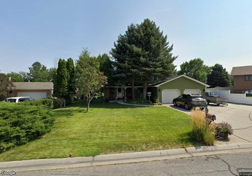
391 Stewart Ct E Billings, MT 59105
Billings Heights NeighborhoodEstimated Value: $423,454 - $470,000
4
Beds
3
Baths
2,232
Sq Ft
$204/Sq Ft
Est. Value
About This Home
This home is located at 391 Stewart Ct E, Billings, MT 59105 and is currently estimated at $454,864, approximately $203 per square foot. 391 Stewart Ct E is a home located in Yellowstone County with nearby schools including Eagle Cliffs Elementary School, Castle Rock Junior High School, and Skyview High School.
Ownership History
Date
Name
Owned For
Owner Type
Purchase Details
Closed on
Jun 24, 2009
Sold by
Odonell Ignatius Daniel and Odonnell Sharon L
Bought by
Odonnell Ignatius Daniel and Odonnell Sharon L
Current Estimated Value
Home Financials for this Owner
Home Financials are based on the most recent Mortgage that was taken out on this home.
Original Mortgage
$159,000
Interest Rate
4.83%
Mortgage Type
New Conventional
Purchase Details
Closed on
Jul 20, 2006
Sold by
Odonnell I Dan and Odonnell Sharon L
Bought by
Odonnell Ignatius Daniel and Odonnell Sharon L
Home Financials for this Owner
Home Financials are based on the most recent Mortgage that was taken out on this home.
Original Mortgage
$158,400
Interest Rate
6.57%
Mortgage Type
New Conventional
Create a Home Valuation Report for This Property
The Home Valuation Report is an in-depth analysis detailing your home's value as well as a comparison with similar homes in the area
Home Values in the Area
Average Home Value in this Area
Purchase History
| Date | Buyer | Sale Price | Title Company |
|---|---|---|---|
| Odonnell Ignatius Daniel | -- | St | |
| Odonnell Ignatius Daniel | -- | None Available |
Source: Public Records
Mortgage History
| Date | Status | Borrower | Loan Amount |
|---|---|---|---|
| Closed | Odonnell Ignatius Daniel | $159,000 | |
| Closed | Odonnell Ignatius Daniel | $158,400 |
Source: Public Records
Tax History Compared to Growth
Tax History
| Year | Tax Paid | Tax Assessment Tax Assessment Total Assessment is a certain percentage of the fair market value that is determined by local assessors to be the total taxable value of land and additions on the property. | Land | Improvement |
|---|---|---|---|---|
| 2025 | $4,291 | $454,100 | $64,002 | $390,098 |
| 2024 | $4,291 | $430,200 | $65,111 | $365,089 |
| 2023 | $4,284 | $430,200 | $65,111 | $365,089 |
| 2022 | $2,714 | $287,500 | $0 | $0 |
| 2021 | $3,156 | $287,500 | $0 | $0 |
| 2020 | $3,240 | $282,900 | $0 | $0 |
| 2019 | $3,098 | $282,900 | $0 | $0 |
| 2018 | $3,153 | $283,800 | $0 | $0 |
| 2017 | $3,070 | $283,800 | $0 | $0 |
| 2016 | $2,695 | $248,200 | $0 | $0 |
| 2015 | $2,638 | $248,200 | $0 | $0 |
| 2014 | $2,239 | $109,869 | $0 | $0 |
Source: Public Records
Map
Nearby Homes
- 324 Stewart Ct N
- 844 Governors Blvd
- 1017 Toole Cir
- 153 W Hilltop Rd
- 961 Governors Blvd
- 325 Sahara Dr
- 2011 Gleneagles Blvd
- 2059 Gleneagles Blvd
- 2027 Gleneagles Blvd
- 2019 Gleneagles Blvd
- 2067 Gleneagles Blvd
- TBD Antelope Place
- 1126 Yorktown St
- 69 Nugget Place
- 1322 Babcock Cir
- 707 Aquarius Place
- 1168 Minuteman St
- 361 Tabriz Dr
- 475 Republic Ave
- 721 Constitution Ave
- 395 Stewart Ct E
- 914 Aronson Ave
- 389 Stewart Ct E
- 910 Aronson Ave
- 306 Stewart Ct N
- 382 Stewart Ct E
- 922 Aronson Ave
- 385 Stewart Ct S
- 906 Aronson Ave
- 398 Stewart Ct E
- 381 Stewart Ct S
- 378 Stewart Ct S
- 851 Governors Blvd
- 847 Governors Blvd
- 855 Governors Blvd
- 911 Aronson Ave
- 377 Stewart Ct S
- 377 Stewart Ct S
- 917 Aronson Ave
- 909 Aronson Ave