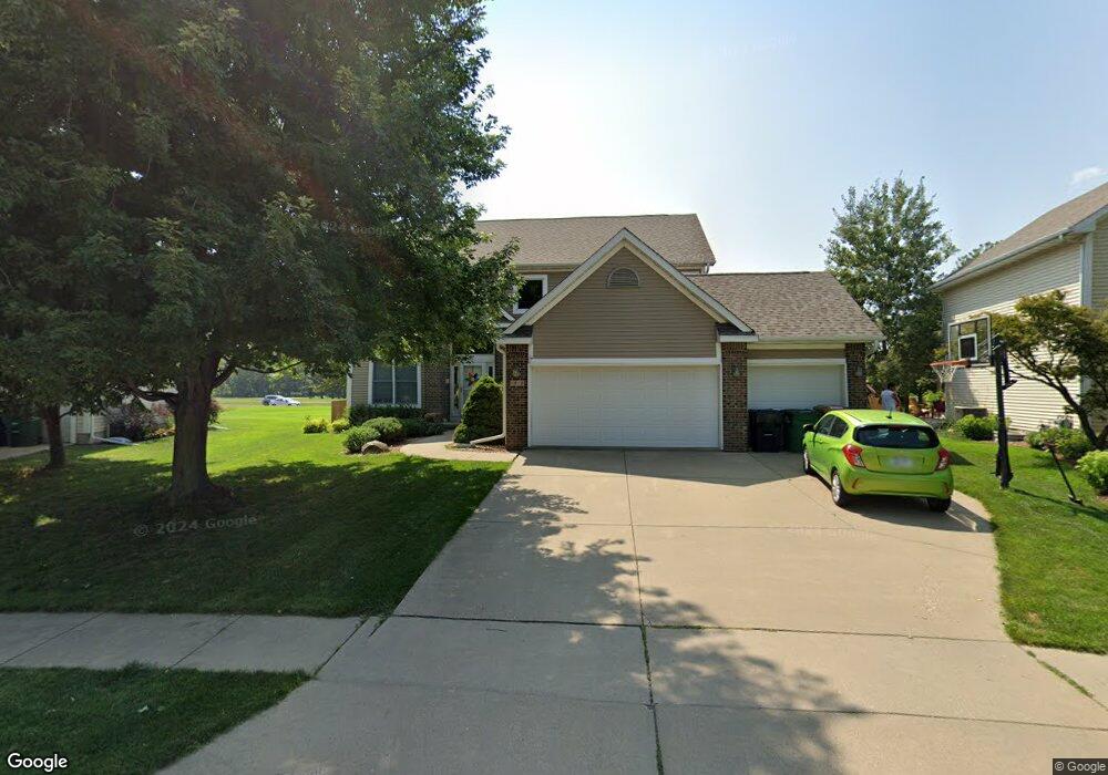
3910 127th St Urbandale, IA 50323
Estimated Value: $455,199 - $461,000
4
Beds
4
Baths
2,370
Sq Ft
$194/Sq Ft
Est. Value
About This Home
This home is located at 3910 127th St, Urbandale, IA 50323 and is currently estimated at $459,050, approximately $193 per square foot. 3910 127th St is a home located in Polk County with nearby schools including Webster Elementary School, Urbandale Middle School, and Urbandale High School.
Ownership History
Date
Name
Owned For
Owner Type
Purchase Details
Closed on
Mar 31, 2010
Sold by
Birchem Patrick J and Birchem Jennifer L
Bought by
Motroni Joseph R and Motroni Jill L
Current Estimated Value
Home Financials for this Owner
Home Financials are based on the most recent Mortgage that was taken out on this home.
Original Mortgage
$192,000
Outstanding Balance
$127,126
Interest Rate
4.96%
Mortgage Type
New Conventional
Estimated Equity
$331,924
Purchase Details
Closed on
Jul 29, 2002
Sold by
Rottlund Homes Of Iowa Inc
Bought by
Birchem Patrick J and Birchem Jennifer L
Home Financials for this Owner
Home Financials are based on the most recent Mortgage that was taken out on this home.
Original Mortgage
$201,740
Interest Rate
5.37%
Purchase Details
Closed on
May 14, 2002
Sold by
Douglas Parkway Developers Lc
Bought by
Rottlund Homes Of Iowa Inc
Create a Home Valuation Report for This Property
The Home Valuation Report is an in-depth analysis detailing your home's value as well as a comparison with similar homes in the area
Home Values in the Area
Average Home Value in this Area
Purchase History
| Date | Buyer | Sale Price | Title Company |
|---|---|---|---|
| Motroni Joseph R | $296,500 | Itc | |
| Birchem Patrick J | $252,000 | -- | |
| Rottlund Homes Of Iowa Inc | $41,500 | -- |
Source: Public Records
Mortgage History
| Date | Status | Borrower | Loan Amount |
|---|---|---|---|
| Open | Motroni Joseph R | $192,000 | |
| Previous Owner | Birchem Patrick J | $201,740 |
Source: Public Records
Tax History Compared to Growth
Tax History
| Year | Tax Paid | Tax Assessment Tax Assessment Total Assessment is a certain percentage of the fair market value that is determined by local assessors to be the total taxable value of land and additions on the property. | Land | Improvement |
|---|---|---|---|---|
| 2025 | $7,446 | $439,700 | $89,900 | $349,800 |
| 2024 | $7,446 | $421,600 | $84,400 | $337,200 |
| 2023 | $6,908 | $421,600 | $84,400 | $337,200 |
| 2022 | $6,826 | $330,800 | $68,500 | $262,300 |
| 2021 | $7,006 | $330,800 | $68,500 | $262,300 |
| 2020 | $6,884 | $322,200 | $66,500 | $255,700 |
| 2019 | $6,436 | $322,200 | $66,500 | $255,700 |
| 2018 | $6,206 | $284,100 | $57,500 | $226,600 |
| 2017 | $5,974 | $284,100 | $57,500 | $226,600 |
| 2016 | $5,830 | $268,600 | $53,600 | $215,000 |
| 2015 | $5,830 | $268,600 | $53,600 | $215,000 |
| 2014 | $5,698 | $260,200 | $51,200 | $209,000 |
Source: Public Records
Map
Nearby Homes
- 12723 Sunflower Dr
- 4016 127th St
- 12527 Airline Ave
- 12515 Airline Ave
- 12510 Prairie Dr
- 12324 Sunflower Dr
- 12220 Horton Ave
- 12202 Madison Ave
- 3935 122nd St
- 12912 Hammontree Dr
- 12926 Timberline Dr
- 12335 Tanglewood Dr
- 4143 122nd St
- 4309 129th St
- 14216 Catalpa Dr
- 14212 Catalpa Dr
- 14311 Catalpa Dr
- 4412 125th St
- 4111 140th St
- 12993 Oak Brook Dr
- 3916 127th St
- 3904 127th St
- 3922 127th St
- 12624 Horton Ave
- 12623 Horton Ave
- 12632 Airline Ave
- 12620 Horton Ave
- 12628 Airline Ave
- 12721 Sunflower Dr
- 12616 Horton Ave
- 12705 Airline Ave
- 12619 Horton Ave
- 12727 Sunflower Dr
- 12719 Sunflower Dr
- 12622 Airline Ave
- 12729 Sunflower Dr
- 12631 Airline Ave
- 12612 Horton Ave
- 12615 Horton Ave
- 12717 Sunflower Dr