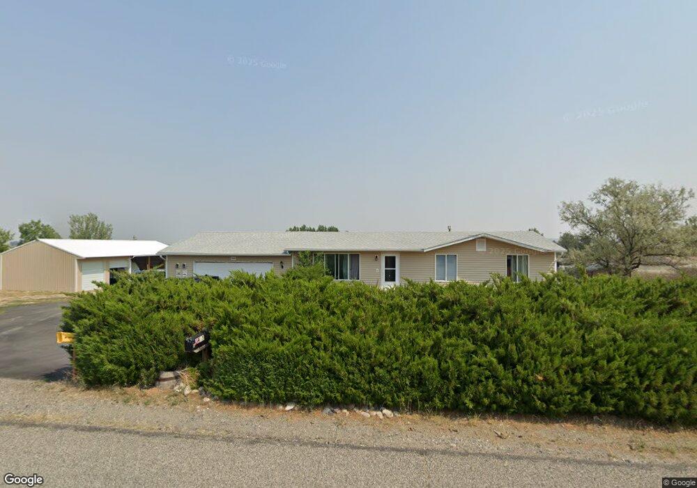
3915 Clint Rd Billings, MT 59105
Billings Heights NeighborhoodEstimated Value: $330,000 - $396,000
5
Beds
2
Baths
2,208
Sq Ft
$167/Sq Ft
Est. Value
About This Home
This home is located at 3915 Clint Rd, Billings, MT 59105 and is currently estimated at $368,695, approximately $166 per square foot. 3915 Clint Rd is a home located in Yellowstone County with nearby schools including Independent Elementary School, Castle Rock Junior High School, and Skyview High School.
Ownership History
Date
Name
Owned For
Owner Type
Purchase Details
Closed on
Jun 23, 2016
Sold by
Davis Daniel
Bought by
Johnson Leslie R and Johnson Michelle M
Current Estimated Value
Purchase Details
Closed on
Feb 2, 2011
Sold by
Franczyk Gregory and Franczyk Kaye Lynne
Bought by
Davis Daniel
Home Financials for this Owner
Home Financials are based on the most recent Mortgage that was taken out on this home.
Original Mortgage
$193,782
Interest Rate
4.79%
Mortgage Type
New Conventional
Create a Home Valuation Report for This Property
The Home Valuation Report is an in-depth analysis detailing your home's value as well as a comparison with similar homes in the area
Home Values in the Area
Average Home Value in this Area
Purchase History
| Date | Buyer | Sale Price | Title Company |
|---|---|---|---|
| Johnson Leslie R | -- | Stewart Title | |
| Davis Daniel | -- | St |
Source: Public Records
Mortgage History
| Date | Status | Borrower | Loan Amount |
|---|---|---|---|
| Previous Owner | Davis Daniel | $193,782 |
Source: Public Records
Tax History
| Year | Tax Paid | Tax Assessment Tax Assessment Total Assessment is a certain percentage of the fair market value that is determined by local assessors to be the total taxable value of land and additions on the property. | Land | Improvement |
|---|---|---|---|---|
| 2025 | $2,428 | $321,400 | $71,817 | $249,583 |
| 2024 | $2,428 | $299,200 | $57,378 | $241,822 |
| 2023 | $2,525 | $299,200 | $57,378 | $241,822 |
| 2022 | $2,234 | $240,400 | $0 | $0 |
| 2021 | $2,238 | $240,400 | $0 | $0 |
| 2020 | $2,176 | $239,400 | $0 | $0 |
| 2019 | $2,212 | $239,400 | $0 | $0 |
| 2018 | $2,107 | $207,700 | $0 | $0 |
| 2017 | $2,115 | $207,700 | $0 | $0 |
| 2016 | $1,997 | $208,600 | $0 | $0 |
| 2015 | $1,899 | $208,600 | $0 | $0 |
| 2014 | $1,815 | $101,124 | $0 | $0 |
Source: Public Records
Map
Nearby Homes
- 1395 W Eugene Ave
- 2647 Palmer Ln
- 2635 Palmer Ln
- 2623 Palmer Ln
- 2624 Palmer Ln
- 2617 Palmer Ln
- 1384 W Eugene Ave
- 1385 W Eugene Ave
- 2618 Palmer Ln
- 2629 Palmer Ln
- 2648 Palmer Ln
- 2641 Palmer Ln
- 1365 W Eugene Ave
- 2611 Palmer Ln
- 1394 W Eugene Ave
- 2719 Strapper Ln
- 2737 Strapper Ln
- 2738 Strapper Ln
- 2743 Strapper Ln
- 2731 Strapper Ln
- LOT 7 Clint Rd
- 0 Clint Rd
- 1716 Clint Rd
- 3839 Clint Rd
- 3850 Campfire Ct
- 3931 Clint Rd
- 3908 Clint Rd
- 3910 Barry Dr
- 3840 Barry Dr
- 3914 Barry Dr
- 3819 Clint Rd
- 1825 Campfire Ct
- 1825 Campfire Ct
- 1920 Plateau Rd
- 1824 Lariat Ln
- 3948 Clint Rd
- 3818 Barry Dr
- 1940 Plateau Rd
- 1825 Lariat Ln
- 3911 Pleasant View Place
Your Personal Tour Guide
Ask me questions while you tour the home.