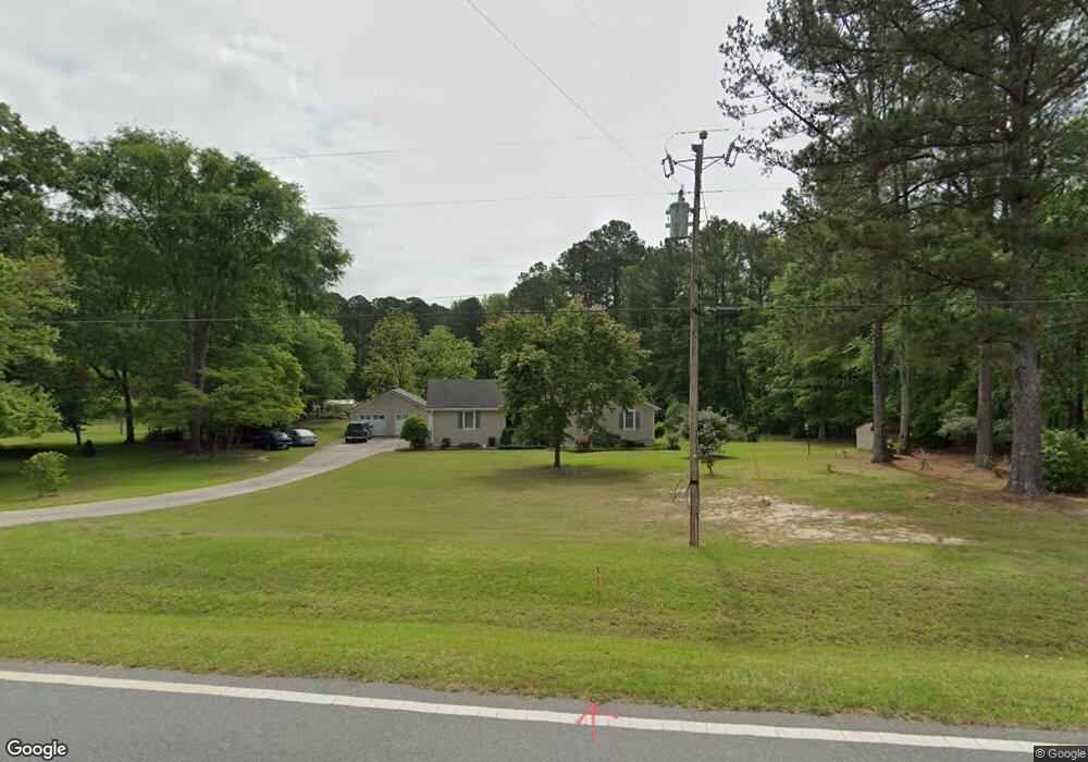
392 Bankstown Rd Brooks, GA 30205
Estimated Value: $450,750 - $1,019,000
--
Bed
2
Baths
1,953
Sq Ft
$319/Sq Ft
Est. Value
About This Home
This home is located at 392 Bankstown Rd, Brooks, GA 30205 and is currently estimated at $623,688, approximately $319 per square foot. 392 Bankstown Rd is a home located in Fayette County with nearby schools including Peeples Elementary School, Whitewater Middle School, and Whitewater High School.
Ownership History
Date
Name
Owned For
Owner Type
Purchase Details
Closed on
Jul 16, 1997
Sold by
Bailey Mary Ann
Bought by
Schonmack Gerard R and Schonmack Theresa A
Current Estimated Value
Home Financials for this Owner
Home Financials are based on the most recent Mortgage that was taken out on this home.
Original Mortgage
$108,800
Outstanding Balance
$15,619
Interest Rate
7.52%
Mortgage Type
New Conventional
Estimated Equity
$608,069
Create a Home Valuation Report for This Property
The Home Valuation Report is an in-depth analysis detailing your home's value as well as a comparison with similar homes in the area
Home Values in the Area
Average Home Value in this Area
Purchase History
| Date | Buyer | Sale Price | Title Company |
|---|---|---|---|
| Schonmack Gerard R | $136,000 | -- |
Source: Public Records
Mortgage History
| Date | Status | Borrower | Loan Amount |
|---|---|---|---|
| Open | Schonmack Gerard R | $108,800 |
Source: Public Records
Tax History Compared to Growth
Tax History
| Year | Tax Paid | Tax Assessment Tax Assessment Total Assessment is a certain percentage of the fair market value that is determined by local assessors to be the total taxable value of land and additions on the property. | Land | Improvement |
|---|---|---|---|---|
| 2024 | $2,992 | $153,736 | $47,704 | $106,032 |
| 2023 | $2,992 | $142,804 | $41,924 | $100,880 |
| 2022 | $2,845 | $134,388 | $37,588 | $96,800 |
| 2021 | $2,713 | $120,256 | $34,696 | $85,560 |
| 2020 | $2,983 | $108,016 | $29,856 | $78,160 |
| 2019 | $2,891 | $103,656 | $29,856 | $73,800 |
| 2018 | $2,672 | $94,948 | $25,788 | $69,160 |
| 2017 | $2,379 | $84,508 | $24,428 | $60,080 |
| 2016 | $2,214 | $77,188 | $24,428 | $52,760 |
| 2015 | $2,113 | $72,508 | $24,428 | $48,080 |
| 2014 | $1,976 | $66,788 | $24,428 | $42,360 |
| 2013 | -- | $64,232 | $0 | $0 |
Source: Public Records
Map
Nearby Homes
- 0 Morgan Mill Rd Unit LOT 7 10597544
- 0 Morgan Mill Rd Unit LOT 5 10432804
- 460 Morgan Mill Rd
- 165 Grace Hope Dr
- 0 Price Rd Unit LOT 2
- 0 Price Rd Unit LOT 1
- 604 Morgan Mill Rd
- 1481 Highway 85 Connector
- 0 Padgett Rd Unit 10612849
- 0 Padgett Rd Unit LOT 9 10432801
- 0 Padgett Rd Unit LOT 8 10432798
- 360 Morgan Mill Rd
- 291 Morgan Mill Rd
- 190 Gable Rd
- 0 Mask and Lynch Rd Unit 10611467
- 786 Highway 85 Connector
- 130 Brooklet Way
- 423 Mask Rd
- 160 Carrington Ln
- 9902 Highway 16
- 386 Bankstown Rd
- 410 Bankstown Rd
- 378 Bankstown Rd
- 370 Bankstown Rd
- 379 Bankstown Rd
- 418 Bankstown Rd
- 306 Bankstown Rd
- 430 Bankstown Rd Unit 2
- 430 Bankstown Rd
- 358 Bankstown Rd
- 314 Bankstown Rd Unit 6
- 419 Bankstown Rd Unit 2
- 419 Bankstown Rd
- 482 Price Rd
- 413 Bankstown Rd
- 433 Bankstown Rd
- 470 Price Rd
- 434 Bankstown Rd
- 466 Price Rd
- 436 Bankstown Rd