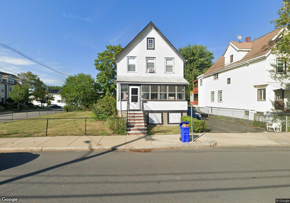
392 Bryant St Malden, MA 02148
Suffolk Square NeighborhoodEstimated Value: $670,461 - $782,000
3
Beds
2
Baths
1,452
Sq Ft
$506/Sq Ft
Est. Value
About This Home
This home is located at 392 Bryant St, Malden, MA 02148 and is currently estimated at $734,865, approximately $506 per square foot. 392 Bryant St is a home located in Middlesex County with nearby schools including Malden High School, Cheverus Catholic School, and Malden Catholic.
Ownership History
Date
Name
Owned For
Owner Type
Purchase Details
Closed on
Aug 31, 2001
Sold by
Metcalf Richard D and Metcalf Frances A
Bought by
Ou Li Zhen and Chung Pui Wu
Current Estimated Value
Create a Home Valuation Report for This Property
The Home Valuation Report is an in-depth analysis detailing your home's value as well as a comparison with similar homes in the area
Home Values in the Area
Average Home Value in this Area
Purchase History
| Date | Buyer | Sale Price | Title Company |
|---|---|---|---|
| Ou Li Zhen | $269,900 | -- |
Source: Public Records
Mortgage History
| Date | Status | Borrower | Loan Amount |
|---|---|---|---|
| Previous Owner | Ou Li Zhen | $57,000 |
Source: Public Records
Tax History Compared to Growth
Tax History
| Year | Tax Paid | Tax Assessment Tax Assessment Total Assessment is a certain percentage of the fair market value that is determined by local assessors to be the total taxable value of land and additions on the property. | Land | Improvement |
|---|---|---|---|---|
| 2025 | $63 | $553,900 | $294,800 | $259,100 |
| 2024 | $5,895 | $504,300 | $276,300 | $228,000 |
| 2023 | $5,763 | $472,800 | $248,700 | $224,100 |
| 2022 | $5,702 | $461,700 | $244,100 | $217,600 |
| 2021 | $5,226 | $425,200 | $214,200 | $211,000 |
| 2020 | $5,055 | $399,600 | $203,100 | $196,500 |
| 2019 | $4,984 | $375,600 | $193,400 | $182,200 |
| 2018 | $4,630 | $328,600 | $154,300 | $174,300 |
| 2017 | $4,526 | $319,400 | $154,300 | $165,100 |
| 2016 | $4,595 | $303,100 | $154,300 | $148,800 |
| 2015 | $4,485 | $285,100 | $146,900 | $138,200 |
| 2014 | $4,292 | $266,600 | $133,600 | $133,000 |
Source: Public Records
Map
Nearby Homes
- 272-274 Cross St Unit 1
- 272-274 Cross St Unit 4
- 272-274 Cross St Unit 3
- 272-274 Cross St Unit 5
- 272-274 Cross St Unit 2
- 17 Ashton St
- 16 Boylston St
- 13-15 Benner Ave
- 23 Upham St
- 37 Greenhalge Ave
- 58 Almont St Unit 3
- 417-419 Ferry St
- 5 Mason St
- 30 Franklin St Unit 105
- 23 Pratt St
- 45 Richardson St
- 244 Shute St
- 452 Salem St
- 33 Lodgen Ct Unit 4G
- 494 Salem St
- 398 Bryant St
- 398 Bryant St Unit 1
- 404 Bryant St
- 404 Bryant St Unit 2
- 395 Bryant St
- 387 Bryant St
- 69 Suffolk St
- 73 Suffolk St
- 412 Bryant St Unit 2
- 412 Bryant St Unit 1
- 77 Suffolk St
- 77 Suffolk St Unit 2
- 409 Bryant St
- 152 Harvard St
- 158 Harvard St
- 162 Harvard St
- 162 Harvard St Unit 162
- 133 Harvard St Unit 2
- 133 Harvard St Unit 1
- 133 Harvard St