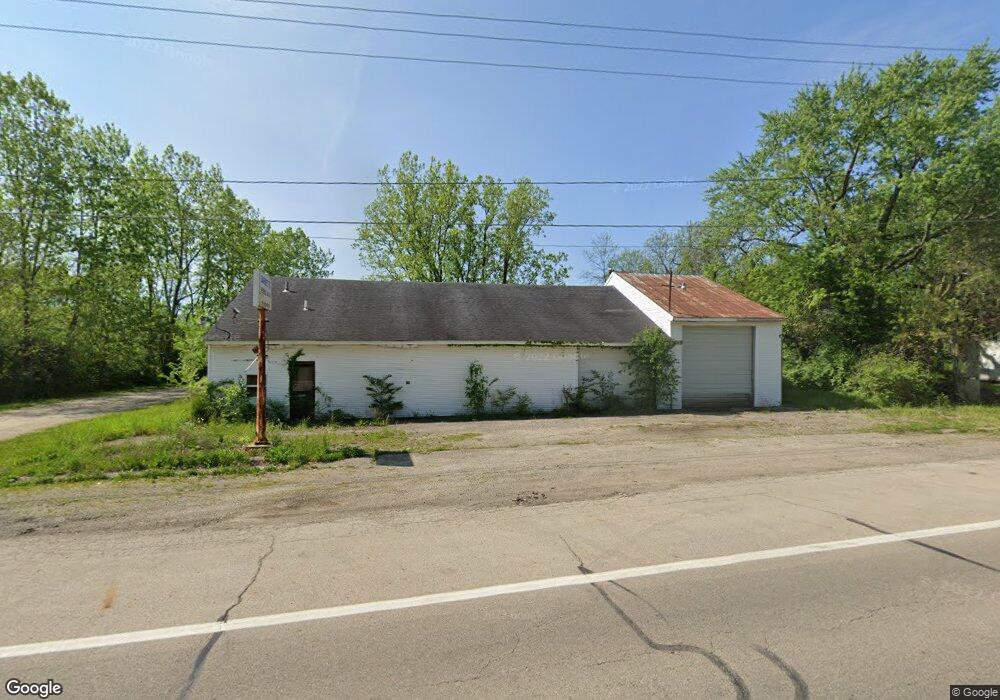
3921 W National Rd Springfield, OH 45504
Cedar Hills/Broadview NeighborhoodEstimated Value: $84,745
--
Bed
--
Bath
3,400
Sq Ft
$25/Sq Ft
Est. Value
About This Home
This home is located at 3921 W National Rd, Springfield, OH 45504 and is currently estimated at $84,745, approximately $24 per square foot. 3921 W National Rd is a home located in Clark County with nearby schools including Shawnee Middle School/High School, Clark Preparatory Academy, and Springfield Christian School.
Ownership History
Date
Name
Owned For
Owner Type
Purchase Details
Closed on
Jul 24, 2025
Sold by
Simonton Theodore L and Simonton Ronald M
Bought by
Rons Holy Smokin Bbq Llc
Current Estimated Value
Purchase Details
Closed on
Jul 3, 2025
Sold by
Simonton Theodore
Bought by
Simonton Theodore L and Simonton Ronald M
Purchase Details
Closed on
Jun 14, 2024
Sold by
Hannahs Patricia L
Bought by
Simonton Deborah
Purchase Details
Closed on
Mar 19, 1999
Sold by
Seaman Charles E and Seaman Kathleen
Bought by
Barnett Edmond L
Purchase Details
Closed on
Aug 14, 1997
Sold by
Taylor David R
Bought by
Ed Barnett
Home Financials for this Owner
Home Financials are based on the most recent Mortgage that was taken out on this home.
Original Mortgage
$65,000
Interest Rate
10%
Mortgage Type
Commercial
Purchase Details
Closed on
Mar 28, 1988
Create a Home Valuation Report for This Property
The Home Valuation Report is an in-depth analysis detailing your home's value as well as a comparison with similar homes in the area
Home Values in the Area
Average Home Value in this Area
Purchase History
| Date | Buyer | Sale Price | Title Company |
|---|---|---|---|
| Rons Holy Smokin Bbq Llc | -- | None Listed On Document | |
| Simonton Theodore L | -- | None Listed On Document | |
| Simonton Deborah | $82,000 | Team Title & Closing Services | |
| Barnett Edmond L | $12,000 | -- | |
| Ed Barnett | $65,000 | -- | |
| -- | $57,000 | -- |
Source: Public Records
Mortgage History
| Date | Status | Borrower | Loan Amount |
|---|---|---|---|
| Previous Owner | Ed Barnett | $65,000 |
Source: Public Records
Tax History Compared to Growth
Tax History
| Year | Tax Paid | Tax Assessment Tax Assessment Total Assessment is a certain percentage of the fair market value that is determined by local assessors to be the total taxable value of land and additions on the property. | Land | Improvement |
|---|---|---|---|---|
| 2024 | $1,322 | $20,750 | $7,790 | $12,960 |
| 2023 | $1,322 | $20,750 | $7,790 | $12,960 |
| 2022 | $1,298 | $20,750 | $7,790 | $12,960 |
| 2021 | $1,373 | $20,750 | $7,790 | $12,960 |
| 2020 | $1,382 | $20,750 | $7,790 | $12,960 |
| 2019 | $1,403 | $20,750 | $7,790 | $12,960 |
| 2018 | $1,684 | $25,040 | $7,790 | $17,250 |
| 2017 | $1,738 | $25,036 | $7,788 | $17,248 |
| 2016 | $1,558 | $25,036 | $7,788 | $17,248 |
| 2015 | $1,591 | $25,036 | $7,788 | $17,248 |
| 2014 | $1,576 | $25,036 | $7,788 | $17,248 |
| 2013 | $689 | $25,036 | $7,788 | $17,248 |
Source: Public Records
Map
Nearby Homes
- 224 E Downey Dr
- 3721 W National Rd
- 323 Saint Paul Ave
- 124 Old Mill Rd
- 4461 New Carlisle Pike
- 3587 Lower Valley Pike
- 245 Gordon Rd
- 570 Aberfelda Dr
- 709 Shrine Rd
- 201 Beech Dr
- 190 Oakridge Dr
- 5095 W National Rd
- 5171 New Carlisle Pike
- 3161 Dayton Springfield Rd
- 3161 Dayton Rd
- 1290 Red Oaks Cir
- 0 Upper Valley Pike
- 2805 Cottonwood Dr
- 361 Upper Valley Pike
- 3951 W National Rd
- 3962 W National Rd
- 10 Rockway Ave
- 3964 W National Rd
- 3968 W National Rd
- 3864 W National Rd
- 16 Rockway Ave
- 3990 W National Rd
- 3966 W National Rd
- 3923 Glendale Ave
- 3935 Glendale Ave
- 20 Rockway Ave
- 3941 Glendale Ave
- 3842 W National Rd
- 21 Carlisle Ave
- 11 Rockway Ave
- 3815 W National Rd
- 24 Rockway Ave
- 3930 Glendale Ave
- 3920 Glendale Ave