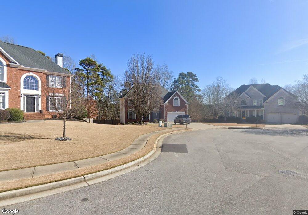
3925 Lost Oak Ct Unit 2 Buford, GA 30519
Estimated Value: $585,000 - $653,000
4
Beds
3
Baths
3,104
Sq Ft
$200/Sq Ft
Est. Value
About This Home
This home is located at 3925 Lost Oak Ct Unit 2, Buford, GA 30519 and is currently estimated at $621,424, approximately $200 per square foot. 3925 Lost Oak Ct Unit 2 is a home located in Gwinnett County with nearby schools including Harmony Elementary School and Glenn C. Jones Middle School.
Ownership History
Date
Name
Owned For
Owner Type
Purchase Details
Closed on
Jul 30, 2003
Sold by
Morrison Homes Inc
Bought by
Mcgowan Patrick A
Current Estimated Value
Home Financials for this Owner
Home Financials are based on the most recent Mortgage that was taken out on this home.
Original Mortgage
$260,550
Outstanding Balance
$115,570
Interest Rate
5.72%
Mortgage Type
New Conventional
Estimated Equity
$505,854
Create a Home Valuation Report for This Property
The Home Valuation Report is an in-depth analysis detailing your home's value as well as a comparison with similar homes in the area
Home Values in the Area
Average Home Value in this Area
Purchase History
| Date | Buyer | Sale Price | Title Company |
|---|---|---|---|
| Mcgowan Patrick A | $274,400 | -- |
Source: Public Records
Mortgage History
| Date | Status | Borrower | Loan Amount |
|---|---|---|---|
| Open | Mcgowan Patrick A | $260,550 |
Source: Public Records
Tax History Compared to Growth
Tax History
| Year | Tax Paid | Tax Assessment Tax Assessment Total Assessment is a certain percentage of the fair market value that is determined by local assessors to be the total taxable value of land and additions on the property. | Land | Improvement |
|---|---|---|---|---|
| 2024 | $7,438 | $248,640 | $48,000 | $200,640 |
| 2023 | $7,438 | $194,960 | $33,600 | $161,360 |
| 2022 | $6,305 | $194,960 | $33,600 | $161,360 |
| 2021 | $4,000 | $144,720 | $29,600 | $115,120 |
| 2020 | $5,603 | $144,720 | $29,600 | $115,120 |
| 2019 | $4,940 | $131,640 | $26,400 | $105,240 |
| 2018 | $4,256 | $111,890 | $22,440 | $89,450 |
| 2016 | $4,844 | $128,240 | $26,400 | $101,840 |
| 2015 | $4,557 | $118,880 | $18,400 | $100,480 |
| 2014 | $4,250 | $109,560 | $18,400 | $91,160 |
Source: Public Records
Map
Nearby Homes
- 2551 E Maddox Rd
- 2101 E Maddox Rd
- 4017 S South Bogan Rd
- 3685 Rolling Creek Dr
- 2380 Black Bear Ct
- 2398 E Maddox Rd
- 4010 Hamilton Mill Rd
- 3964 Hamilton Mill Rd
- 2361 Black Bear Ct Unit 2
- 3641 Devenwood Way
- 2753 Blue Moon Dr Unit 4
- 3600 Devenwood Way
- 2446 Thrasher Rd
- 2262 Silver Fox Ln
- 2410 Thrasher Rd
- 3765 Woodlawn Ct
- 3935 Lost Oak Ct
- 3915 Lost Oak Ct Unit 2
- 3935 Lost Oak Ct Unit 2
- 3910 Lost Oak Ct Unit 2
- 2572 Bogan Bridge Cir
- 3920 Lost Oak Ct
- 2562 Bogan Bridge Cir
- 3930 Lost Oak Ct Unit 2
- 2582 Bogan Bridge Cir Unit 2
- 2552 Bogan Bridge Cir
- 3940 Lost Oak Ct Unit 2
- 4100 Lost Mill Ln Unit 93
- 4100 Lost Mill Ln
- 3950 Lost Oak Ct
- 0 Bogan Bridge Cir Unit 7533008
- 0 Bogan Bridge Cir Unit 8937914
- 0 Bogan Bridge Cir Unit 7197205
- 0 Bogan Bridge Cir Unit 8184562
- 0 Bogan Bridge Cir Unit 8239521
- 0 Bogan Bridge Cir Unit 34