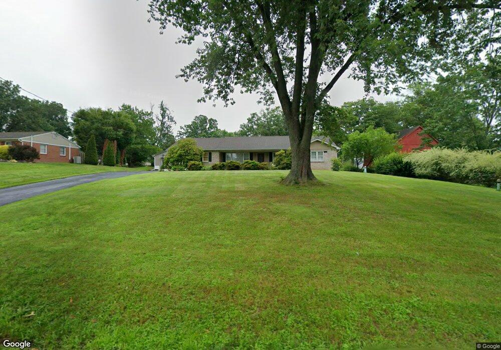
393 Cowpath Rd Souderton, PA 18964
Estimated Value: $474,000 - $532,389
3
Beds
2
Baths
1,785
Sq Ft
$289/Sq Ft
Est. Value
About This Home
This home is located at 393 Cowpath Rd, Souderton, PA 18964 and is currently estimated at $515,347, approximately $288 per square foot. 393 Cowpath Rd is a home located in Montgomery County with nearby schools including Franconia Elementary School, Indian Crest Middle School, and Souderton Area Senior High School.
Ownership History
Date
Name
Owned For
Owner Type
Purchase Details
Closed on
Nov 10, 2011
Sold by
Sadler Donna and Sadler Mary
Bought by
Kratz Lawrence R and Kratz Helen Fay
Current Estimated Value
Home Financials for this Owner
Home Financials are based on the most recent Mortgage that was taken out on this home.
Original Mortgage
$80,000
Outstanding Balance
$54,815
Interest Rate
4.12%
Estimated Equity
$460,532
Create a Home Valuation Report for This Property
The Home Valuation Report is an in-depth analysis detailing your home's value as well as a comparison with similar homes in the area
Home Values in the Area
Average Home Value in this Area
Purchase History
| Date | Buyer | Sale Price | Title Company |
|---|---|---|---|
| Kratz Lawrence R | $185,000 | None Available |
Source: Public Records
Mortgage History
| Date | Status | Borrower | Loan Amount |
|---|---|---|---|
| Open | Kratz Lawrence R | $80,000 |
Source: Public Records
Tax History Compared to Growth
Tax History
| Year | Tax Paid | Tax Assessment Tax Assessment Total Assessment is a certain percentage of the fair market value that is determined by local assessors to be the total taxable value of land and additions on the property. | Land | Improvement |
|---|---|---|---|---|
| 2025 | $6,720 | $167,330 | -- | -- |
| 2024 | $6,720 | $167,330 | -- | -- |
| 2023 | $6,412 | $167,330 | $0 | $0 |
| 2022 | $6,216 | $167,330 | $0 | $0 |
| 2021 | $6,086 | $167,330 | $0 | $0 |
| 2020 | $6,003 | $167,330 | $0 | $0 |
| 2019 | $5,480 | $167,330 | $0 | $0 |
| 2018 | $5,931 | $167,330 | $0 | $0 |
| 2017 | $5,782 | $167,330 | $0 | $0 |
| 2016 | $5,717 | $167,330 | $0 | $0 |
| 2015 | $5,363 | $161,330 | $66,330 | $95,000 |
| 2014 | $5,363 | $161,330 | $66,330 | $95,000 |
Source: Public Records
Map
Nearby Homes
- 554 Harleysville Pike
- 478 Smokepipe Rd
- 3443 Devlin Way
- 314 Harleysville Pike
- 44 Diamond St
- 171 Hopewell Ln Unit B
- 124 Hollybush Cir
- 103 Arlington Ln
- 227 Ridge Ave
- 0001 Sydney Ln
- 223 W Reliance Rd
- 196 Penn Ave
- 44 Adams Ave
- 17 N 2nd St
- 51 Cambridge Ct Unit 51
- 208 E Broad St
- 340 S Main St
- 110 Washington Ave
- 3 Carousel Dr
- 517 Hemsing Cir
- 375 Cowpath Rd Unit 36
- 397 Cowpath Rd
- 376 Cowpath Rd
- 363 Cowpath Rd
- 403 Cowpath Rd
- 384 Cowpath Rd
- 370 Cowpath Rd
- 364 Oak Dr
- 245 W Reliance Rd
- 368 Oak Dr
- 411 Cowpath Rd
- 241 W Reliance Rd Unit 28
- 249 W Reliance Rd
- 235 W Reliance Rd
- 364 Cowpath Rd
- 372 Oak Dr
- 417 Cowpath Rd
- 257 W Reliance Rd
- 231 W Reliance Rd
- 360 Cowpath Rd