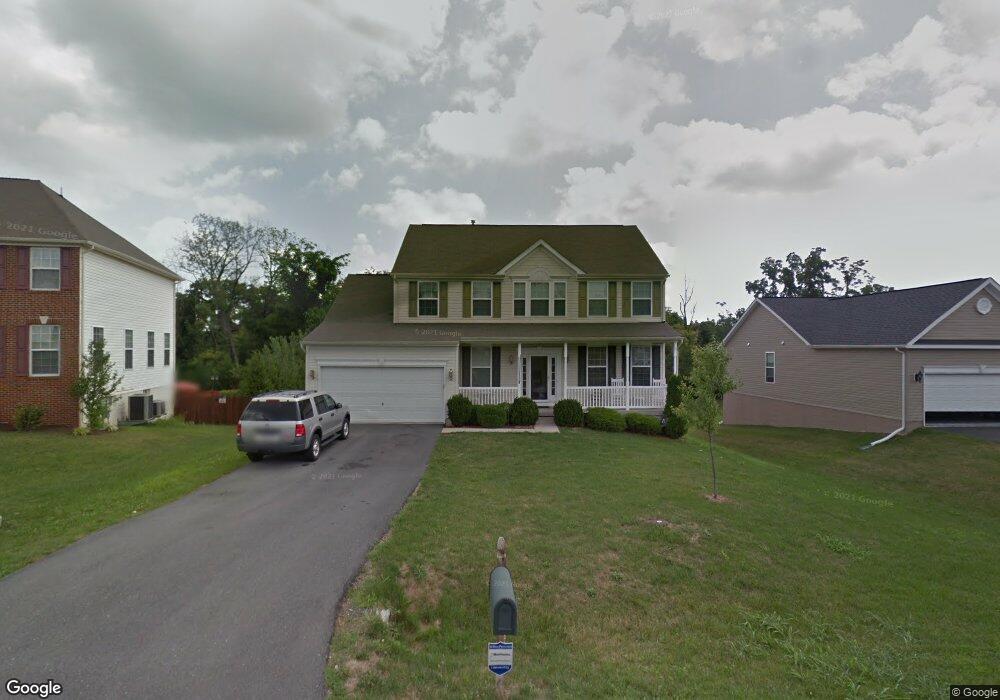
393 Fortress Dr Winchester, VA 22603
Estimated Value: $505,610 - $608,000
4
Beds
3
Baths
2,698
Sq Ft
$200/Sq Ft
Est. Value
About This Home
This home is located at 393 Fortress Dr, Winchester, VA 22603 and is currently estimated at $540,403, approximately $200 per square foot. 393 Fortress Dr is a home located in Frederick County with nearby schools including Apple Pie Ridge Elementary School and Sacred Heart Academy.
Ownership History
Date
Name
Owned For
Owner Type
Purchase Details
Closed on
Mar 20, 2008
Sold by
Dan Ryan Bldrs Inc
Bought by
Black Steven P
Current Estimated Value
Home Financials for this Owner
Home Financials are based on the most recent Mortgage that was taken out on this home.
Original Mortgage
$299,250
Outstanding Balance
$186,528
Interest Rate
5.75%
Mortgage Type
New Conventional
Estimated Equity
$353,875
Create a Home Valuation Report for This Property
The Home Valuation Report is an in-depth analysis detailing your home's value as well as a comparison with similar homes in the area
Home Values in the Area
Average Home Value in this Area
Purchase History
| Date | Buyer | Sale Price | Title Company |
|---|---|---|---|
| Black Steven P | $315,000 | -- |
Source: Public Records
Mortgage History
| Date | Status | Borrower | Loan Amount |
|---|---|---|---|
| Open | Black Steven P | $299,250 |
Source: Public Records
Tax History Compared to Growth
Tax History
| Year | Tax Paid | Tax Assessment Tax Assessment Total Assessment is a certain percentage of the fair market value that is determined by local assessors to be the total taxable value of land and additions on the property. | Land | Improvement |
|---|---|---|---|---|
| 2025 | $2,291 | $477,300 | $93,000 | $384,300 |
| 2024 | $1,084 | $413,500 | $77,000 | $336,500 |
| 2023 | $2,109 | $413,500 | $77,000 | $336,500 |
| 2022 | $2,060 | $337,700 | $72,000 | $265,700 |
| 2021 | $2,120 | $337,700 | $72,000 | $265,700 |
| 2020 | $1,873 | $297,200 | $72,000 | $225,200 |
| 2019 | $1,873 | $297,200 | $72,000 | $225,200 |
| 2018 | $1,787 | $283,100 | $72,000 | $211,100 |
| 2017 | $1,759 | $283,100 | $72,000 | $211,100 |
| 2016 | $1,610 | $258,300 | $59,500 | $198,800 |
| 2015 | $1,446 | $258,300 | $59,500 | $198,800 |
| 2014 | $732 | $238,200 | $59,500 | $178,700 |
Source: Public Records
Map
Nearby Homes
- Lot 84 Purcell Ln
- 112 Star Fort Dr
- 1243 N Frederick Pike
- 903 N Loudoun St
- Lot 4 Handley Dr
- 26 A Jackson Ave
- 801 Fairmont Ave
- 117 W Oates Ave
- 105 W Oates Ave
- 792 Fox Dr
- 700 Watson Ave
- 153 Welltown Rd
- 627 Watson Ave
- 580 N Braddock St
- 148 Amoco Ln
- 0 Amoco Unit VAFV2010648
- 807 Butler Ave
- 1667 N Frederick Pike
- 0 N Frederick Pike Unit VAWI2007698
- 0 N Frederick Pike Unit VAFV2038096
- 395 Fortress Dr
- 391 Fortress Dr
- 397 Fortress Dr
- 100 Blackpowder Ct
- 392 Fortress Dr
- 394 Fortress Dr
- 399 Fortress Dr
- 0 Blackpowder Ct
- 390 Fortress Dr
- 102 Blackpowder Ct
- 396 Fortress Dr
- 401 Fortress Dr
- 398 Fortress Dr
- 101 Blackpowder Ct
- 298 Fortress Dr
- 104 Blackpowder Ct
- 403 Fortress Dr
- 400 Fortress Dr
- 109 Sentry Ct
- 108 Sentry Ct