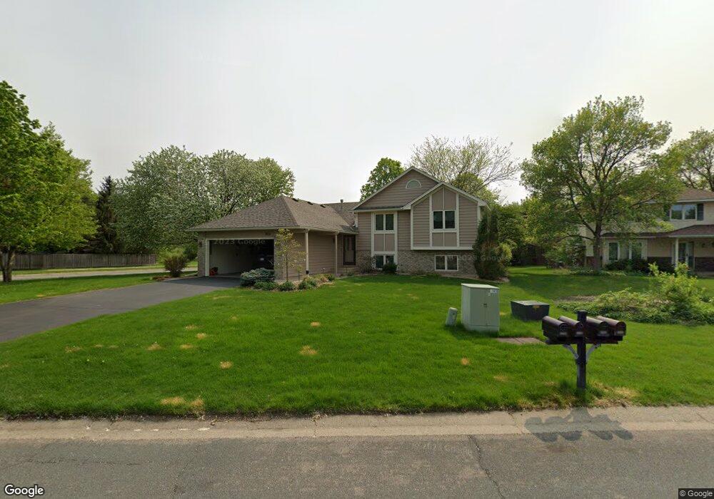
3935 Canter Glen Dr Saint Paul, MN 55123
Estimated Value: $451,000 - $496,000
3
Beds
3
Baths
2,174
Sq Ft
$219/Sq Ft
Est. Value
About This Home
This home is located at 3935 Canter Glen Dr, Saint Paul, MN 55123 and is currently estimated at $477,000, approximately $219 per square foot. 3935 Canter Glen Dr is a home located in Dakota County with nearby schools including Woodland Elementary School, Dakota Hills Middle School, and Eagan Senior High School.
Ownership History
Date
Name
Owned For
Owner Type
Purchase Details
Closed on
Jun 24, 2022
Sold by
Fedie Scott and Fedie Peggy
Bought by
Glynn Deanne and Valdepena Benjamin
Current Estimated Value
Home Financials for this Owner
Home Financials are based on the most recent Mortgage that was taken out on this home.
Original Mortgage
$480,000
Outstanding Balance
$456,841
Interest Rate
5.3%
Mortgage Type
New Conventional
Estimated Equity
$20,159
Create a Home Valuation Report for This Property
The Home Valuation Report is an in-depth analysis detailing your home's value as well as a comparison with similar homes in the area
Home Values in the Area
Average Home Value in this Area
Purchase History
| Date | Buyer | Sale Price | Title Company |
|---|---|---|---|
| Glynn Deanne | $480,000 | -- |
Source: Public Records
Mortgage History
| Date | Status | Borrower | Loan Amount |
|---|---|---|---|
| Open | Glynn Deanne | $480,000 |
Source: Public Records
Tax History Compared to Growth
Tax History
| Year | Tax Paid | Tax Assessment Tax Assessment Total Assessment is a certain percentage of the fair market value that is determined by local assessors to be the total taxable value of land and additions on the property. | Land | Improvement |
|---|---|---|---|---|
| 2024 | $4,710 | $451,400 | $122,000 | $329,400 |
| 2023 | $4,710 | $433,600 | $122,400 | $311,200 |
| 2022 | $4,284 | $423,600 | $122,000 | $301,600 |
| 2021 | $4,052 | $383,100 | $106,100 | $277,000 |
| 2020 | $4,060 | $355,400 | $101,100 | $254,300 |
| 2019 | $3,903 | $347,000 | $96,200 | $250,800 |
| 2018 | $3,462 | $351,300 | $91,700 | $259,600 |
| 2017 | $3,363 | $305,200 | $87,300 | $217,900 |
| 2016 | $3,396 | $284,500 | $83,100 | $201,400 |
| 2015 | $3,281 | $273,192 | $79,713 | $193,479 |
| 2014 | -- | $268,396 | $77,437 | $190,959 |
| 2013 | -- | $232,644 | $68,966 | $163,678 |
Source: Public Records
Map
Nearby Homes
- 3902 Canter Glen Dr
- 4080 Camberwell Dr N
- 4027 Camberwell Dr N
- 785 Canter Glen Cir
- 711 Stonebridge Cir
- 4124 New York Ave
- 4001 Haven Woods Ct
- 3998 Haven Woods Ct
- 790 Summerbrooke Ct
- 680 Brockton Curve
- 782 Summerbrooke Ct
- 4125 Pennsylvania Ave
- 3806 Bridgewater Dr
- 826 Hidden Meadow Trail
- 4358 Yorktown Dr
- 591 Autumn Oaks Ct
- 791 Sunset Dr
- 4274 Maclaren Place
- 593 Coventry Pkwy
- 3726 Wescott Hills Dr
- 3931 Canter Glen Dr
- 3927 Canter Glen Dr
- 750 Cheshire Ct
- 3926 Canter Glen Dr
- 3930 Canter Glen Dr
- 3922 Canter Glen Dr
- 3923 Canter Glen Dr
- 746 Cheshire Ct
- 3918 Canter Glen Dr
- 743 Cheshire Ct
- 760 Windmill Ct
- 3919 Canter Glen Dr
- 757 Windmill Ct
- 742 Cheshire Ct
- 739 Cheshire Ct
- 3914 Canter Glen Dr
- 4051 Tilbury Way
- 756 Windmill Ct
- 3915 Canter Glen Dr
- 735 Cheshire Ct