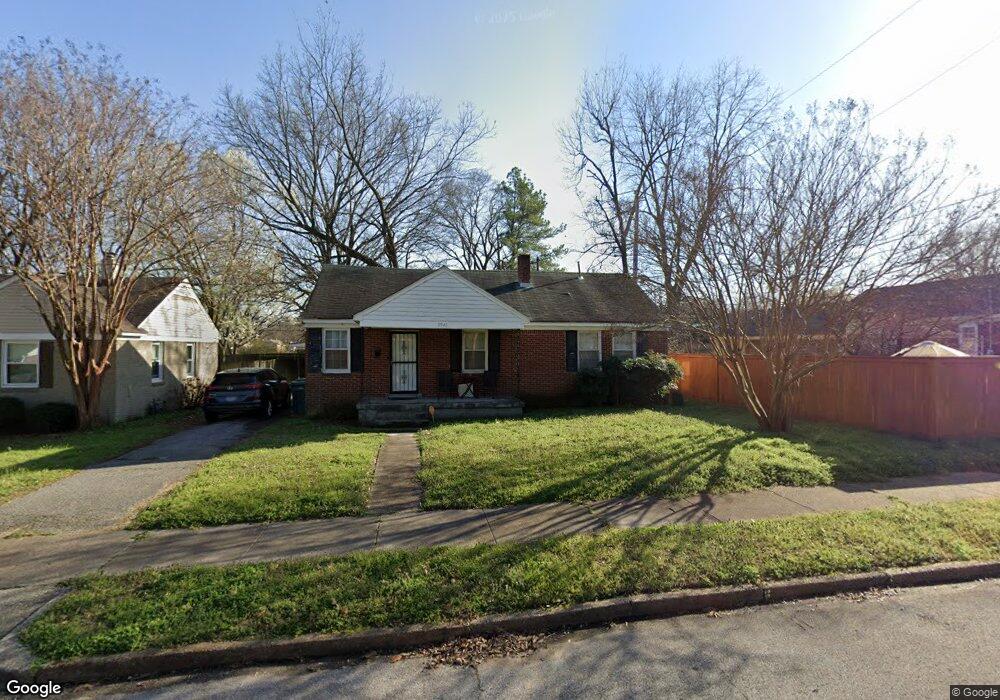
3941 Carter Ave Memphis, TN 38122
High Point Terrace NeighborhoodEstimated Value: $88,000 - $160,000
3
Beds
1
Bath
1,051
Sq Ft
$121/Sq Ft
Est. Value
About This Home
This home is located at 3941 Carter Ave, Memphis, TN 38122 and is currently estimated at $127,333, approximately $121 per square foot. 3941 Carter Ave is a home located in Shelby County with nearby schools including Grahamwood Elementary School, Kingsbury High School, and Treadwell Middle School.
Ownership History
Date
Name
Owned For
Owner Type
Purchase Details
Closed on
Jul 19, 1999
Sold by
Lambert Carl B and Lambert Altha L
Bought by
Mccall James R
Current Estimated Value
Home Financials for this Owner
Home Financials are based on the most recent Mortgage that was taken out on this home.
Original Mortgage
$53,000
Outstanding Balance
$14,138
Interest Rate
7.43%
Mortgage Type
Seller Take Back
Estimated Equity
$113,196
Create a Home Valuation Report for This Property
The Home Valuation Report is an in-depth analysis detailing your home's value as well as a comparison with similar homes in the area
Home Values in the Area
Average Home Value in this Area
Purchase History
| Date | Buyer | Sale Price | Title Company |
|---|---|---|---|
| Mccall James R | $55,000 | Mid South Title Insurance Co | |
| Mccall James R | $55,000 | Mid South Title Insurance Co |
Source: Public Records
Mortgage History
| Date | Status | Borrower | Loan Amount |
|---|---|---|---|
| Open | Mccall James R | $53,000 | |
| Closed | Mccall James R | $53,000 |
Source: Public Records
Tax History Compared to Growth
Tax History
| Year | Tax Paid | Tax Assessment Tax Assessment Total Assessment is a certain percentage of the fair market value that is determined by local assessors to be the total taxable value of land and additions on the property. | Land | Improvement |
|---|---|---|---|---|
| 2025 | $300 | $24,700 | $4,375 | $20,325 |
| 2024 | $592 | $17,475 | $2,425 | $15,050 |
| 2023 | $1,065 | $17,475 | $2,425 | $15,050 |
| 2022 | $1,065 | $17,475 | $2,425 | $15,050 |
| 2021 | $1,077 | $17,475 | $2,425 | $15,050 |
| 2020 | $931 | $12,850 | $2,200 | $10,650 |
| 2019 | $931 | $12,850 | $2,200 | $10,650 |
| 2018 | $931 | $12,850 | $2,200 | $10,650 |
| 2017 | $528 | $12,850 | $2,200 | $10,650 |
| 2016 | $591 | $13,525 | $0 | $0 |
| 2014 | $591 | $13,525 | $0 | $0 |
Source: Public Records
Map
Nearby Homes
- 599 Isabelle St
- 3882 Tutwiler Ave
- 501 Gerald Rd
- 4121 Faxon Ave
- 428 E Swan Ridge Cir
- 779 Chatwood Cove
- 781 Chatwood Cove
- 791 Chatwood Cove
- 4023 Hilldale Ave
- 458 Gerald Rd
- 473 Vaughn Rd
- 3727 N Swan Ridge Cir
- 3749 Shirlwood Ave
- 3787 S Swan Ridge Cir
- 3725 Tutwiler Ave
- 3890 Given Ave
- 3697 Shirlwood Ave
- 3815 Montclair Dr
- 4227 Tutwiler Ave
- 4237 Hilldale Ave
- 3947 Carter Ave
- 580 Adrian Dr
- 574 Adrian Dr
- 3953 Carter Ave
- 3942 Forrest Ave
- 566 Adrian Dr
- 3944 Carter Ave
- 3938 Carter Ave
- 3959 Carter Ave
- 3950 Carter Ave
- 3930 Carter Ave
- 3956 Carter Ave
- 3965 Carter Ave
- 579 Adrian Dr
- 587 Adrian Dr
- 571 Adrian Dr
- 3962 Carter Ave
- 595 Adrian Dr
- 567 Adrian Dr
- 3970 Carter Ave