Estimated Value: $494,877 - $617,000
2
Beds
1
Bath
1,070
Sq Ft
$520/Sq Ft
Est. Value
About This Home
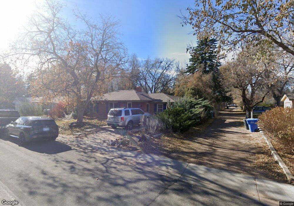
This home is located at 395 Circle Dr, Fort Collins, CO 80524 and is currently estimated at $556,469, approximately $520 per square foot. 395 Circle Dr is a home located in Larimer County with nearby schools including Laurel Elementary School, Lesher Middle School, and Fort Collins High School.
Ownership History
Date
Name
Owned For
Owner Type
Purchase Details
Closed on
Dec 18, 2009
Sold by
Swartzendruber Scott D and Swartzendruber Tara B
Bought by
Perino Stanley C and Dentoni Sarah M
Current Estimated Value
Home Financials for this Owner
Home Financials are based on the most recent Mortgage that was taken out on this home.
Original Mortgage
$152,625
Outstanding Balance
$100,111
Interest Rate
5.01%
Mortgage Type
New Conventional
Estimated Equity
$456,358
Purchase Details
Closed on
May 31, 2000
Sold by
Norwest Bank Colorado National Assn
Bought by
Swartzendruber Scott D and Swartzendruber Tara B
Home Financials for this Owner
Home Financials are based on the most recent Mortgage that was taken out on this home.
Original Mortgage
$60,000
Interest Rate
7.5%
Create a Home Valuation Report for This Property
The Home Valuation Report is an in-depth analysis detailing your home's value as well as a comparison with similar homes in the area
Home Values in the Area
Average Home Value in this Area
Purchase History
| Date | Buyer | Sale Price | Title Company |
|---|---|---|---|
| Perino Stanley C | $203,500 | None Available | |
| Swartzendruber Scott D | $155,000 | Land Title |
Source: Public Records
Mortgage History
| Date | Status | Borrower | Loan Amount |
|---|---|---|---|
| Open | Perino Stanley C | $152,625 | |
| Previous Owner | Swartzendruber Scott D | $60,000 |
Source: Public Records
Tax History Compared to Growth
Tax History
| Year | Tax Paid | Tax Assessment Tax Assessment Total Assessment is a certain percentage of the fair market value that is determined by local assessors to be the total taxable value of land and additions on the property. | Land | Improvement |
|---|---|---|---|---|
| 2025 | $3,111 | $36,106 | $2,814 | $33,292 |
| 2024 | $2,960 | $36,106 | $2,814 | $33,292 |
| 2022 | $2,407 | $25,486 | $2,919 | $22,567 |
| 2021 | $2,432 | $26,219 | $3,003 | $23,216 |
| 2020 | $2,162 | $23,102 | $3,003 | $20,099 |
| 2019 | $2,171 | $23,102 | $3,003 | $20,099 |
| 2018 | $1,928 | $21,154 | $3,024 | $18,130 |
| 2017 | $1,921 | $21,154 | $3,024 | $18,130 |
| 2016 | $1,738 | $19,040 | $3,343 | $15,697 |
| 2015 | $1,726 | $19,040 | $3,340 | $15,700 |
| 2014 | $1,584 | $17,360 | $3,340 | $14,020 |
Source: Public Records
Map
Nearby Homes
- 613 E Lake St
- 205 Circle Dr
- 816 Buckeye St
- 1204 Newsom St
- 1305 Green St
- 1628 Smith Place
- 1110 Peterson St
- 1535 Peterson St
- 1539 Peterson St
- 311 Edwards St
- 1741 Brookhaven Cir E Unit A
- 1741 Brookhaven Cir E Unit D
- 1112 Robertson St
- 834 Cherokee Dr
- 812 Peterson St
- 1737 Springmeadows Ct Unit A
- 801 Peterson St
- 424 E Plum St
- 1304 S Lemay Ave
- 1020 S College Ave
- 385 Circle Dr
- 5 Circle Dr
- 15 Circle Dr Unit 42068
- 15 Circle Dr Unit 44065
- 15 Circle Dr Unit 45691
- 15 Circle Dr
- 375 Circle Dr
- 55 Circle Dr
- 25 Circle Dr
- 65 Circle Dr
- 400 Circle Dr
- 410 Circle Dr
- 390 Circle Dr
- 75 Circle Dr
- 35 Circle Dr
- 365 Circle Dr
- 420 Circle Dr
- 380 Circle Dr
- 85 Circle Dr
- 370 Circle Dr