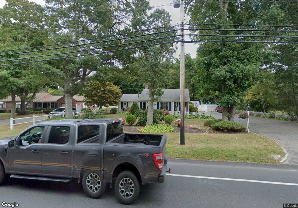
395 Sandwich Rd East Falmouth, MA 02536
Hatchville NeighborhoodEstimated Value: $499,000 - $578,000
2
Beds
1
Bath
1,210
Sq Ft
$438/Sq Ft
Est. Value
About This Home
This home is located at 395 Sandwich Rd, East Falmouth, MA 02536 and is currently estimated at $530,286, approximately $438 per square foot. 395 Sandwich Rd is a home located in Barnstable County with nearby schools including Mullen-Hall School, Morse Pond School, and Lawrence School.
Ownership History
Date
Name
Owned For
Owner Type
Purchase Details
Closed on
May 17, 1989
Sold by
Valadao Manuel M
Bought by
Valadao Wm R
Current Estimated Value
Home Financials for this Owner
Home Financials are based on the most recent Mortgage that was taken out on this home.
Original Mortgage
$23,000
Interest Rate
10.97%
Mortgage Type
Purchase Money Mortgage
Create a Home Valuation Report for This Property
The Home Valuation Report is an in-depth analysis detailing your home's value as well as a comparison with similar homes in the area
Home Values in the Area
Average Home Value in this Area
Purchase History
| Date | Buyer | Sale Price | Title Company |
|---|---|---|---|
| Valadao Wm R | $34,000 | -- | |
| Valadao Wm R | $34,000 | -- |
Source: Public Records
Mortgage History
| Date | Status | Borrower | Loan Amount |
|---|---|---|---|
| Open | Valadao Wm R | $130,000 | |
| Closed | Valadao Wm R | $25,000 | |
| Closed | Valadao Wm R | $23,000 |
Source: Public Records
Tax History Compared to Growth
Tax History
| Year | Tax Paid | Tax Assessment Tax Assessment Total Assessment is a certain percentage of the fair market value that is determined by local assessors to be the total taxable value of land and additions on the property. | Land | Improvement |
|---|---|---|---|---|
| 2025 | $2,646 | $450,700 | $175,900 | $274,800 |
| 2024 | $2,621 | $417,300 | $166,600 | $250,700 |
| 2023 | $2,382 | $344,200 | $166,600 | $177,600 |
| 2022 | $2,293 | $284,800 | $125,600 | $159,200 |
| 2021 | $2,220 | $261,200 | $120,100 | $141,100 |
| 2020 | $2,150 | $250,300 | $109,200 | $141,100 |
| 2019 | $2,070 | $241,800 | $109,200 | $132,600 |
| 2018 | $2,023 | $235,200 | $109,200 | $126,000 |
| 2017 | $1,970 | $231,000 | $109,200 | $121,800 |
| 2016 | $1,930 | $230,600 | $109,200 | $121,400 |
| 2015 | $1,889 | $230,600 | $109,200 | $121,400 |
| 2014 | $1,919 | $235,500 | $115,000 | $120,500 |
Source: Public Records
Map
Nearby Homes
- 17 Pinewood Dr
- 70 Meredith Dr
- 100 Tanglewood Dr
- 68 Deepwood Dr
- 66 Braxton Rd
- 32 Jamie Ln
- 273 Sandwich Rd
- 25 Harris Hill Rd
- 149 Brick Kiln Rd
- 59 Whitecaps Dr
- 590 Sandwich Rd
- 12 Rock Hollow Dr
- 33 John Parker Rd
- 35 Old Barnstable Rd
- 130 Old Barnstable Rd
- 49 Broken Bow Ln
- 25 Percival Rd
- 49 Saint Marks Rd
- 12 Beach Plum Path
- 401 Sandwich Rd
- 391 Sandwich Rd
- 398 Sandwich Rd
- 385 Sandwich Rd
- 404 Sandwich Rd
- 11 Pitch Pine Ln
- Lot 5 Pinewood Dr
- 7 Pinewood Ln
- 408 Sandwich Rd
- 390 Sandwich Rd
- 411 Sandwich Rd
- 17 Pitch Pine Ln
- 412 Sandwich Rd
- 375 Sandwich Rd
- 375 Sandwich Rd
- 375 Sandwich
- 16 Pitch Pine Ln
- 380 Sandwich Rd
- 6 Pinewood Ln
- 415 Sandwich Rd