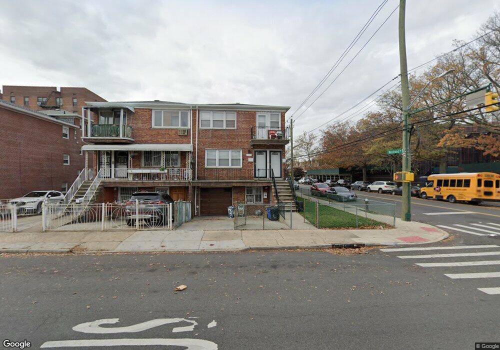
3954 Nostrand Ave Unit TOP Brooklyn, NY 11235
Sheepshead Bay NeighborhoodEstimated Value: $1,345,000 - $1,389,000
3
Beds
2
Baths
1,068
Sq Ft
$1,286/Sq Ft
Est. Value
About This Home
This home is located at 3954 Nostrand Ave Unit TOP, Brooklyn, NY 11235 and is currently estimated at $1,373,667, approximately $1,286 per square foot. 3954 Nostrand Ave Unit TOP is a home located in Kings County with nearby schools including P.S. 52 Sheepshead Bay, Jhs 14 Shell Bank, and New Visions Charter High School for Advanced Math/ Science.
Ownership History
Date
Name
Owned For
Owner Type
Purchase Details
Closed on
Feb 6, 2019
Sold by
Denise Heffez Trust U/W Of Albert Heffez and Denise Heffez As Trustee
Bought by
Clement Heffez Trustee and Denise Heffez Irrevocable Trust
Current Estimated Value
Purchase Details
Closed on
Jun 19, 2006
Sold by
Heffez Executrix Denise and The Estate Of Albert Heffez
Bought by
Estate Of Albert Heffez and Heffez
Create a Home Valuation Report for This Property
The Home Valuation Report is an in-depth analysis detailing your home's value as well as a comparison with similar homes in the area
Home Values in the Area
Average Home Value in this Area
Purchase History
| Date | Buyer | Sale Price | Title Company |
|---|---|---|---|
| Clement Heffez Trustee | -- | -- | |
| Clement Heffez Trustee | -- | -- | |
| Clement Heffez Trustee | -- | -- | |
| Estate Of Albert Heffez | -- | -- | |
| Estate Of Albert Heffez | -- | -- |
Source: Public Records
Tax History Compared to Growth
Tax History
| Year | Tax Paid | Tax Assessment Tax Assessment Total Assessment is a certain percentage of the fair market value that is determined by local assessors to be the total taxable value of land and additions on the property. | Land | Improvement |
|---|---|---|---|---|
| 2025 | $9,596 | $90,300 | $12,360 | $77,940 |
| 2024 | $9,596 | $83,100 | $12,360 | $70,740 |
| 2023 | $9,630 | $89,700 | $12,360 | $77,340 |
| 2022 | $6,698 | $88,080 | $12,360 | $75,720 |
| 2021 | $8,882 | $74,760 | $12,360 | $62,400 |
| 2020 | $4,165 | $83,520 | $12,360 | $71,160 |
| 2019 | $8,329 | $66,420 | $12,360 | $54,060 |
| 2018 | $8,055 | $39,516 | $5,781 | $33,735 |
| 2017 | $7,600 | $37,280 | $8,467 | $28,813 |
| 2016 | $7,031 | $35,170 | $10,781 | $24,389 |
| 2015 | $4,812 | $33,180 | $12,660 | $20,520 |
| 2014 | $4,812 | $33,180 | $12,660 | $20,520 |
Source: Public Records
Map
Nearby Homes
- 3956 Nostrand Ave
- 2906 Voorhies Ave
- 2717 E 28th St Unit 4E
- 2736 Haring St
- 3655 Shore Pkwy Unit 2J
- 3655 Shore Pkwy Unit 4C
- 2703 E 28th St
- 2747 Haring St
- 3901 Nostrand Ave Unit 3T
- 3901 Nostrand Ave Unit LL4
- 3903 Nostrand Ave Unit 3J
- 2678 E 28th St
- 2666 Brown St
- 2733 E 27th St
- 4050 Nostrand Ave Unit 1F
- 14A Lake Ave Unit A
- 4051 Nostrand Ave Unit 3
- 2726 E 27th St
- 2811 Haring St
- 2724 E 27th St
- 3954 Nostrand Ave
- 2914 Voorhies Ave
- 3958 Nostrand Ave Unit 2nd Fl
- 3958 Nostrand Ave Unit 1st Fl
- 3958 Nostrand Ave Unit Lower
- 2912 Voorhies Ave
- 3962 Nostrand Ave
- 2910 Voorhies Ave
- 2908 Voorhies Ave
- 3964 Nostrand Ave
- 2928 Voorhies Ave
- 2904 Voorhies Ave
- 2930 Voorhies Ave
- 3970 Nostrand Ave
- 2932 Voorhies Ave
- 2719 E 28th St Unit 1F
- 2719 E 28th St Unit 1C
- 2719 E 28th St Unit 2E
- 2719 E 28th St Unit 3G
- 2719 E 28th St Unit 6C