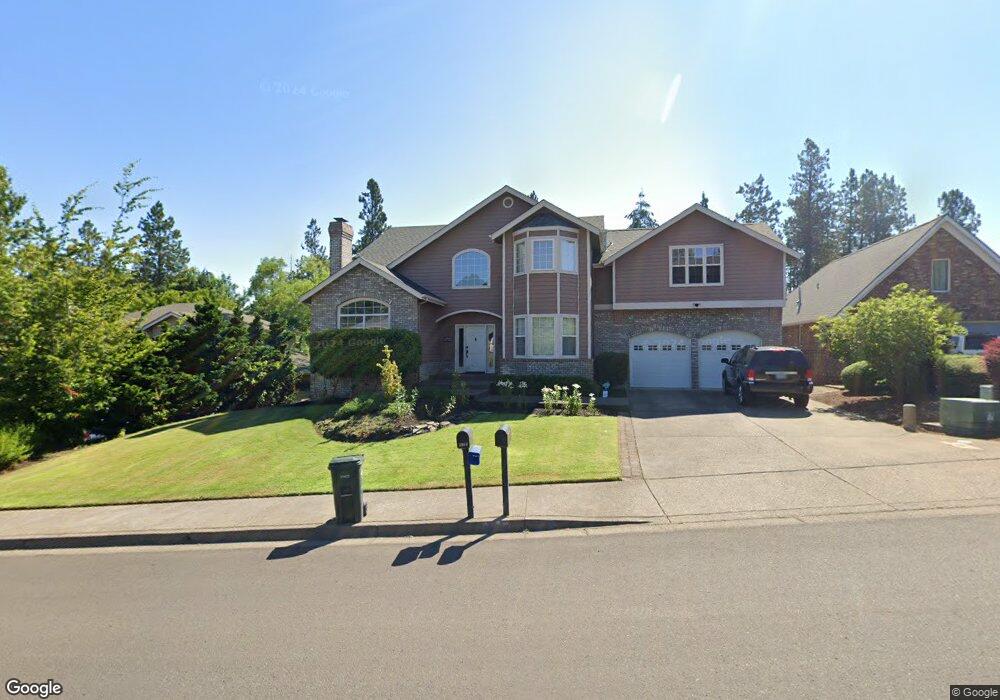
3969 Brae Burn Dr Eugene, OR 97405
Crest Drive NeighborhoodEstimated Value: $845,714 - $990,000
3
Beds
4
Baths
3,076
Sq Ft
$292/Sq Ft
Est. Value
About This Home
This home is located at 3969 Brae Burn Dr, Eugene, OR 97405 and is currently estimated at $899,679, approximately $292 per square foot. 3969 Brae Burn Dr is a home located in Lane County with nearby schools including Edgewood Community Elementary School, Spencer Butte Middle School, and South Eugene High School.
Ownership History
Date
Name
Owned For
Owner Type
Purchase Details
Closed on
Feb 1, 2016
Sold by
David Darin D and David Lori A
Bought by
Mast Richard W
Current Estimated Value
Home Financials for this Owner
Home Financials are based on the most recent Mortgage that was taken out on this home.
Original Mortgage
$410,000
Outstanding Balance
$323,372
Interest Rate
3.79%
Mortgage Type
New Conventional
Estimated Equity
$576,308
Purchase Details
Closed on
Jun 19, 2012
Sold by
David Darin D and David Lori A
Bought by
David Darin D and David Lori A
Home Financials for this Owner
Home Financials are based on the most recent Mortgage that was taken out on this home.
Original Mortgage
$393,000
Interest Rate
3.77%
Mortgage Type
New Conventional
Purchase Details
Closed on
Jun 6, 2000
Sold by
David Darin D and David Lori A
Bought by
David Darin D and David Lori A
Create a Home Valuation Report for This Property
The Home Valuation Report is an in-depth analysis detailing your home's value as well as a comparison with similar homes in the area
Home Values in the Area
Average Home Value in this Area
Purchase History
| Date | Buyer | Sale Price | Title Company |
|---|---|---|---|
| Mast Richard W | $549,000 | Accommodation | |
| David Darin D | -- | First American Title | |
| David Darin D | -- | -- |
Source: Public Records
Mortgage History
| Date | Status | Borrower | Loan Amount |
|---|---|---|---|
| Open | Mast Richard W | $410,000 | |
| Previous Owner | David Darin D | $393,000 |
Source: Public Records
Tax History
| Year | Tax Paid | Tax Assessment Tax Assessment Total Assessment is a certain percentage of the fair market value that is determined by local assessors to be the total taxable value of land and additions on the property. | Land | Improvement |
|---|---|---|---|---|
| 2025 | $11,696 | $600,296 | -- | -- |
| 2024 | $11,551 | $582,812 | -- | -- |
| 2023 | $11,551 | $565,837 | $0 | $0 |
| 2022 | $10,821 | $549,357 | $0 | $0 |
| 2021 | $10,006 | $533,357 | $0 | $0 |
| 2020 | $9,808 | $517,823 | $0 | $0 |
| 2019 | $9,554 | $502,741 | $0 | $0 |
| 2018 | $8,947 | $473,883 | $0 | $0 |
| 2017 | $8,403 | $473,883 | $0 | $0 |
| 2016 | $7,134 | $422,244 | $0 | $0 |
| 2015 | $6,925 | $409,946 | $0 | $0 |
| 2014 | $6,832 | $398,006 | $0 | $0 |
Source: Public Records
Map
Nearby Homes
- 4103 Brae Burn Dr
- 3854 Monroe St
- 275 W 37th Ave
- 806 Sundance St
- 357 W 37th Ave
- 396 Brae Burn Dr
- 0 Pine View Ct Unit 758820410
- 170 E 40th Ave
- 4020 Pearl St
- 605 Fulvue Dr
- 17 Westbrook Way
- 21 Westbrook Way
- 0 Hidden Meadows
- 278 Rockridge Ct
- 275 E 39th Ave
- 4023 Donald St Unit K
- 4083 Donald St Unit A
- 653 Brookside Dr
- 434 E 39th Ave
- 3615 Donald St
- 3975 Brae Burn Dr
- 3947 Brae Burn Dr
- 3923 Brae Burn Dr
- 3987 Brae Burn Dr
- 3968 Brae Burn Dr
- 3946 Brae Burn Dr
- 3999 Brae Burn Dr
- 3924 Brae Burn Dr
- 515 W 40th Ave
- 3917 Brae Burn Dr
- 525 W 40th Ave
- 529 W 40th Ave
- 3970 Monroe St
- 3974 Monroe St
- 3910 Brae Burn Dr
- 4007 Brae Burn Dr
- 3966 Monroe St
- 480 W 40th Ave
- 535 W 40th Ave
- 4002 Brae Burn Dr
Your Personal Tour Guide
Ask me questions while you tour the home.