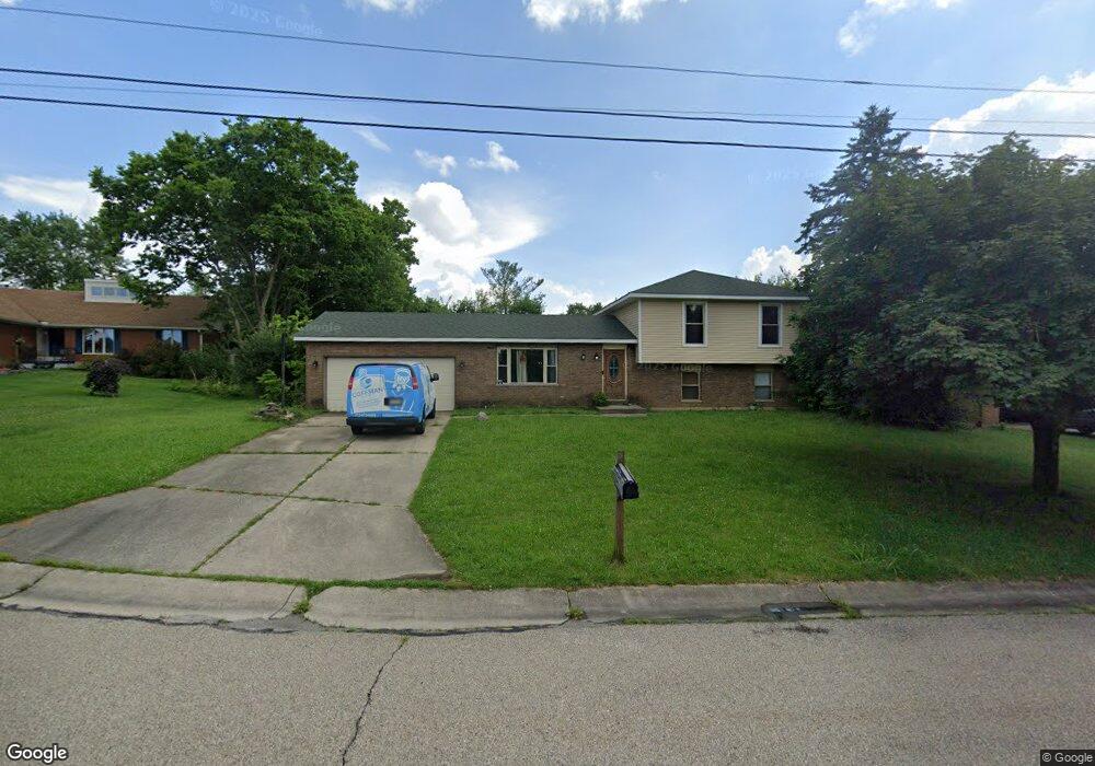
3969 Hassfurt Dr Fairfield, OH 45011
Fairfield Township NeighborhoodEstimated Value: $244,148 - $322,000
4
Beds
2
Baths
1,176
Sq Ft
$242/Sq Ft
Est. Value
About This Home
This home is located at 3969 Hassfurt Dr, Fairfield, OH 45011 and is currently estimated at $284,037, approximately $241 per square foot. 3969 Hassfurt Dr is a home located in Butler County with nearby schools including Compass Elementary School, Creekside Middle School, and Fairfield Senior High School.
Ownership History
Date
Name
Owned For
Owner Type
Purchase Details
Closed on
Mar 29, 2005
Sold by
Jackson Kevin
Bought by
Jackson Brandy M and Roberts Brandy M
Current Estimated Value
Home Financials for this Owner
Home Financials are based on the most recent Mortgage that was taken out on this home.
Original Mortgage
$75,000
Outstanding Balance
$44,683
Interest Rate
8.25%
Mortgage Type
Fannie Mae Freddie Mac
Estimated Equity
$239,354
Purchase Details
Closed on
Aug 24, 1999
Sold by
Roberts Brandy M and Jackson Brandy M
Bought by
Jackson Kevin
Purchase Details
Closed on
Jul 16, 1996
Sold by
Smith Ronald L
Bought by
Roberts Brandy M
Home Financials for this Owner
Home Financials are based on the most recent Mortgage that was taken out on this home.
Original Mortgage
$50,000
Interest Rate
7.63%
Mortgage Type
New Conventional
Purchase Details
Closed on
Feb 1, 1990
Purchase Details
Closed on
Sep 1, 1987
Create a Home Valuation Report for This Property
The Home Valuation Report is an in-depth analysis detailing your home's value as well as a comparison with similar homes in the area
Home Values in the Area
Average Home Value in this Area
Purchase History
| Date | Buyer | Sale Price | Title Company |
|---|---|---|---|
| Jackson Brandy M | -- | Jets Title Agency Llc | |
| Jackson Kevin | -- | -- | |
| Roberts Brandy M | $100,000 | -- | |
| -- | $92,500 | -- | |
| -- | $81,000 | -- |
Source: Public Records
Mortgage History
| Date | Status | Borrower | Loan Amount |
|---|---|---|---|
| Open | Jackson Brandy M | $75,000 | |
| Previous Owner | Roberts Brandy M | $50,000 |
Source: Public Records
Tax History Compared to Growth
Tax History
| Year | Tax Paid | Tax Assessment Tax Assessment Total Assessment is a certain percentage of the fair market value that is determined by local assessors to be the total taxable value of land and additions on the property. | Land | Improvement |
|---|---|---|---|---|
| 2024 | $4,066 | $53,200 | $14,000 | $39,200 |
| 2023 | $1,989 | $53,200 | $14,000 | $39,200 |
| 2022 | $2,370 | $19,360 | $14,000 | $5,360 |
| 2021 | $945 | $19,360 | $14,000 | $5,360 |
| 2020 | $2,922 | $59,450 | $14,000 | $45,450 |
| 2019 | $4,966 | $52,840 | $13,570 | $39,270 |
| 2018 | $2,956 | $52,840 | $13,570 | $39,270 |
| 2017 | $2,983 | $52,840 | $13,570 | $39,270 |
| 2016 | $2,935 | $49,250 | $13,570 | $35,680 |
| 2015 | $2,896 | $49,250 | $13,570 | $35,680 |
| 2014 | $2,371 | $49,250 | $13,570 | $35,680 |
| 2013 | $2,371 | $44,400 | $13,570 | $30,830 |
Source: Public Records
Map
Nearby Homes
- 7587 Vinnedge Rd
- 4101 Jamie Dr
- 7397 Chateauguay Dr
- 7795 Rock Port Way
- 4210 Tylers Estates Dr
- 4257 Primary Colors
- 4401 E Observatory
- 4224 College Dictionary
- 4387 Tylers Estates Dr
- 7920 Jessies Way
- 7918 Jessies Way
- 7918 Jessies Way Unit 304
- 7075 Ashwood Knolls Dr
- 3946 Hamilton Mason Rd
- 7912 Jessies Way
- 7611 Tylers Hill Ct
- 7903 Jessies Way Unit 21-304
- 7066 Hearthside Ct
- 8024 Seabury Ct
- 3959 Hassfurt Dr
- 3979 Hassfurt Dr
- 3968 Schroeder Dr
- 3949 Hassfurt Dr
- 3978 Schroeder Dr
- 3958 Schroeder Dr
- 3989 Hassfurt Dr
- 3983 Schroeder Dr
- 3988 Schroeder Dr
- 3948 Schroeder Dr
- 3939 Hassfurt Dr
- 3988 Hassfurt Dr
- 3946 Hassfurt Dr
- 3998 Schroeder Dr
- 3938 Schroeder Dr
- 3960 Hassfurt Dr
- 7617 Schroeder Ct
- 7627 Schroeder Ct
- 3936 Hassfurt Dr
- 7607 Schroeder Ct