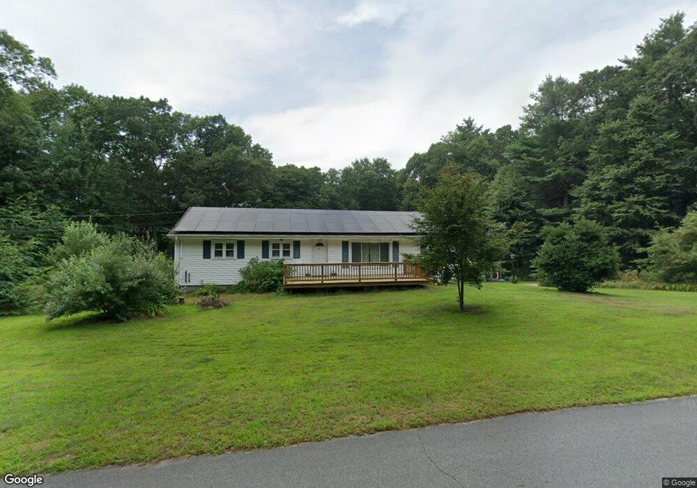
397 Squaw Rock Rd Moosup, CT 06354
Estimated Value: $355,000 - $435,816
3
Beds
2
Baths
1,430
Sq Ft
$276/Sq Ft
Est. Value
About This Home
This home is located at 397 Squaw Rock Rd, Moosup, CT 06354 and is currently estimated at $394,954, approximately $276 per square foot. 397 Squaw Rock Rd is a home located in Windham County with nearby schools including Plainfield Memorial School, Plainfield Central Middle School, and Plainfield High School.
Ownership History
Date
Name
Owned For
Owner Type
Purchase Details
Closed on
Jul 5, 2023
Sold by
Helen Utz Ret and Bonnette
Bought by
Brittland Robert D
Current Estimated Value
Purchase Details
Closed on
Sep 29, 2014
Sold by
Utz Helen
Bought by
Helen Utz Ret and Utz
Purchase Details
Closed on
Apr 11, 2014
Sold by
Utz Helen
Bought by
Helen Utz Ret
Create a Home Valuation Report for This Property
The Home Valuation Report is an in-depth analysis detailing your home's value as well as a comparison with similar homes in the area
Home Values in the Area
Average Home Value in this Area
Purchase History
| Date | Buyer | Sale Price | Title Company |
|---|---|---|---|
| Brittland Robert D | -- | None Available | |
| Brittland Robert D | -- | None Available | |
| Helen Utz Ret | -- | -- | |
| Helen Utz Ret | -- | -- | |
| Helen Utz Ret | -- | -- | |
| Helen Utz Ret | -- | -- |
Source: Public Records
Mortgage History
| Date | Status | Borrower | Loan Amount |
|---|---|---|---|
| Previous Owner | Helen Utz Ret | $51,000 | |
| Previous Owner | Helen Utz Ret | $34,000 |
Source: Public Records
Tax History
| Year | Tax Paid | Tax Assessment Tax Assessment Total Assessment is a certain percentage of the fair market value that is determined by local assessors to be the total taxable value of land and additions on the property. | Land | Improvement |
|---|---|---|---|---|
| 2025 | $5,925 | $250,940 | $66,610 | $184,330 |
| 2024 | $5,784 | $250,940 | $66,610 | $184,330 |
| 2023 | $5,757 | $250,940 | $66,610 | $184,330 |
| 2022 | $7,234 | $167,470 | $56,060 | $111,410 |
| 2021 | $5,102 | $166,030 | $56,060 | $109,970 |
| 2020 | $5,069 | $166,030 | $56,060 | $109,970 |
| 2019 | $5,069 | $166,030 | $56,060 | $109,970 |
| 2018 | $4,991 | $166,030 | $56,060 | $109,970 |
| 2017 | $4,604 | $143,790 | $56,060 | $87,730 |
| 2016 | $4,450 | $143,790 | $56,060 | $87,730 |
| 2015 | $4,337 | $143,790 | $56,060 | $87,730 |
| 2014 | $4,337 | $143,790 | $56,060 | $87,730 |
Source: Public Records
Map
Nearby Homes
- 13 Henry Dr
- 277 Moosup Pond Rd
- 25 Snake Meadow Rd
- 181 Snake Meadow Rd
- 58 Milner Ave
- 23 High St
- 100 Squaw Rock Rd
- 365 Putnam Rd Unit 367
- 6 Grace Ln
- 12 Mechanic St
- 44-46 S Chestnut St
- 143 Goshen Rd
- 29 Union St
- 41 Grove St Unit 45
- 30 Main St
- 30 S Walnut St
- 0 Putnam Rd Unit 24147722
- 247 Green Hollow Rd
- 77 Charlotte Dr
- 0 Wauregan Rd NE Unit 24143170
- 389 Squaw Rock Rd
- 392 Squaw Rock Rd
- 383 Squaw Rock Rd
- 400 Squaw Rock Rd
- 377 Squaw Rock Rd
- 410 Squaw Rock Rd
- 371 Squaw Rock Rd
- 393 Squaw Rock Rd
- 372 Squaw Rock Rd
- 367 Squaw Rock Rd
- 424 Squaw Rock Rd
- 1 Squaw Rock Rd
- 425 Squaw Rock Rd
- 362 Squaw Rock Rd
- 430 Squaw Rock Rd
- 396 Squaw Rock Rd
- 356 Pond Hill Rd
- 384 Squaw Rock Rd
- 0 Squaw Rock Rd Unit 170128675
- 0 Squaw Rock Rd Unit E216187
Your Personal Tour Guide
Ask me questions while you tour the home.