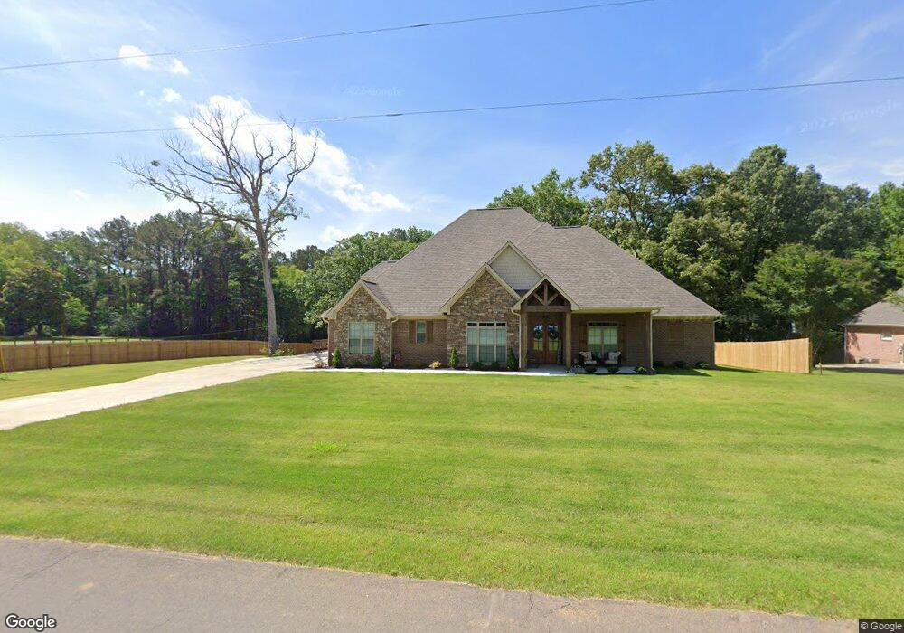
3971 Magnolia Ln Nesbit, MS 38651
Estimated Value: $507,098 - $620,000
4
Beds
--
Bath
3,802
Sq Ft
$142/Sq Ft
Est. Value
About This Home
This home is located at 3971 Magnolia Ln, Nesbit, MS 38651 and is currently estimated at $540,775, approximately $142 per square foot. 3971 Magnolia Ln is a home with nearby schools including Lewisburg Primary School, Lewisburg Elementary School, and Lewisburg Middle School.
Ownership History
Date
Name
Owned For
Owner Type
Purchase Details
Closed on
Dec 15, 2023
Sold by
Massey Home Builders Inc
Bought by
Brown Kevin Dewayne
Current Estimated Value
Purchase Details
Closed on
Jan 31, 2022
Sold by
Massey Home Builders Inc
Bought by
Massey Jackie Christopher and Massey Chatherine
Purchase Details
Closed on
Jul 12, 2018
Sold by
Homeland Partners Inc
Bought by
Massey Home Builders Inc
Create a Home Valuation Report for This Property
The Home Valuation Report is an in-depth analysis detailing your home's value as well as a comparison with similar homes in the area
Home Values in the Area
Average Home Value in this Area
Purchase History
| Date | Buyer | Sale Price | Title Company |
|---|---|---|---|
| Brown Kevin Dewayne | -- | None Listed On Document | |
| Massey Jackie Christopher | -- | Austin Law Firm Pa | |
| Massey Home Builders Inc | -- | None Available |
Source: Public Records
Tax History Compared to Growth
Tax History
| Year | Tax Paid | Tax Assessment Tax Assessment Total Assessment is a certain percentage of the fair market value that is determined by local assessors to be the total taxable value of land and additions on the property. | Land | Improvement |
|---|---|---|---|---|
| 2024 | $2,576 | $28,769 | $1,610 | $27,159 |
| 2023 | $2,576 | $28,769 | $0 | $0 |
| 2022 | $241 | $2,415 | $2,415 | $0 |
| 2021 | $241 | $2,415 | $2,415 | $0 |
| 2020 | $241 | $2,415 | $2,415 | $0 |
| 2019 | $241 | $2,415 | $2,415 | $0 |
| 2017 | $243 | $2,415 | $2,415 | $0 |
| 2016 | $243 | $2,415 | $2,415 | $0 |
| 2015 | $243 | $2,415 | $2,415 | $0 |
| 2014 | $243 | $2,415 | $0 | $0 |
| 2013 | $243 | $2,415 | $0 | $0 |
Source: Public Records
Map
Nearby Homes
- 1699 Baisley Dr
- 1721 Baisley Dr
- 1722 Baisley Dr
- 4259 Adriane Cove
- 1735 Bakersfield Way
- 0 Sandy Betts Rd
- 4209 Brooke Dr
- 130 Bakersfield Way
- 127 Bakersfield Way
- 1794 Bakersfield Way
- 1789 Caribe Dr
- 4276 Brooke Dr
- 4339 Brooke Dr
- 1817 Caribe Dr
- 4300 Brooke Dr
- 4391 Brooke Dr
- 560 N Malone
- 2009 Plumas Dr
- 3049 Pleasant Hill Rd
- 4041 Los Padres Dr
- 3949 Magnolia Ln
- 1362 Malone Rd
- 3911 Magnolia Ln
- 3885 Magnolia Ln
- 1383 Malone Rd
- 1420 Malone Rd
- 3855 Magnolia Ln
- 1228 Malone Rd
- 1445 Malone Rd
- 1200 Malone Rd
- 3821 Magnolia Ln
- 1490 Malone Rd
- 3793 Magnolia Ln
- 1160 Malone Rd
- 3745 Magnolia Ln
- 1150 Malone Rd
- 3711 Magnolia Ln
- 1595 Malone Rd
- 1078 Malone Rd
- 3683 Magnolia Ln