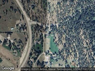
39767 Kings Point Rd Polson, MT 59860
Estimated Value: $378,000 - $1,179,000
3
Beds
2
Baths
1,584
Sq Ft
$516/Sq Ft
Est. Value
About This Home
This home is located at 39767 Kings Point Rd, Polson, MT 59860 and is currently estimated at $817,243, approximately $515 per square foot. 39767 Kings Point Rd is a home located in Lake County with nearby schools including Cherry Valley School, Linderman Elementary School, and Polson Middle School (7-8).
Ownership History
Date
Name
Owned For
Owner Type
Purchase Details
Closed on
Jun 11, 2007
Sold by
Skaggs Daniel S and Skaggs J B
Bought by
Kasnitz Bruce D and Kasnitz Lorilee M
Current Estimated Value
Home Financials for this Owner
Home Financials are based on the most recent Mortgage that was taken out on this home.
Original Mortgage
$344,000
Interest Rate
6.14%
Mortgage Type
New Conventional
Create a Home Valuation Report for This Property
The Home Valuation Report is an in-depth analysis detailing your home's value as well as a comparison with similar homes in the area
Home Values in the Area
Average Home Value in this Area
Purchase History
| Date | Buyer | Sale Price | Title Company |
|---|---|---|---|
| Kasnitz Bruce D | -- | Insured Titles |
Source: Public Records
Mortgage History
| Date | Status | Borrower | Loan Amount |
|---|---|---|---|
| Open | Kasnitz Bruce D | $328,000 | |
| Closed | Kasnitz Bruce D | $20,000 | |
| Closed | Kasnitz Bruce D | $356,800 | |
| Closed | Kasnitz Bruce D | $369,000 | |
| Closed | Kasnitz Bruce D | $344,000 | |
| Previous Owner | Skaggs Daniel S | $0 |
Source: Public Records
Tax History Compared to Growth
Tax History
| Year | Tax Paid | Tax Assessment Tax Assessment Total Assessment is a certain percentage of the fair market value that is determined by local assessors to be the total taxable value of land and additions on the property. | Land | Improvement |
|---|---|---|---|---|
| 2024 | $4,085 | $603,300 | $0 | $0 |
| 2023 | $3,834 | $603,300 | $0 | $0 |
| 2022 | $3,442 | $468,700 | $0 | $0 |
| 2021 | $3,620 | $468,700 | $0 | $0 |
| 2020 | $3,002 | $360,600 | $0 | $0 |
| 2019 | $3,088 | $360,600 | $0 | $0 |
| 2018 | $2,602 | $304,100 | $0 | $0 |
| 2017 | $2,396 | $304,100 | $0 | $0 |
| 2016 | $2,627 | $309,800 | $0 | $0 |
| 2015 | $2,515 | $309,800 | $0 | $0 |
| 2014 | $2,722 | $235,532 | $0 | $0 |
Source: Public Records
Map
Nearby Homes
- 32162 Rocky Point Rd
- Nhn Blue Spruce Dr
- 31402 Rocky Shores Ln
- 38648 Masumola Rd
- Lot 2 Solar Way
- 38844 Parker Ln
- Nhn Rocky Point Rd
- 34238 Rocky Point Rd
- 41001 Canyon View Dr
- 31009 Canyon View Place
- 40566 S Terrace Cir
- 40994 Terrace Cir
- 31716 Meadow Rd
- 33766 W Shore Dr
- Nhn Baypoint Rd
- 33792 Meadow Rd
- NHN Isaac Walton Way
- 32994 Meadow Rd
- 33115 Meadow Rd
- 33953 Fox Rd
- 39767 Kings Point Rd
- 38246 Pinewood Dr
- 39783 Kings Point Rd
- 39783 Kings Point Rd
- 38258 Pinewood Dr
- 38258 Pinewood Dr
- 255 Pinewood Dr
- 460 Kings Point Rd
- 38219 Pinewood Dr
- 38243 Pinewood Dr
- 38304 Pinewood Dr
- 31018 Stone Quarry Dr
- 31017 Stone Quarry Dr
- 234 Grinde Bay Ln
- 38201 Grinde Shore Ln
- Nhn Grinde Bay Ln
- 276 Pinewood Dr
- 372 Grinde Bay Ln
- 38334 Pinewood Dr
- 38181 Grinde Shore Ln
