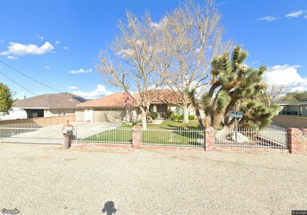
39854 17th St W Palmdale, CA 93551
Northwest Palmdale NeighborhoodEstimated Value: $605,832 - $844,000
3
Beds
2
Baths
2,683
Sq Ft
$260/Sq Ft
Est. Value
About This Home
This home is located at 39854 17th St W, Palmdale, CA 93551 and is currently estimated at $696,458, approximately $259 per square foot. 39854 17th St W is a home located in Los Angeles County with nearby schools including Summerwind Elementary School, David G. Millen Magnet Academy, and Highland High School.
Ownership History
Date
Name
Owned For
Owner Type
Purchase Details
Closed on
Dec 5, 2006
Sold by
Ries Carl Stanley
Bought by
Ries Carl S and Ries Carolyn Sue
Current Estimated Value
Purchase Details
Closed on
May 24, 2001
Sold by
Mcconnachie Craig T
Bought by
Ries Carl Stanley and Ries Carolyn Sue
Home Financials for this Owner
Home Financials are based on the most recent Mortgage that was taken out on this home.
Original Mortgage
$188,000
Outstanding Balance
$70,770
Interest Rate
7.14%
Estimated Equity
$625,688
Purchase Details
Closed on
Jan 27, 1999
Sold by
Federal Home Loan Mortgage Corporation
Bought by
Mcconnachie Craig T and Mcconnachie Laura L
Purchase Details
Closed on
Aug 18, 1997
Sold by
Clapsaddle Marvin R and Federal Home Loan Mortgage Cor
Bought by
Federal Home Loan Mortgage Corporation
Purchase Details
Closed on
May 6, 1996
Sold by
Clapsaddle Marvin R
Bought by
Edwards W Joseph and Elite Home Services
Create a Home Valuation Report for This Property
The Home Valuation Report is an in-depth analysis detailing your home's value as well as a comparison with similar homes in the area
Home Values in the Area
Average Home Value in this Area
Purchase History
| Date | Buyer | Sale Price | Title Company |
|---|---|---|---|
| Ries Carl S | -- | None Available | |
| Ries Carl Stanley | $235,000 | Chicago Title Co | |
| Mcconnachie Craig T | $126,000 | First American Title Co | |
| Federal Home Loan Mortgage Corporation | $160,000 | Landsafe Title | |
| Edwards W Joseph | -- | -- |
Source: Public Records
Mortgage History
| Date | Status | Borrower | Loan Amount |
|---|---|---|---|
| Open | Ries Carl Stanley | $188,000 |
Source: Public Records
Tax History
| Year | Tax Paid | Tax Assessment Tax Assessment Total Assessment is a certain percentage of the fair market value that is determined by local assessors to be the total taxable value of land and additions on the property. | Land | Improvement |
|---|---|---|---|---|
| 2025 | $5,710 | $470,166 | $75,074 | $395,092 |
| 2024 | $5,710 | $460,948 | $73,602 | $387,346 |
| 2023 | $5,655 | $451,910 | $72,159 | $379,751 |
| 2022 | $5,413 | $443,050 | $70,745 | $372,305 |
| 2021 | $5,343 | $434,363 | $69,358 | $365,005 |
| 2019 | $5,152 | $421,481 | $67,301 | $354,180 |
| 2018 | $5,069 | $413,218 | $65,982 | $347,236 |
| 2017 | $5,015 | $405,117 | $64,689 | $340,428 |
| 2016 | $4,654 | $397,174 | $63,421 | $333,753 |
| 2015 | $4,352 | $366,000 | $58,500 | $307,500 |
| 2014 | $4,390 | $366,000 | $58,500 | $307,500 |
Source: Public Records
Map
Nearby Homes
- 22 W Avenue O 8
- 39612 Dover Dr
- 40139 15th St W
- 40121 13th St W
- 40102 13th St W
- 1728 Blackberry Ct
- 2002 Willowbrook Ave
- 0000 27 Ave
- 2047 Sundance Ct
- 1806 W Avenue p4
- 39341 Thames Ct
- 1847 Heritage Ln
- 39543 Armfield Ave
- 2259 W Avenue o8
- 2259 W Avenue O 8
- 39551 Blackhawk Ct
- 157 W Avenue O
- 1429 Wellington Dr
- 39299 Gainsborough Dr
- 2038 Falcon Ave
- 39862 17th St W
- 39836 17th St W
- 39849 17th St W
- 39851 16th St W
- 1651 W Avenue o12
- 39928 17th St W
- 39817 17th St W
- 39919 17th St W
- 1611 W Avenue o12
- 39929 16th St W
- 1647 Watling Dr
- 1659 Watling Dr
- 1637 Watling Dr
- 39954 17th St W
- 39846 18th St W
- 1623 Watling Dr
- 1716 W Avenue o8
- 1737 W Avenue o12
- 1624 W Avenue o8
- 39916 16th St W
Your Personal Tour Guide
Ask me questions while you tour the home.