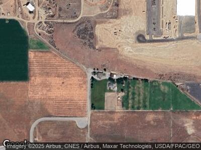
399 N Union Ave East Wenatchee, WA 98802
Estimated Value: $562,000 - $815,000
3
Beds
2
Baths
1,765
Sq Ft
$397/Sq Ft
Est. Value
About This Home
This home is located at 399 N Union Ave, East Wenatchee, WA 98802 and is currently estimated at $701,539, approximately $397 per square foot. 399 N Union Ave is a home located in Douglas County with nearby schools including Clovis Point Intermediate School, Rock Island Elementary School, and Eastmont Junior High School.
Ownership History
Date
Name
Owned For
Owner Type
Purchase Details
Closed on
Jul 5, 2005
Sold by
Ammerman Randaul E and Ammerman Linda G
Bought by
Evenhus Stanton A and Evenhus Jennifer L
Current Estimated Value
Home Financials for this Owner
Home Financials are based on the most recent Mortgage that was taken out on this home.
Original Mortgage
$256,000
Interest Rate
5.58%
Mortgage Type
New Conventional
Create a Home Valuation Report for This Property
The Home Valuation Report is an in-depth analysis detailing your home's value as well as a comparison with similar homes in the area
Home Values in the Area
Average Home Value in this Area
Purchase History
| Date | Buyer | Sale Price | Title Company |
|---|---|---|---|
| Evenhus Stanton A | $320,000 | Central Washington Title Ser |
Source: Public Records
Mortgage History
| Date | Status | Borrower | Loan Amount |
|---|---|---|---|
| Open | Evenhus Stanton A | $375,200 | |
| Closed | Evenhus Stanton A | $417,000 | |
| Closed | Evenhus Stanton A | $150,000 | |
| Closed | Evenhus Stanton A | $256,000 |
Source: Public Records
Tax History Compared to Growth
Tax History
| Year | Tax Paid | Tax Assessment Tax Assessment Total Assessment is a certain percentage of the fair market value that is determined by local assessors to be the total taxable value of land and additions on the property. | Land | Improvement |
|---|---|---|---|---|
| 2025 | $2,472 | $653,200 | $237,100 | $416,100 |
| 2024 | $7,409 | $581,600 | $237,100 | $344,500 |
| 2023 | $7,585 | $543,600 | $237,100 | $306,500 |
| 2022 | $6,634 | $498,600 | $192,100 | $306,500 |
| 2021 | $7,052 | $498,600 | $192,100 | $306,500 |
| 2020 | $6,615 | $498,900 | $188,600 | $310,300 |
| 2018 | $6,451 | $468,700 | $159,600 | $309,100 |
| 2017 | $5,731 | $468,700 | $159,600 | $309,100 |
| 2016 | $5,082 | $447,000 | $159,600 | $287,400 |
| 2015 | $5,299 | $447,000 | $159,600 | $287,400 |
| 2014 | -- | $447,000 | $159,600 | $287,400 |
| 2013 | -- | $447,000 | $159,600 | $287,400 |
Source: Public Records
Map
Nearby Homes
- 89 S Texas Ave
- 0 N Quincy Ave
- 3260 1st St SE
- 312 Perry Ave N
- 2575 1st St SE
- 812 N Newport Loop
- 819 N Newport Loop
- 2526 1st St SE
- 898 N Nile Ave
- 861 N Newport Loop
- 2487 3rd St SE
- 2438 Noah St SE
- 561 Canyon Dr Unit 53
- 854 N Manchester Place
- 2404 Noah St SE
- 515 Country Ln
- 518 Country Ln
- 507 Nahalee Dr
- 2339 Noah St SE
- 521 Nahalee Dr
- 399 N Union Ave
- 0 NNA N Union Ave Unit B
- 0 Industrial Way Unit NWM2212681
- 150 N Union Ave
- 305 N Stark Ave
- 8888 NE Trident Way
- 0 N Union Ave Unit 1289225
- 0 N Union Ave Unit 1289234
- 0 N Union Ave Unit 1289038
- 0 N Union Ave Unit 1289044
- 0 N Union Ave Unit 1221700
- 0 N Union Ave Unit 1221860
- 0 N Union Ave Unit 1221858
- 0 N Union Ave Unit 1212146
- 0 N Union Ave Unit 1221698
- 0 S Union Ave
- 374 Urban Industrial Way
- 3224 Grant Rd
- 3220 Grant Rd
- 3214 Grant Rd
