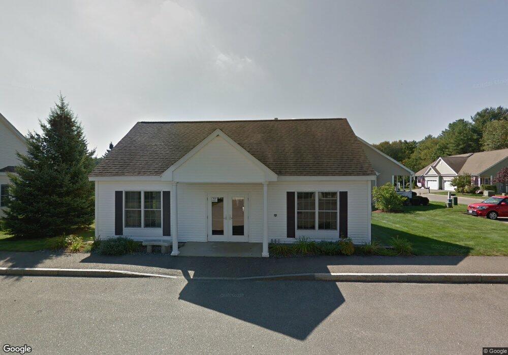
4 Blackford Ln Epping, NH 03042
Estimated Value: $415,774 - $484,000
2
Beds
2
Baths
1,320
Sq Ft
$335/Sq Ft
Est. Value
About This Home
This home is located at 4 Blackford Ln, Epping, NH 03042 and is currently estimated at $442,694, approximately $335 per square foot. 4 Blackford Ln is a home located in Rockingham County with nearby schools including Epping Elementary School, Epping Middle School, and Epping High School.
Ownership History
Date
Name
Owned For
Owner Type
Purchase Details
Closed on
Nov 30, 2020
Sold by
Black Birch Dev Grp Llc
Bought by
Kampf Linda M and Kampf Quentin L
Current Estimated Value
Purchase Details
Closed on
Feb 19, 2014
Sold by
Blackbriar Woods Llc
Bought by
Ojeda-Montalvo Jose L and Soto-Reyes Dariana
Home Financials for this Owner
Home Financials are based on the most recent Mortgage that was taken out on this home.
Original Mortgage
$295,000
Interest Rate
4.5%
Mortgage Type
New Conventional
Purchase Details
Closed on
Mar 14, 2012
Sold by
Barbara T Cross Ret and Cabral Wendy S
Bought by
Dunklee Gerald R and Dunklee Cheryel J
Create a Home Valuation Report for This Property
The Home Valuation Report is an in-depth analysis detailing your home's value as well as a comparison with similar homes in the area
Home Values in the Area
Average Home Value in this Area
Purchase History
| Date | Buyer | Sale Price | Title Company |
|---|---|---|---|
| Kampf Linda M | $355,000 | None Available | |
| Ojeda-Montalvo Jose L | $310,800 | -- | |
| Dunklee Gerald R | $173,000 | -- |
Source: Public Records
Mortgage History
| Date | Status | Borrower | Loan Amount |
|---|---|---|---|
| Previous Owner | Dunklee Gerald R | $295,000 |
Source: Public Records
Tax History
| Year | Tax Paid | Tax Assessment Tax Assessment Total Assessment is a certain percentage of the fair market value that is determined by local assessors to be the total taxable value of land and additions on the property. | Land | Improvement |
|---|---|---|---|---|
| 2024 | $6,431 | $254,900 | $0 | $254,900 |
| 2023 | $5,965 | $254,900 | $0 | $254,900 |
| 2021 | $5,715 | $254,900 | $0 | $254,900 |
| 2020 | $6,026 | $254,900 | $0 | $254,900 |
| 2019 | $5,205 | $187,900 | $0 | $187,900 |
| 2018 | $4,874 | $187,900 | $0 | $187,900 |
| 2017 | $4,874 | $187,900 | $0 | $187,900 |
| 2016 | $4,874 | $187,900 | $0 | $187,900 |
| 2015 | $4,874 | $187,900 | $0 | $187,900 |
| 2014 | $4,552 | $186,400 | $0 | $186,400 |
| 2013 | $4,524 | $186,400 | $0 | $186,400 |
Source: Public Records
Map
Nearby Homes
- 16B Lunas Ave Unit 16B
- 65 Sunset Ridge Rd Unit 65A
- 65 Sunset Ridge Rd Unit 65B
- 63 Sunset Ridge Rd Unit 63A
- 63 Sunset Ridge Rd Unit 63B
- 2 Prescott Rd
- 1B Connor Ct Unit 1B
- 13 Elm St
- 1A Connor Ct Unit 1A
- 3A Connor Ct Unit 3A
- 54 Sunset Ridge Rd Unit 54B
- 55 Sunset Ridge Rd Unit 55A
- 55 Sunset Ridge Rd Unit 55B
- 3B Connor Ct Unit 3B
- 18 Shannon Way
- 290 Calef Hwy Unit B21
- 5A Connor Ct Unit 5A
- 27 Mulberry Ln
- 58 Three Ponds Dr
- 110 Tuck Dr
Your Personal Tour Guide
Ask me questions while you tour the home.