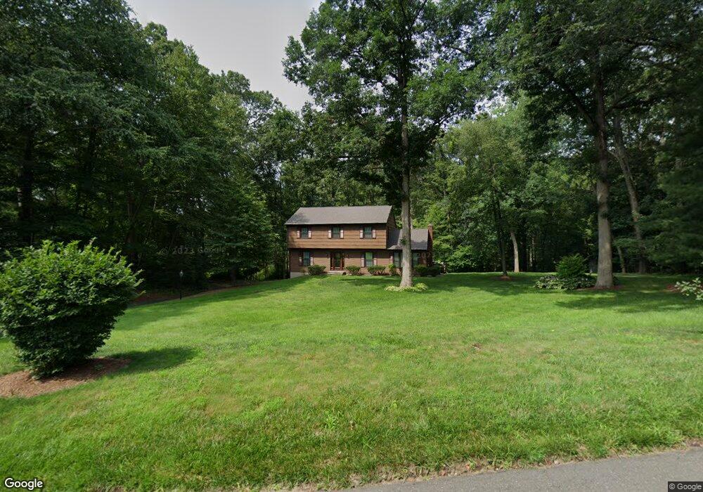
4 College Park Dr Danbury, CT 06811
Estimated Value: $553,000 - $738,000
4
Beds
3
Baths
2,136
Sq Ft
$290/Sq Ft
Est. Value
About This Home
This home is located at 4 College Park Dr, Danbury, CT 06811 and is currently estimated at $619,932, approximately $290 per square foot. 4 College Park Dr is a home located in Fairfield County with nearby schools including Mill Ridge Primary School, Rogers Park Middle School, and Danbury High School.
Ownership History
Date
Name
Owned For
Owner Type
Purchase Details
Closed on
Jun 29, 1993
Sold by
Goldstein Michael and Goldstein Nancy
Bought by
Doubek John and Doubek Pamela
Current Estimated Value
Home Financials for this Owner
Home Financials are based on the most recent Mortgage that was taken out on this home.
Original Mortgage
$192,000
Interest Rate
7.37%
Mortgage Type
Unknown
Purchase Details
Closed on
Apr 15, 1988
Sold by
Reda Robert
Bought by
Goldstein Michael
Create a Home Valuation Report for This Property
The Home Valuation Report is an in-depth analysis detailing your home's value as well as a comparison with similar homes in the area
Home Values in the Area
Average Home Value in this Area
Purchase History
| Date | Buyer | Sale Price | Title Company |
|---|---|---|---|
| Doubek John | $240,000 | -- | |
| Goldstein Michael | $240,000 | -- |
Source: Public Records
Mortgage History
| Date | Status | Borrower | Loan Amount |
|---|---|---|---|
| Closed | Goldstein Michael | $32,000 | |
| Open | Goldstein Michael | $219,904 | |
| Closed | Goldstein Michael | $240,000 | |
| Closed | Goldstein Michael | $192,000 |
Source: Public Records
Tax History Compared to Growth
Tax History
| Year | Tax Paid | Tax Assessment Tax Assessment Total Assessment is a certain percentage of the fair market value that is determined by local assessors to be the total taxable value of land and additions on the property. | Land | Improvement |
|---|---|---|---|---|
| 2025 | $7,510 | $300,510 | $72,520 | $227,990 |
| 2024 | $7,344 | $300,510 | $72,520 | $227,990 |
| 2023 | $7,011 | $300,510 | $72,520 | $227,990 |
| 2022 | $6,143 | $217,700 | $75,500 | $142,200 |
| 2021 | $6,009 | $217,700 | $75,500 | $142,200 |
| 2020 | $6,009 | $217,700 | $75,500 | $142,200 |
| 2019 | $6,009 | $217,700 | $75,500 | $142,200 |
| 2018 | $6,009 | $217,700 | $75,500 | $142,200 |
| 2017 | $5,836 | $201,600 | $72,000 | $129,600 |
| 2016 | $5,782 | $201,600 | $72,000 | $129,600 |
| 2015 | $5,697 | $201,600 | $72,000 | $129,600 |
| 2014 | $5,564 | $201,600 | $72,000 | $129,600 |
Source: Public Records
Map
Nearby Homes
- 23 Scuppo Rd Unit 5-6
- 6 Kenosia Ave Unit LOT 31
- 12 Scuppo Rd Unit H45
- 55 Mill Plain Rd Unit 17-6
- 55 Mill Plain Rd Unit 5-3
- 1603 Briar Woods Ln
- 4 Kenmere Blvd
- 44 Boulevard Dr
- 31 Greenlawn Dr
- 6 Ken Oaks Dr
- 30 Myrtle Ave
- 11 Westwood Dr
- 1102 Larson Dr Unit 1102
- 4 Staples St
- 17 Staples St
- 78 Lee Ave Unit 1
- 38 Fairmount Dr
- 139 Westville Ave
- 11 W Lake Shore Dr
- 206 Park Ave Unit 206
- 26 Crestdale Dr
- 24 Crestdale Dr
- 10 College Park Dr
- 20 Crestdale Dr
- 8 College Park Dr
- 28 Crestdale Dr
- 7 College Park Dr
- 5 College Park Dr
- 11 Crestdale Dr
- 20 Crestdale Rd
- 12 College Park Dr
- 22 Crestdale Rd
- 9 Crestdale Dr
- 16 Crestdale Rd
- 14 College Park Dr
- 9 College Park Dr
- 16 Crestdale Dr
- 25 Crestdale Rd
- 7 Crestdale Dr