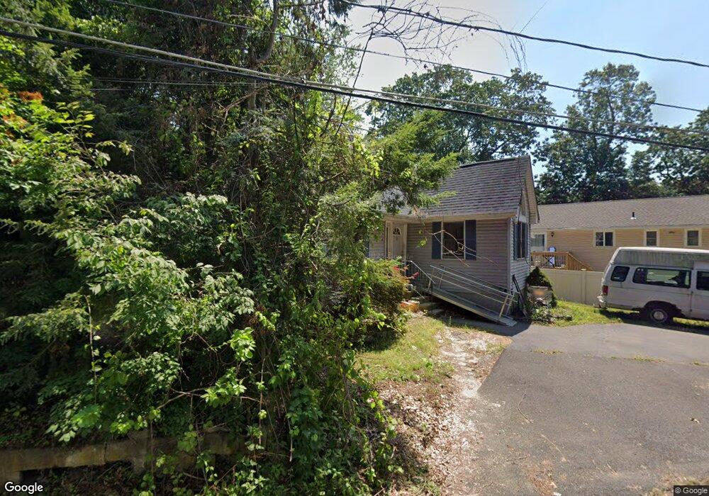
4 Coslin Rd Enfield, CT 06082
Estimated Value: $317,542 - $331,000
3
Beds
2
Baths
1,286
Sq Ft
$250/Sq Ft
Est. Value
About This Home
This home is located at 4 Coslin Rd, Enfield, CT 06082 and is currently estimated at $321,886, approximately $250 per square foot. 4 Coslin Rd is a home located in Hartford County with nearby schools including Prudence Crandall Elementary School, Nathan Hale Elementary School, and Enfield High School.
Ownership History
Date
Name
Owned For
Owner Type
Purchase Details
Closed on
Aug 30, 2005
Sold by
Stokowski Shawn
Bought by
Warmouth Leanu
Current Estimated Value
Home Financials for this Owner
Home Financials are based on the most recent Mortgage that was taken out on this home.
Original Mortgage
$155,920
Outstanding Balance
$82,524
Interest Rate
5.68%
Estimated Equity
$239,362
Purchase Details
Closed on
Jul 28, 1999
Sold by
Kula Peter and Kula Frances
Bought by
Stokowski Shawn
Home Financials for this Owner
Home Financials are based on the most recent Mortgage that was taken out on this home.
Original Mortgage
$105,000
Interest Rate
7.61%
Purchase Details
Closed on
Sep 30, 1993
Sold by
Lomas Mtg Usa Inc
Bought by
Kula Peter and Jekot Frances
Purchase Details
Closed on
Oct 6, 1989
Sold by
G&K Custom Bldrs
Bought by
George Douglas
Create a Home Valuation Report for This Property
The Home Valuation Report is an in-depth analysis detailing your home's value as well as a comparison with similar homes in the area
Home Values in the Area
Average Home Value in this Area
Purchase History
| Date | Buyer | Sale Price | Title Company |
|---|---|---|---|
| Warmouth Leanu | $194,900 | -- | |
| Stokowski Shawn | $105,000 | -- | |
| Kula Peter | $101,900 | -- | |
| George Douglas | $144,000 | -- |
Source: Public Records
Mortgage History
| Date | Status | Borrower | Loan Amount |
|---|---|---|---|
| Open | George Douglas | $155,920 | |
| Previous Owner | George Douglas | $105,500 | |
| Previous Owner | George Douglas | $105,000 | |
| Previous Owner | George Douglas | $9,000 |
Source: Public Records
Tax History
| Year | Tax Paid | Tax Assessment Tax Assessment Total Assessment is a certain percentage of the fair market value that is determined by local assessors to be the total taxable value of land and additions on the property. | Land | Improvement |
|---|---|---|---|---|
| 2025 | $4,998 | $140,800 | $42,400 | $98,400 |
| 2024 | $4,866 | $140,800 | $42,400 | $98,400 |
| 2023 | $4,838 | $140,800 | $42,400 | $98,400 |
| 2022 | $4,455 | $140,800 | $42,400 | $98,400 |
| 2021 | $4,248 | $109,970 | $35,130 | $74,840 |
| 2020 | $4,204 | $109,970 | $35,130 | $74,840 |
| 2019 | $4,094 | $109,970 | $35,130 | $74,840 |
| 2018 | $4,003 | $109,970 | $35,130 | $74,840 |
| 2017 | $3,786 | $109,970 | $35,130 | $74,840 |
| 2016 | $3,586 | $108,130 | $35,130 | $73,000 |
| 2015 | $3,481 | $108,130 | $35,130 | $73,000 |
| 2014 | $3,399 | $108,130 | $35,130 | $73,000 |
Source: Public Records
Map
Nearby Homes
- 176 Cottage Rd
- 14 W Forrest Dr
- 137 the Laurels Unit 137
- 39 Liberty Ln
- 54 Liberty Ln
- 59 Liberty Ln
- 44 Liberty Ln
- 60 Liberty Ln
- 42 Liberty Ln
- 50 Liberty Ln
- 56 Liberty Ln
- 46 Liberty Ln
- 43 Liberty Ln
- 41 Liberty Ln
- 449 The Meadows
- 208 Birch Rd
- 3 Pinecrest Rd
- 53 Meadowlark Dr
- 63 Meadowlark Dr
- 31 Sharren Ln
Your Personal Tour Guide
Ask me questions while you tour the home.