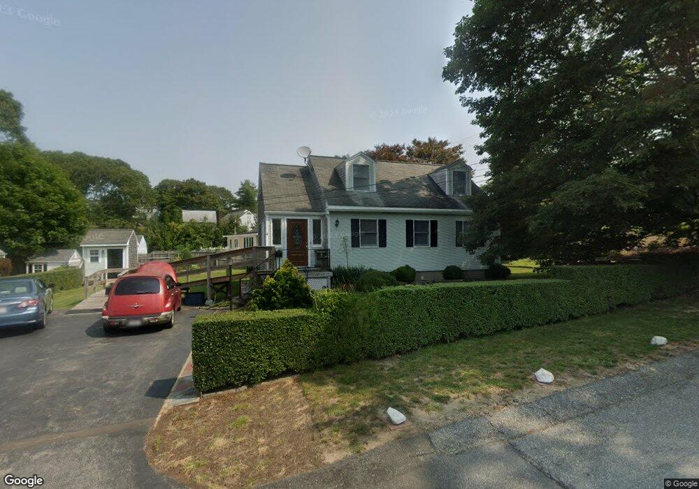
4 Cranberry Rd Buzzards Bay, MA 02532
Buzzards Bay NeighborhoodEstimated Value: $468,000 - $715,000
4
Beds
2
Baths
1,152
Sq Ft
$476/Sq Ft
Est. Value
About This Home
This home is located at 4 Cranberry Rd, Buzzards Bay, MA 02532 and is currently estimated at $548,446, approximately $476 per square foot. 4 Cranberry Rd is a home located in Barnstable County with nearby schools including Bourne High School and St Margaret Regional School.
Ownership History
Date
Name
Owned For
Owner Type
Purchase Details
Closed on
Sep 25, 2024
Sold by
Lindsay Kevin D
Bought by
Kevin D Lindsay Ret and Lindsay
Current Estimated Value
Purchase Details
Closed on
Nov 10, 2022
Sold by
Bilodeau Robert E
Bought by
Bilodeau Robert E and Greeson Emma
Purchase Details
Closed on
Mar 30, 2015
Sold by
Lindsay Catherine C
Bought by
Lindsay Catherine C and Lindsay Kevin D
Create a Home Valuation Report for This Property
The Home Valuation Report is an in-depth analysis detailing your home's value as well as a comparison with similar homes in the area
Home Values in the Area
Average Home Value in this Area
Purchase History
| Date | Buyer | Sale Price | Title Company |
|---|---|---|---|
| Kevin D Lindsay Ret | -- | None Available | |
| Kevin D Lindsay Ret | -- | None Available | |
| Bilodeau Robert E | -- | None Available | |
| Bilodeau Robert E | -- | None Available | |
| Bilodeau Robert E | -- | None Available | |
| Lindsay Catherine C | -- | -- | |
| Lindsay Catherine C | -- | -- |
Source: Public Records
Tax History
| Year | Tax Paid | Tax Assessment Tax Assessment Total Assessment is a certain percentage of the fair market value that is determined by local assessors to be the total taxable value of land and additions on the property. | Land | Improvement |
|---|---|---|---|---|
| 2025 | $3,259 | $417,300 | $184,100 | $233,200 |
| 2024 | $3,187 | $397,400 | $175,400 | $222,000 |
| 2023 | $3,098 | $351,700 | $155,200 | $196,500 |
| 2022 | $2,839 | $281,400 | $137,300 | $144,100 |
| 2021 | $2,759 | $256,200 | $125,000 | $131,200 |
| 2020 | $2,608 | $242,800 | $123,800 | $119,000 |
| 2019 | $2,481 | $236,100 | $123,800 | $112,300 |
| 2018 | $2,370 | $224,900 | $117,900 | $107,000 |
| 2017 | $2,294 | $222,700 | $116,800 | $105,900 |
| 2016 | $2,212 | $217,700 | $116,800 | $100,900 |
| 2015 | $2,192 | $217,700 | $116,800 | $100,900 |
Source: Public Records
Map
Nearby Homes
- 23 Alderberry Rd
- 0 Lewis Point Rd
- 48 Maple St
- 73 Lewis Point Rd
- 3 Wolf Rd
- 40-A Lafayette Ave
- 46 Holt Rd Unit A
- 4 Van Bummel Rd
- 151 - 153 Main St
- 304 Main St
- 56 Rip Van Winkle Way
- 9 Hideaway Rd Unit F
- 810 Head of The Bay Rd
- 13 Hideaway Village Unit G
- 38 Old Bridge Rd
- 6 Honora Ct
- 11 Buzzards Bay Dr
- 60 Sandwich Rd
- 90-92 Sandwich Rd Unit 9C
- 92 Choctaw Dr