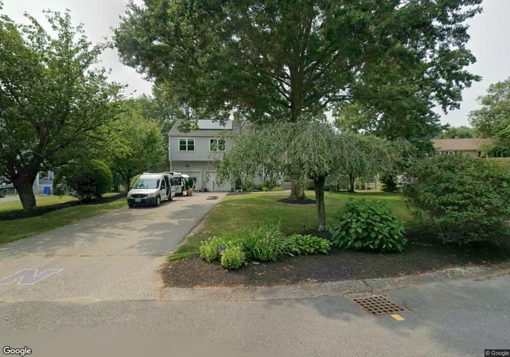
4 Fieldstone Cir Norton, MA 02766
Estimated Value: $817,000 - $968,000
3
Beds
3
Baths
2,268
Sq Ft
$383/Sq Ft
Est. Value
About This Home
This home is located at 4 Fieldstone Cir, Norton, MA 02766 and is currently estimated at $868,270, approximately $382 per square foot. 4 Fieldstone Cir is a home located in Bristol County with nearby schools including J.C. Solmonese Elementary School, Henri A. Yelle Elementary School, and Norton Middle School.
Ownership History
Date
Name
Owned For
Owner Type
Purchase Details
Closed on
Oct 31, 2011
Sold by
Petel Earle R and Petel Linda A
Bought by
Tepper Ryan M and Culley Kathryn E
Current Estimated Value
Home Financials for this Owner
Home Financials are based on the most recent Mortgage that was taken out on this home.
Original Mortgage
$362,537
Outstanding Balance
$248,287
Interest Rate
4.11%
Mortgage Type
Purchase Money Mortgage
Estimated Equity
$619,983
Create a Home Valuation Report for This Property
The Home Valuation Report is an in-depth analysis detailing your home's value as well as a comparison with similar homes in the area
Home Values in the Area
Average Home Value in this Area
Purchase History
| Date | Buyer | Sale Price | Title Company |
|---|---|---|---|
| Tepper Ryan M | $392,500 | -- |
Source: Public Records
Mortgage History
| Date | Status | Borrower | Loan Amount |
|---|---|---|---|
| Open | Tepper Ryan M | $362,537 |
Source: Public Records
Tax History
| Year | Tax Paid | Tax Assessment Tax Assessment Total Assessment is a certain percentage of the fair market value that is determined by local assessors to be the total taxable value of land and additions on the property. | Land | Improvement |
|---|---|---|---|---|
| 2025 | $103 | $791,700 | $218,400 | $573,300 |
| 2024 | $9,784 | $755,500 | $208,000 | $547,500 |
| 2023 | $7,487 | $576,400 | $196,200 | $380,200 |
| 2022 | $7,236 | $507,400 | $178,300 | $329,100 |
| 2021 | $6,816 | $459,700 | $169,900 | $289,800 |
| 2020 | $6,664 | $450,300 | $164,900 | $285,400 |
| 2019 | $6,426 | $431,300 | $158,600 | $272,700 |
| 2018 | $6,922 | $417,200 | $158,600 | $258,600 |
| 2017 | $6,171 | $401,500 | $158,600 | $242,900 |
| 2016 | $5,940 | $380,500 | $158,600 | $221,900 |
| 2015 | $5,727 | $372,100 | $155,500 | $216,600 |
| 2014 | $5,496 | $357,600 | $148,100 | $209,500 |
Source: Public Records
Map
Nearby Homes
- 37 Oakleaf Dr
- 14 Country Club Way
- 143 Oak St Unit 10
- 2 Oak St Unit 2A
- 2 Oak St Unit 2B
- 451R Gilbert St
- 71 Richardson Ave
- 10 Walter St
- 65 Godfrey Dr Unit 65
- 4 Village Way Unit F
- 20 John F. Kennedy Dr
- 95 Godfrey Dr
- 250 Mansfield Ave Unit 11
- 27 Smith St Unit 11
- 345 Richardson Ave
- 157 Mansfield Ave Unit 14
- 14 Claire Ave
- 49 Pheasant Hill Rd
- 5 Robin Cir Unit 5
- 150 Gilbert St
- 6 Fieldstone Cir
- 2 Fieldstone Cir
- 1 Fieldstone Cir
- 7 Fieldstone Cir
- 1 Brookwood Ln
- 3 Fieldstone Cir
- 5 Brookwood Ln
- 5 Fieldstone Cir
- 4 Larson Farm Dr
- 2 Brookwood Ln
- 4 Brookwood Ln
- 6 Brookwood Ln
- 10 Strawstone Ln
- 1 Larson Farm Dr
- 8 Strawstone Ln
- 6 Strawstone Ln
- 3 Larson Farm Dr
- 234 Oak St
- 6 Larson Farm Dr
- 4 Strawstone Ln
Your Personal Tour Guide
Ask me questions while you tour the home.