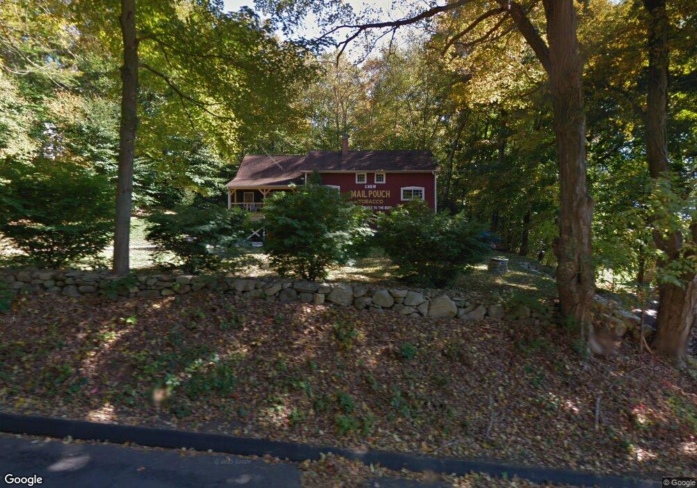
4 Jeremiah Rd Sandy Hook, CT 06482
Estimated Value: $542,796 - $686,000
3
Beds
2
Baths
2,106
Sq Ft
$288/Sq Ft
Est. Value
About This Home
This home is located at 4 Jeremiah Rd, Sandy Hook, CT 06482 and is currently estimated at $606,949, approximately $288 per square foot. 4 Jeremiah Rd is a home located in Fairfield County with nearby schools including Sandy Hook Elementary School, Reed Intermediate School, and Newtown Middle School.
Ownership History
Date
Name
Owned For
Owner Type
Purchase Details
Closed on
Feb 27, 2004
Sold by
Petro Carol
Bought by
Zemola Gary
Current Estimated Value
Purchase Details
Closed on
Jan 3, 2001
Sold by
Chontos Shane R and Chontos Jeffrey A
Bought by
Petro Carol A
Purchase Details
Closed on
Apr 18, 1999
Sold by
Long J Dan and Long Gail A
Bought by
Chontos Shane R and Chontos Jeffrey
Create a Home Valuation Report for This Property
The Home Valuation Report is an in-depth analysis detailing your home's value as well as a comparison with similar homes in the area
Home Values in the Area
Average Home Value in this Area
Purchase History
| Date | Buyer | Sale Price | Title Company |
|---|---|---|---|
| Zemola Gary | $422,000 | -- | |
| Zemola Gary | $422,000 | -- | |
| Petro Carol A | $320,000 | -- | |
| Petro Carol A | $320,000 | -- | |
| Chontos Shane R | $110,000 | -- | |
| Chontos Shane R | $110,000 | -- |
Source: Public Records
Mortgage History
| Date | Status | Borrower | Loan Amount |
|---|---|---|---|
| Open | Chontos Shane R | $424,000 | |
| Closed | Chontos Shane R | $59,000 |
Source: Public Records
Tax History
| Year | Tax Paid | Tax Assessment Tax Assessment Total Assessment is a certain percentage of the fair market value that is determined by local assessors to be the total taxable value of land and additions on the property. | Land | Improvement |
|---|---|---|---|---|
| 2025 | $8,405 | $292,450 | $64,800 | $227,650 |
| 2024 | $7,887 | $292,450 | $64,800 | $227,650 |
| 2023 | $7,674 | $292,450 | $64,800 | $227,650 |
| 2022 | $7,354 | $212,120 | $67,610 | $144,510 |
| 2021 | $7,350 | $212,120 | $67,610 | $144,510 |
| 2020 | $7,373 | $212,120 | $67,610 | $144,510 |
| 2019 | $7,375 | $212,120 | $67,610 | $144,510 |
| 2018 | $7,263 | $212,120 | $67,610 | $144,510 |
| 2017 | $6,746 | $199,160 | $65,750 | $133,410 |
| 2016 | $6,692 | $199,160 | $65,750 | $133,410 |
| 2015 | $6,586 | $199,160 | $65,750 | $133,410 |
| 2014 | $6,634 | $199,160 | $65,750 | $133,410 |
Source: Public Records
Map
Nearby Homes
- 16A Pole Bridge Rd
- 12 Skidmore Ln
- 22 Misty Vale Rd
- 3 Owl Ridge Ln
- 1 Owl Ridge Ln
- 23 Fawnwood Rd
- 53 A Toddy Hill Rd
- 7 Longview Rd
- 6 Crestwood Dr
- 108 Riverside Rd
- 4 Sunnyview Terrace
- 30 Capitol Dr
- 41 Chipmunk Trail
- 93 Toddy Hill Rd
- 89 Alpine Dr
- 7 Dayton St
- 32 Yogananda St
- 22 Hemlock Trail
- 17 Buttonball Dr
- 123 Louis Hill Rd
- 1 Misty Vale Rd
- 6 Jeremiah Rd
- 1 Jeremiah Rd
- 3 Misty Vale Rd
- 8 Jeremiah Rd
- 5 Misty Vale Rd
- 3 Jeremiah Rd
- 2 Misty Vale Rd
- 7 Misty Vale Rd
- 10 Jeremiah Rd
- 9 Misty Vale Rd
- 4 Misty Vale Rd
- 9 Pole Bridge Rd
- 5 Jeremiah Rd
- 6 Misty Vale Rd
- 7 Pole Bridge Rd
- 10 Pole Bridge Rd
- 11 Pole Bridge Rd
- 8 Misty Vale Rd
- 11 Misty Vale Rd
Your Personal Tour Guide
Ask me questions while you tour the home.