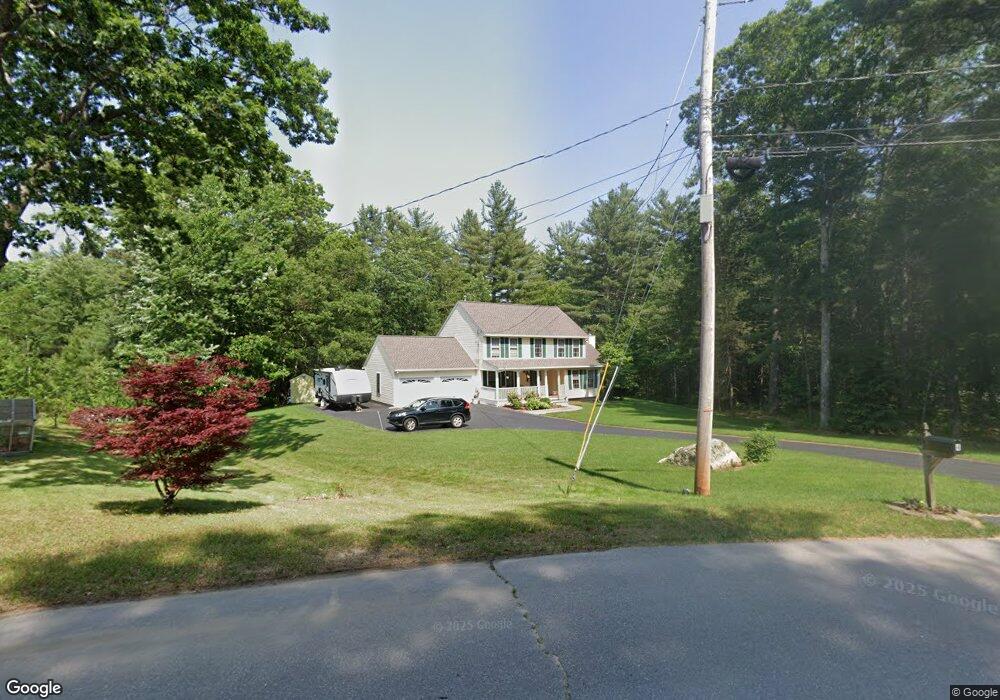
4 Newstead St Litchfield, NH 03052
Estimated Value: $718,040 - $735,000
3
Beds
3
Baths
2,637
Sq Ft
$275/Sq Ft
Est. Value
About This Home
This home is located at 4 Newstead St, Litchfield, NH 03052 and is currently estimated at $725,260, approximately $275 per square foot. 4 Newstead St is a home located in Hillsborough County with nearby schools including Griffin Memorial School, Litchfield Middle School, and Campbell High School.
Ownership History
Date
Name
Owned For
Owner Type
Purchase Details
Closed on
Jul 12, 2017
Sold by
Stonge Michael J and Stonge Candace M
Bought by
Stonge Ft
Current Estimated Value
Purchase Details
Closed on
Aug 18, 2008
Sold by
Esposito Paul M and Esposito Andrea R
Bought by
Stonge Michael J and Stonge Candace M
Home Financials for this Owner
Home Financials are based on the most recent Mortgage that was taken out on this home.
Original Mortgage
$323,000
Interest Rate
6.4%
Mortgage Type
Purchase Money Mortgage
Purchase Details
Closed on
Apr 1, 1999
Sold by
Ashwood Dev Co Inc
Bought by
Esposito Paul M and Esposito Andrea R
Home Financials for this Owner
Home Financials are based on the most recent Mortgage that was taken out on this home.
Original Mortgage
$164,500
Interest Rate
6.78%
Purchase Details
Closed on
Oct 6, 1998
Sold by
Sawmill Brook Dev Co
Bought by
Ashwood Dev Co Inc
Create a Home Valuation Report for This Property
The Home Valuation Report is an in-depth analysis detailing your home's value as well as a comparison with similar homes in the area
Home Values in the Area
Average Home Value in this Area
Purchase History
| Date | Buyer | Sale Price | Title Company |
|---|---|---|---|
| Stonge Ft | -- | -- | |
| Stonge Michael J | $340,000 | -- | |
| Esposito Paul M | $173,200 | -- | |
| Ashwood Dev Co Inc | $40,000 | -- | |
| Ashwood Dev Co Inc | $40,000 | -- |
Source: Public Records
Mortgage History
| Date | Status | Borrower | Loan Amount |
|---|---|---|---|
| Previous Owner | Ashwood Dev Co Inc | $325,365 | |
| Previous Owner | Ashwood Dev Co Inc | $323,000 | |
| Previous Owner | Ashwood Dev Co Inc | $164,500 |
Source: Public Records
Tax History Compared to Growth
Tax History
| Year | Tax Paid | Tax Assessment Tax Assessment Total Assessment is a certain percentage of the fair market value that is determined by local assessors to be the total taxable value of land and additions on the property. | Land | Improvement |
|---|---|---|---|---|
| 2024 | $8,426 | $405,500 | $155,600 | $249,900 |
| 2023 | $8,491 | $405,500 | $155,600 | $249,900 |
| 2022 | $7,717 | $405,500 | $155,600 | $249,900 |
| 2021 | $7,477 | $405,500 | $155,600 | $249,900 |
| 2020 | $7,517 | $404,600 | $155,600 | $249,000 |
| 2019 | $7,603 | $321,500 | $124,600 | $196,900 |
| 2017 | $7,231 | $321,500 | $124,600 | $196,900 |
| 2016 | $3,720 | $321,500 | $124,600 | $196,900 |
| 2015 | $6,552 | $321,500 | $124,600 | $196,900 |
| 2014 | $6,398 | $309,100 | $123,200 | $185,900 |
| 2013 | $6,348 | $308,600 | $123,200 | $185,400 |
Source: Public Records
Map
Nearby Homes
- 41 Century Ln
- 25 Chatfield Dr
- 1 Morrill St
- 1 Tallarico St Unit 2
- 1 Tallarico St Unit 14
- 0 Tallarico St Unit Lot 11 5056385
- 0 Tallarico St Unit 10 5044310
- 0 Tallarico St Unit 25 5043170
- 0 Tallarico St Unit 5041169
- 0 Tallarico St Unit 12 5033131
- 0 Tallarico St Unit 5 5032751
- 0 Tallarico St Unit 3 5032471
- 490 Charles Bancroft Hwy
- 17 Winter Cir
- 343 Charles Bancroft Hwy
- 6 Stearns Ln Unit 202
- 3-C Mustang Dr Unit MODEL
- 26 Moose Hollow Rd
- 315 Charles Bancroft Hwy
- 24 Windsor Dr Unit 10