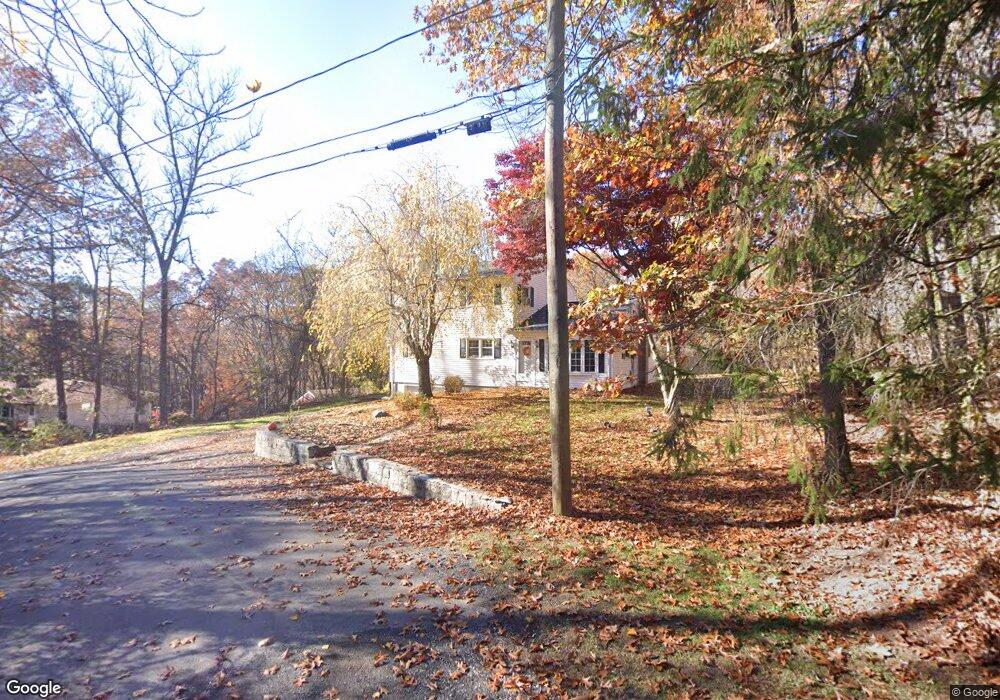
4 Sojo Rd Brookfield, CT 06804
Estimated Value: $538,000 - $605,000
4
Beds
2
Baths
1,768
Sq Ft
$318/Sq Ft
Est. Value
About This Home
This home is located at 4 Sojo Rd, Brookfield, CT 06804 and is currently estimated at $562,828, approximately $318 per square foot. 4 Sojo Rd is a home located in Fairfield County with nearby schools including Whisconier Middle School, Brookfield High School, and The Goddard School - Brookfield.
Ownership History
Date
Name
Owned For
Owner Type
Purchase Details
Closed on
Jun 20, 2003
Sold by
Patel Ashwin and Patel Madula
Bought by
Fleming John and Fleming Maryann
Current Estimated Value
Home Financials for this Owner
Home Financials are based on the most recent Mortgage that was taken out on this home.
Original Mortgage
$248,000
Interest Rate
5.71%
Purchase Details
Closed on
Jun 19, 1997
Sold by
Fortier Charles and Fortier Brenda
Bought by
Patel Ashwin R and Patel Madula A
Purchase Details
Closed on
Aug 31, 1993
Sold by
Matte David and Matte Lauren
Bought by
Fortier Charles and Fortier Brenda
Create a Home Valuation Report for This Property
The Home Valuation Report is an in-depth analysis detailing your home's value as well as a comparison with similar homes in the area
Home Values in the Area
Average Home Value in this Area
Purchase History
| Date | Buyer | Sale Price | Title Company |
|---|---|---|---|
| Fleming John | $310,000 | -- | |
| Fleming John | $310,000 | -- | |
| Patel Ashwin R | $156,500 | -- | |
| Patel Ashwin R | $156,500 | -- | |
| Fortier Charles | $150,500 | -- | |
| Fortier Charles | $150,500 | -- |
Source: Public Records
Mortgage History
| Date | Status | Borrower | Loan Amount |
|---|---|---|---|
| Open | Fortier Charles | $80,000 | |
| Open | Fortier Charles | $332,000 | |
| Closed | Fortier Charles | $248,000 |
Source: Public Records
Tax History
| Year | Tax Paid | Tax Assessment Tax Assessment Total Assessment is a certain percentage of the fair market value that is determined by local assessors to be the total taxable value of land and additions on the property. | Land | Improvement |
|---|---|---|---|---|
| 2025 | $7,272 | $251,350 | $92,800 | $158,550 |
| 2024 | $7,013 | $251,350 | $92,800 | $158,550 |
| 2023 | $6,751 | $251,350 | $92,800 | $158,550 |
| 2022 | $6,505 | $251,350 | $92,800 | $158,550 |
| 2021 | $8,692 | $208,430 | $103,110 | $105,320 |
| 2020 | $6,180 | $208,430 | $103,110 | $105,320 |
| 2019 | $6,074 | $208,430 | $103,110 | $105,320 |
| 2018 | $5,907 | $208,430 | $103,110 | $105,320 |
| 2017 | $5,688 | $208,430 | $103,110 | $105,320 |
| 2016 | $5,881 | $222,760 | $112,230 | $110,530 |
| 2015 | $5,725 | $222,760 | $112,230 | $110,530 |
| 2014 | $5,725 | $222,760 | $112,230 | $110,530 |
Source: Public Records
Map
Nearby Homes
- 1 Rajcula Farm Rd
- 154A Long Meadow Hill Rd
- 154B Long Meadow Hill Rd
- 77 Old Middle Rd
- 1 Old Middle Rd
- 109 Long Meadow Hill Rd
- 22 Prospect Dr
- 13 Nicoles Ct
- 6 Poppy Dr
- 45 Old Pumpkin Hill Rd
- 26 Cove Rd
- 126 Carmen Hill Rd
- 44 N Mountain Rd
- 5 Kary Ln
- 47 Mist Hill Dr
- 10 Juniper Dr
- 16 Dogwood Dr
- 38 Candlewood Lake Rd S Unit 3
- 892 Candlewood Lake Rd S
- 128 Carmen Hill Rd
- 6 Sojo Rd
- 16 Richards Rd
- 14 Richards Rd
- 18 Richards Rd
- 13 Robins Ln
- 12A Richards Rd
- 12 Richards Rd
- 8 Sojo Rd
- 8 Sojo Rd Unit Legal In-Law
- 20 Richards Rd
- 19 Richards Rd
- 17 Richards Rd
- 12 Robins Ln
- 21 Richards Rd
- 22 Richards Rd
- 10 Richards Rd
- 15 Richards Rd
- 15A Richards Rd
- 15B Richards Rd
- 23 Richards Rd
Your Personal Tour Guide
Ask me questions while you tour the home.