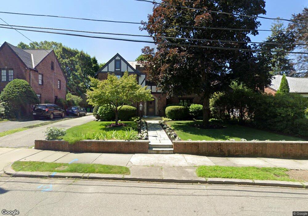
40 Brackett Rd Newton, MA 02458
Newton Corner NeighborhoodEstimated Value: $2,673,554 - $3,446,000
4
Beds
4
Baths
3,443
Sq Ft
$869/Sq Ft
Est. Value
About This Home
This home is located at 40 Brackett Rd, Newton, MA 02458 and is currently estimated at $2,990,889, approximately $868 per square foot. 40 Brackett Rd is a home located in Middlesex County with nearby schools including Ward Elementary School, Bigelow Middle School, and Newton North High School.
Ownership History
Date
Name
Owned For
Owner Type
Purchase Details
Closed on
Nov 16, 2005
Sold by
Judith C Isroff T and Isroff Judith C
Bought by
Bunis David A and Hallo Jacqueline L
Current Estimated Value
Home Financials for this Owner
Home Financials are based on the most recent Mortgage that was taken out on this home.
Original Mortgage
$940,000
Outstanding Balance
$515,986
Interest Rate
6.07%
Mortgage Type
Purchase Money Mortgage
Estimated Equity
$2,474,903
Purchase Details
Closed on
May 5, 2004
Sold by
Isroff Judith C
Bought by
Judith C Isroff 1995 T and Isroff Judith C
Create a Home Valuation Report for This Property
The Home Valuation Report is an in-depth analysis detailing your home's value as well as a comparison with similar homes in the area
Home Values in the Area
Average Home Value in this Area
Purchase History
We collect this data history from publicly available records. To have your information removed, we recommend requesting removal directly through your county’s website.
| Date | Buyer | Sale Price | Title Company |
|---|---|---|---|
| Bunis David A | $1,560,000 | -- | |
| Judith C Isroff 1995 T | -- | -- |
Source: Public Records
Mortgage History
We collect this data history from publicly available records. To have your information removed, we recommend requesting removal directly through your county’s website.
| Date | Status | Borrower | Loan Amount |
|---|---|---|---|
| Open | Bunis David A | $940,000 |
Source: Public Records
Tax History
| Year | Tax Paid | Tax Assessment Tax Assessment Total Assessment is a certain percentage of the fair market value that is determined by local assessors to be the total taxable value of land and additions on the property. | Land | Improvement |
|---|---|---|---|---|
| 2025 | $25,774 | $2,630,000 | $1,458,900 | $1,171,100 |
| 2024 | $24,921 | $2,553,400 | $1,416,400 | $1,137,000 |
| 2023 | $23,899 | $2,347,600 | $1,097,500 | $1,250,100 |
| 2022 | $22,867 | $2,173,700 | $1,016,200 | $1,157,500 |
| 2021 | $22,066 | $2,050,700 | $958,700 | $1,092,000 |
| 2020 | $21,409 | $2,050,700 | $958,700 | $1,092,000 |
| 2019 | $20,806 | $1,991,000 | $930,800 | $1,060,200 |
| 2018 | $20,257 | $1,872,200 | $839,200 | $1,033,000 |
| 2017 | $19,640 | $1,766,200 | $791,700 | $974,500 |
| 2016 | $18,785 | $1,650,700 | $739,900 | $910,800 |
| 2015 | $17,911 | $1,542,700 | $691,500 | $851,200 |
Source: Public Records
Map
Nearby Homes
- 81 Brackett Rd
- 20 Montrose St
- 17 Lancaster Rd
- 16 Lancaster Rd
- 66 Montrose St
- 150 Cotton St
- 15 Farlow Rd
- 31 George St
- 33 George St Unit 33
- 30 Dorr Rd
- 216 Waverley Ave
- 34 Converse Ave
- 34 Irving St
- 12-14 Nottingham St
- 105 Grant Ave
- 269 Franklin St
- 0 Claremont St
- 13 Mount Ida Terrace Unit 13
- 56 Bennington St
- 549 Centre St Unit 2
Your Personal Tour Guide
Ask me questions while you tour the home.