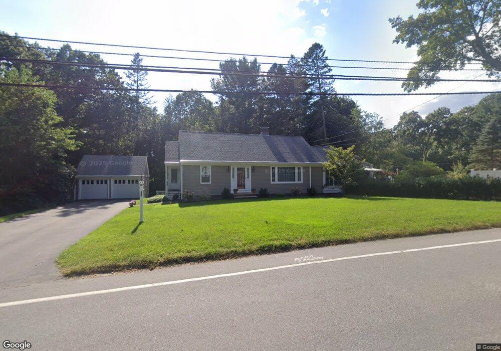
40 Chandler Rd Andover, MA 01810
West Andover NeighborhoodEstimated Value: $909,000 - $1,159,000
3
Beds
3
Baths
3,136
Sq Ft
$316/Sq Ft
Est. Value
About This Home
This home is located at 40 Chandler Rd, Andover, MA 01810 and is currently estimated at $990,872, approximately $315 per square foot. 40 Chandler Rd is a home located in Essex County with nearby schools including West Elementary School, Wood Hill Middle School, and Willow River Secondary School.
Ownership History
Date
Name
Owned For
Owner Type
Purchase Details
Closed on
Dec 5, 2019
Sold by
Spoto John S and Spoto Helene M
Bought by
Spoto Rt and Spoto
Current Estimated Value
Purchase Details
Closed on
Jun 28, 1991
Sold by
Coutis Peter
Bought by
Spoto John S
Purchase Details
Closed on
Jun 29, 1990
Sold by
Deneu Frank P
Bought by
Coutis Peter
Create a Home Valuation Report for This Property
The Home Valuation Report is an in-depth analysis detailing your home's value as well as a comparison with similar homes in the area
Home Values in the Area
Average Home Value in this Area
Purchase History
| Date | Buyer | Sale Price | Title Company |
|---|---|---|---|
| Spoto Rt | -- | None Available | |
| Spoto Rt | -- | None Available | |
| Spoto John S | $197,500 | -- | |
| Spoto John S | $197,500 | -- | |
| Coutis Peter | $180,000 | -- | |
| Coutis Peter | $180,000 | -- |
Source: Public Records
Mortgage History
| Date | Status | Borrower | Loan Amount |
|---|---|---|---|
| Previous Owner | Coutis Peter | $150,000 | |
| Previous Owner | Coutis Peter | $58,000 | |
| Previous Owner | Coutis Peter | $148,500 |
Source: Public Records
Tax History Compared to Growth
Tax History
| Year | Tax Paid | Tax Assessment Tax Assessment Total Assessment is a certain percentage of the fair market value that is determined by local assessors to be the total taxable value of land and additions on the property. | Land | Improvement |
|---|---|---|---|---|
| 2024 | $9,625 | $747,300 | $404,900 | $342,400 |
| 2023 | $9,201 | $673,600 | $364,600 | $309,000 |
| 2022 | $8,742 | $598,800 | $317,100 | $281,700 |
| 2021 | $8,364 | $547,000 | $288,300 | $258,700 |
| 2020 | $8,023 | $534,500 | $281,400 | $253,100 |
| 2019 | $7,934 | $519,600 | $273,000 | $246,600 |
| 2018 | $7,595 | $485,600 | $262,600 | $223,000 |
| 2017 | $7,264 | $478,500 | $257,400 | $221,100 |
| 2016 | $7,091 | $478,500 | $257,400 | $221,100 |
| 2015 | $6,820 | $455,600 | $247,400 | $208,200 |
Source: Public Records
Map
Nearby Homes
- 25 Clubview Dr Unit 25
- 13 Clubview Dr Unit 13
- 29 Glenwood Dr
- 0
- 96 Beacon St
- 21 Clubview Dr Unit 21
- 37 Crenshaw Ln Unit 37
- 11 Devonshire St
- 5 Marc Ln
- 42 Beresford St
- 10 Martingale Ln Unit 10
- 33 Jefferson St
- 15 Beaconsfield St
- 102 Weare St
- 54 Amherst St
- 750 Brookside Dr Unit G
- 34 Leeds Terrace
- 11 W Hawley St
- 6 Windsor St
- 38 Lincoln Cir E