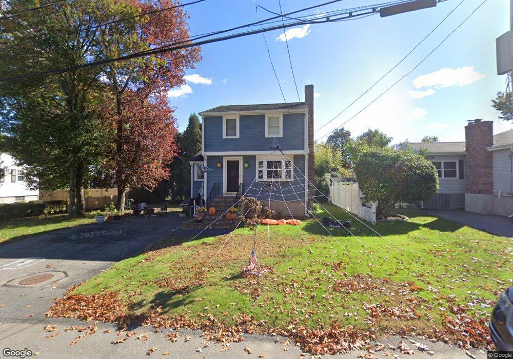
40 Mckinley Ave Unit 1 Dedham, MA 02026
Oakdale NeighborhoodEstimated Value: $662,000 - $740,000
3
Beds
2
Baths
1,026
Sq Ft
$697/Sq Ft
Est. Value
About This Home
This home is located at 40 Mckinley Ave Unit 1, Dedham, MA 02026 and is currently estimated at $715,141, approximately $697 per square foot. 40 Mckinley Ave Unit 1 is a home located in Norfolk County with nearby schools including Oakdale Elementary School, Dedham Middle School, and Dedham High School.
Ownership History
Date
Name
Owned For
Owner Type
Purchase Details
Closed on
Aug 31, 2010
Sold by
Stewart Maria A and Stewart James E
Bought by
Kear David P and Kear Allison J
Current Estimated Value
Home Financials for this Owner
Home Financials are based on the most recent Mortgage that was taken out on this home.
Original Mortgage
$306,373
Outstanding Balance
$202,923
Interest Rate
4.5%
Mortgage Type
FHA
Estimated Equity
$512,218
Purchase Details
Closed on
May 1, 2007
Sold by
Stewart Maria A
Bought by
Stewart Maria A and Stewart Thomas W
Purchase Details
Closed on
Feb 14, 2007
Sold by
Stewart Rt and Stewart Maria A
Bought by
Stewart Maria A
Create a Home Valuation Report for This Property
The Home Valuation Report is an in-depth analysis detailing your home's value as well as a comparison with similar homes in the area
Home Values in the Area
Average Home Value in this Area
Purchase History
| Date | Buyer | Sale Price | Title Company |
|---|---|---|---|
| Kear David P | $310,500 | -- | |
| Stewart Maria A | -- | -- | |
| Stewart Maria A | -- | -- |
Source: Public Records
Mortgage History
| Date | Status | Borrower | Loan Amount |
|---|---|---|---|
| Open | Kear David P | $306,373 |
Source: Public Records
Tax History Compared to Growth
Tax History
| Year | Tax Paid | Tax Assessment Tax Assessment Total Assessment is a certain percentage of the fair market value that is determined by local assessors to be the total taxable value of land and additions on the property. | Land | Improvement |
|---|---|---|---|---|
| 2025 | $7,650 | $606,200 | $350,100 | $256,100 |
| 2024 | $7,323 | $585,800 | $322,300 | $263,500 |
| 2023 | $6,759 | $526,400 | $299,100 | $227,300 |
| 2022 | $6,303 | $472,100 | $273,600 | $198,500 |
| 2021 | $6,153 | $450,100 | $273,600 | $176,500 |
| 2020 | $5,981 | $435,900 | $262,100 | $173,800 |
| 2019 | $5,663 | $400,200 | $237,900 | $162,300 |
| 2018 | $5,520 | $379,400 | $217,100 | $162,300 |
| 2017 | $5,337 | $361,600 | $208,400 | $153,200 |
| 2016 | $5,533 | $357,200 | $185,200 | $172,000 |
| 2015 | $5,262 | $331,600 | $176,300 | $155,300 |
| 2014 | $5,194 | $323,000 | $176,300 | $146,700 |
Source: Public Records
Map
Nearby Homes
- 183 Grant Ave
- 18 Boulevard Rd
- 989 East St Unit 107
- 989 East St Unit 403
- 414 Cedar St
- 50 Sprague St
- 94 Madison St
- 16 Norwich St
- 79 Sprague St
- 155 Mount Vernon St
- 29 S Gate St
- 570 Washington St
- 767 Washington St
- 55 Dwight St
- 17 Savin St
- 163 Whiting Ave
- 56 Mount Vernon St
- 27 Edison Ave
- 22 Azalea Cir
- 12 Tarbox St
- 40 Mckinley Ave
- 44 Mckinley Ave
- 121 Rustcraft Rd
- 32 Mckinley Ave
- 115 Rustcraft Rd
- 125 Rustcraft Rd
- 45 Mckinley Ave
- 111 Rustcraft Rd
- 50 Mckinley Ave
- 33 Mckinley Ave
- 133 Rustcraft Rd
- 6 Snow Ln
- 27 Mckinley Ave
- 24 Mckinley Ave
- 105 Rustcraft Rd
- 358 Central Ave
- 346 Central Ave
- 5 Snow Ln
- 21 Mckinley Ave
- 340 Central Ave