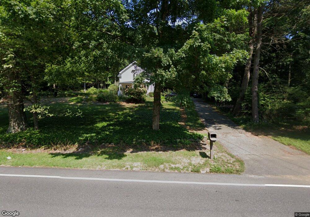
40 Route 55 W Sherman, CT 06784
Estimated Value: $347,144 - $536,000
3
Beds
2
Baths
1,525
Sq Ft
$293/Sq Ft
Est. Value
About This Home
This home is located at 40 Route 55 W, Sherman, CT 06784 and is currently estimated at $447,036, approximately $293 per square foot. 40 Route 55 W is a home located in Fairfield County with nearby schools including Sherman School.
Ownership History
Date
Name
Owned For
Owner Type
Purchase Details
Closed on
Feb 21, 2003
Sold by
Phillips Christopher J
Bought by
Hofsdal Mark
Current Estimated Value
Home Financials for this Owner
Home Financials are based on the most recent Mortgage that was taken out on this home.
Original Mortgage
$190,000
Interest Rate
5.98%
Purchase Details
Closed on
Jun 29, 1994
Sold by
Klvana Michael T and Mancini Klvana Joy
Bought by
Phillips Christopher and Carroll Donna T
Home Financials for this Owner
Home Financials are based on the most recent Mortgage that was taken out on this home.
Original Mortgage
$136,000
Interest Rate
8.13%
Mortgage Type
Unknown
Create a Home Valuation Report for This Property
The Home Valuation Report is an in-depth analysis detailing your home's value as well as a comparison with similar homes in the area
Home Values in the Area
Average Home Value in this Area
Purchase History
| Date | Buyer | Sale Price | Title Company |
|---|---|---|---|
| Hofsdal Mark | $200,000 | -- | |
| Phillips Christopher | $170,000 | -- |
Source: Public Records
Mortgage History
| Date | Status | Borrower | Loan Amount |
|---|---|---|---|
| Open | Phillips Christopher | $163,000 | |
| Closed | Phillips Christopher | $190,000 | |
| Previous Owner | Phillips Christopher | $136,000 | |
| Previous Owner | Phillips Christopher | $100,000 |
Source: Public Records
Tax History Compared to Growth
Tax History
| Year | Tax Paid | Tax Assessment Tax Assessment Total Assessment is a certain percentage of the fair market value that is determined by local assessors to be the total taxable value of land and additions on the property. | Land | Improvement |
|---|---|---|---|---|
| 2025 | $3,024 | $181,400 | $70,500 | $110,900 |
| 2024 | $2,968 | $181,400 | $70,500 | $110,900 |
| 2023 | $3,233 | $181,400 | $70,500 | $110,900 |
| 2022 | $3,298 | $181,400 | $70,500 | $110,900 |
| 2021 | $4,706 | $181,400 | $70,500 | $110,900 |
| 2020 | $3,467 | $181,400 | $70,500 | $110,900 |
| 2019 | $3,594 | $181,400 | $70,500 | $110,900 |
| 2018 | $3,749 | $184,400 | $74,500 | $109,900 |
| 2017 | $4,745 | $184,400 | $74,500 | $109,900 |
| 2016 | $3,748 | $184,380 | $74,480 | $109,900 |
| 2015 | $3,695 | $184,380 | $74,480 | $109,900 |
| 2014 | $3,658 | $184,380 | $74,480 | $109,900 |
Source: Public Records
Map
Nearby Homes
- 41 Long River Rd
- 42 Long River Rd
- 60 Long River Rd
- 55 Colonial Ridge Dr
- 73 Long River Rd
- 1 Hoyt Rd
- 685 Kent Rd
- 696 Kent Rd
- 1 Cloverleaf Farm S
- 16 Gaylord Rd
- 27 Meadowland Dr
- 00 Anderson Rd
- 43 Gaylord Rd
- 48 Gaylord Rd
- 31 Cedar Hill Rd
- 612 Kent Rd
- 34 Front of the Mountain Rd
- 228 Dog Tail Corners Rd
- 49 Quaker Ridge Rd
- 152 S Kent Rd
- 44 Evans Hill Rd
- 44 Route 55 W
- 48 Route 55 W
- 44-B Route 55 W
- 47 Route 55 W
- 25 Evans Hill Rd
- 37 Route 55 W
- 56 Route 55 W
- 21 Evans Hill Rd
- 57 Route 55 W
- 60 Route 55 W
- 15 Evans Hill Rd
- 13 Evans Hill Rd
- 33 Route 55 W
- 59 Route 55 W
- 31 Route 55 W
- 62 Route 55 W
- 30 Anderson Rd E
- 18 Evans Hill Rd
- 18 Route 55 W