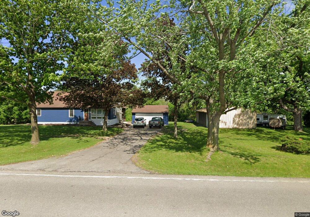
400 Robins Rd Robins, IA 52328
Estimated Value: $202,000 - $282,000
2
Beds
2
Baths
2,022
Sq Ft
$129/Sq Ft
Est. Value
About This Home
This home is located at 400 Robins Rd, Robins, IA 52328 and is currently estimated at $260,197, approximately $128 per square foot. 400 Robins Rd is a home located in Linn County with nearby schools including Nixon Elementary School, Harding Middle School, and John F. Kennedy High School.
Ownership History
Date
Name
Owned For
Owner Type
Purchase Details
Closed on
Jun 21, 2021
Sold by
Pollard Andrew R and Pollard Molly K
Bought by
Palm Properties 2 0 Llc
Current Estimated Value
Home Financials for this Owner
Home Financials are based on the most recent Mortgage that was taken out on this home.
Original Mortgage
$220,400
Outstanding Balance
$193,109
Interest Rate
2.9%
Mortgage Type
Future Advance Clause Open End Mortgage
Estimated Equity
$67,088
Purchase Details
Closed on
Jun 14, 2021
Sold by
Goodin Robert J
Bought by
Pollard Andrew R and Pollard Molly K
Home Financials for this Owner
Home Financials are based on the most recent Mortgage that was taken out on this home.
Original Mortgage
$220,400
Outstanding Balance
$193,109
Interest Rate
2.9%
Mortgage Type
Future Advance Clause Open End Mortgage
Estimated Equity
$67,088
Create a Home Valuation Report for This Property
The Home Valuation Report is an in-depth analysis detailing your home's value as well as a comparison with similar homes in the area
Home Values in the Area
Average Home Value in this Area
Purchase History
| Date | Buyer | Sale Price | Title Company |
|---|---|---|---|
| Palm Properties 2 0 Llc | -- | None Available | |
| Pollard Andrew R | $217,500 | None Available |
Source: Public Records
Mortgage History
| Date | Status | Borrower | Loan Amount |
|---|---|---|---|
| Open | Pollard Andrew R | $220,400 |
Source: Public Records
Tax History
| Year | Tax Paid | Tax Assessment Tax Assessment Total Assessment is a certain percentage of the fair market value that is determined by local assessors to be the total taxable value of land and additions on the property. | Land | Improvement |
|---|---|---|---|---|
| 2025 | $3,048 | $256,200 | $56,300 | $199,900 |
| 2024 | $2,758 | $225,800 | $56,300 | $169,500 |
| 2023 | $2,758 | $225,800 | $56,300 | $169,500 |
| 2022 | $2,938 | $181,000 | $56,300 | $124,700 |
| 2021 | $2,850 | $181,000 | $56,300 | $124,700 |
| 2020 | $2,850 | $171,500 | $56,300 | $115,200 |
| 2019 | $2,636 | $162,000 | $56,300 | $105,700 |
Source: Public Records
Map
Nearby Homes
- 620 Hampton St
- 570 Hampton St
- 540 Hampton St
- 560 Hampton St
- 590 Hampton St
- 600 Hampton St
- 500 Hampton St
- 545 Hampton St
- 580 Hampton St
- 610 Hampton St
- 520 Hampton St
- 530 Hampton St
- 535 Hampton St
- 550 Hampton St
- 515 Hampton St
- 2965 Trailside Dr
- 2970 Trailside Dr
- 545 Trailside Ct
- 2915 Trailside Dr
- 2935 Trailside Dr
- 100 Robins Rd
- 500 Robins Rd
- 25 Robinwood Dr
- 250 W Main St
- 405 W Main St
- 75 Robinwood Dr
- 300 W Main St
- 75 Irene St
- 125 Robinwood Dr
- 80 Robinwood Dr
- 495 Rickey Allen Dr
- 75 W Main St
- 145 Robinwood Dr
- 60 W Main St
- 165 Robinwood Dr
- 505 Rickey Allen Dr
- 170 Robinwood Dr
- 185 N Robinwood Dr
- 185 Robinwood Dr
- 195 S Troy Rd