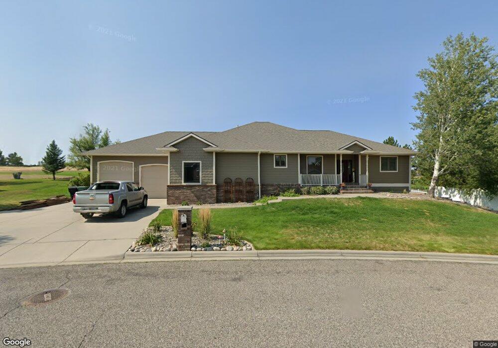
400 Tamarisk Dr Billings, MT 59105
Billings Heights NeighborhoodEstimated Value: $527,000 - $734,000
5
Beds
4
Baths
2,307
Sq Ft
$286/Sq Ft
Est. Value
About This Home
This home is located at 400 Tamarisk Dr, Billings, MT 59105 and is currently estimated at $659,352, approximately $285 per square foot. 400 Tamarisk Dr is a home located in Yellowstone County with nearby schools including Sandstone School, Castle Rock Junior High School, and Skyview High School.
Ownership History
Date
Name
Owned For
Owner Type
Purchase Details
Closed on
Apr 27, 2005
Sold by
Nelson Gregory H and Nelson Vicki L
Bought by
Sukut Terral D and Sukut Peggy L
Current Estimated Value
Home Financials for this Owner
Home Financials are based on the most recent Mortgage that was taken out on this home.
Original Mortgage
$342,000
Outstanding Balance
$177,289
Interest Rate
5.75%
Mortgage Type
Adjustable Rate Mortgage/ARM
Estimated Equity
$482,063
Create a Home Valuation Report for This Property
The Home Valuation Report is an in-depth analysis detailing your home's value as well as a comparison with similar homes in the area
Home Values in the Area
Average Home Value in this Area
Purchase History
| Date | Buyer | Sale Price | Title Company |
|---|---|---|---|
| Sukut Terral D | -- | None Available |
Source: Public Records
Mortgage History
| Date | Status | Borrower | Loan Amount |
|---|---|---|---|
| Open | Sukut Terral D | $342,000 |
Source: Public Records
Tax History Compared to Growth
Tax History
| Year | Tax Paid | Tax Assessment Tax Assessment Total Assessment is a certain percentage of the fair market value that is determined by local assessors to be the total taxable value of land and additions on the property. | Land | Improvement |
|---|---|---|---|---|
| 2025 | $6,890 | $694,700 | $119,926 | $574,774 |
| 2024 | $6,890 | $664,400 | $105,173 | $559,227 |
| 2023 | $6,882 | $664,400 | $105,173 | $559,227 |
| 2022 | $4,609 | $488,200 | $0 | $0 |
| 2021 | $5,479 | $488,200 | $0 | $0 |
| 2020 | $5,511 | $470,400 | $0 | $0 |
| 2019 | $5,276 | $470,400 | $0 | $0 |
| 2018 | $5,178 | $452,500 | $0 | $0 |
| 2017 | $5,018 | $452,500 | $0 | $0 |
| 2016 | $4,723 | $426,500 | $0 | $0 |
| 2015 | $4,628 | $426,500 | $0 | $0 |
| 2014 | $4,258 | $206,435 | $0 | $0 |
Source: Public Records
Map
Nearby Homes
- 2164 Greenbriar Rd
- 2043 Cypress Point
- 00 Winged Foot Drive Lot 10
- Lot 1, Block 1 Greenbriar Rd
- 0 Winged Foot Dr
- 00
- 0 Greenbriar Rd
- 0 Clubhouse Way
- LOT 3 Clubhouse Way
- LOT 4 Clubhouse Way
- 2032 Clubhouse Way
- 2115 Saint Andrews Dr
- 2049 Saint Andrews Dr
- 0 Greenbriar Block 12 Lot 5 Rd Unit 352965
- 650 Pinehurst Rd
- 2029 Ridgeview Dr
- 2030 Gleneagles Blvd
- 2152 Gleneagles Blvd
- 2435 Lake Heights Dr
- 2253 Gleneagles Blvd
- 404 Tamarisk Dr
- 360 Tamarisk Dr
- 401 Tamarisk Dr
- 359 Tamarisk Dr
- 354 Tamarisk Dr
- 408 Tamarisk Dr
- 407 Tamarisk Dr
- 2036 Wentworth Dr
- 2030 Wentworth Dr
- 412 Tamarisk Dr
- 411 Tamarisk Dr
- 2195 Greenbriar Rd
- 2101 Wentworth Dr
- 2037 Wentworth Dr
- Lot 5A2 Block 54 Green Briar Rd
- 2026 Wentworth Dr
- 2033 Wentworth Dr
- 416 Tamarisk Dr
- 2201 Greenbriar Rd
- 2105 Wentworth Dr