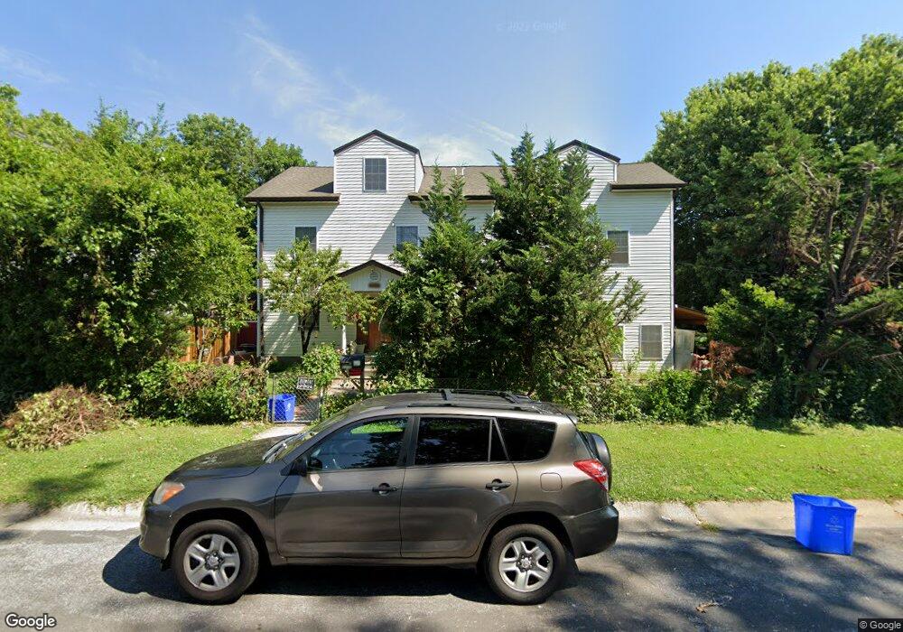
4001 Sampson Rd Silver Spring, MD 20906
North Kensington NeighborhoodEstimated Value: $772,000 - $952,000
Studio
3
Baths
4,320
Sq Ft
$205/Sq Ft
Est. Value
About This Home
This home is located at 4001 Sampson Rd, Silver Spring, MD 20906 and is currently estimated at $884,159, approximately $204 per square foot. 4001 Sampson Rd is a home located in Montgomery County with nearby schools including Viers Mill Elementary School, A. Mario Loiederman Middle School, and Wheaton High School.
Ownership History
Date
Name
Owned For
Owner Type
Purchase Details
Closed on
Dec 29, 1994
Sold by
Swarm William E
Bought by
Gutierrez Cruz A
Current Estimated Value
Home Financials for this Owner
Home Financials are based on the most recent Mortgage that was taken out on this home.
Original Mortgage
$106,300
Interest Rate
9.2%
Create a Home Valuation Report for This Property
The Home Valuation Report is an in-depth analysis detailing your home's value as well as a comparison with similar homes in the area
Home Values in the Area
Average Home Value in this Area
Purchase History
| Date | Buyer | Sale Price | Title Company |
|---|---|---|---|
| Gutierrez Cruz A | $111,900 | -- |
Source: Public Records
Mortgage History
| Date | Status | Borrower | Loan Amount |
|---|---|---|---|
| Closed | Gutierrez Cruz A | $106,300 |
Source: Public Records
Tax History Compared to Growth
Tax History
| Year | Tax Paid | Tax Assessment Tax Assessment Total Assessment is a certain percentage of the fair market value that is determined by local assessors to be the total taxable value of land and additions on the property. | Land | Improvement |
|---|---|---|---|---|
| 2025 | $9,842 | $836,900 | -- | -- |
| 2024 | $9,842 | $785,500 | $196,900 | $588,600 |
| 2023 | $9,061 | $785,500 | $196,900 | $588,600 |
| 2022 | $6,331 | $785,500 | $196,900 | $588,600 |
| 2021 | $7,433 | $793,200 | $181,900 | $611,300 |
| 2020 | $6,099 | $717,867 | $0 | $0 |
| 2019 | $6,709 | $642,533 | $0 | $0 |
| 2018 | $5,681 | $567,200 | $166,400 | $400,800 |
| 2017 | $3,842 | $542,433 | $0 | $0 |
| 2016 | -- | $517,667 | $0 | $0 |
| 2015 | $5,899 | $492,900 | $0 | $0 |
| 2014 | $5,899 | $492,900 | $0 | $0 |
Source: Public Records
Map
Nearby Homes
- 3835 Ferrara Dr
- 3726 Ferrara Dr
- 11802 Pittson Rd
- 12300 Downer Dr
- 4511 Bennion Rd
- 11814 College View Dr
- 3802 Elby Ct
- 12220 Centerhill St
- 11951 Andrew St
- 12216 Charles Rd
- 12106 Bluhill Rd
- 11757 Veirs Mill Rd
- 12304 Charles Rd
- 4205 Garrett Park Rd
- 11605 Gail St
- 12317 Middle Rd
- 3312 Clay St
- 12704 Bushey Dr
- 4410 Fernhill Rd
- 4305 Garrett Park Rd
- 12102 Veirs Mill Rd
- 4003 Sampson Rd
- 12104 Veirs Mill Rd
- 4005 Sampson Rd
- 4000 Sampson Rd
- 4004 Sampson Rd
- 4002 Sampson Rd
- 4006 Sampson Rd
- 12106 Veirs Mill Rd
- 4007 Sampson Rd
- 4008 Sampson Rd
- 12028 Veirs Mill Rd
- 4010 Sampson Rd
- 12103 Veirs Mill Rd
- 12105 Veirs Mill Rd
- 12108 Veirs Mill Rd
- 4009 Sampson Rd
- 12107 Veirs Mill Rd
- 12100 Atherton Dr
- 12026 Veirs Mill Rd