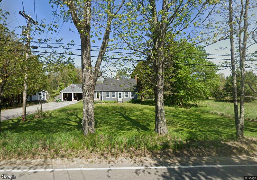
401 Pleasant Point Rd Cushing, ME 04563
Estimated Value: $269,000 - $444,000
3
Beds
1
Bath
1,650
Sq Ft
$221/Sq Ft
Est. Value
About This Home
This home is located at 401 Pleasant Point Rd, Cushing, ME 04563 and is currently estimated at $364,451, approximately $220 per square foot. 401 Pleasant Point Rd is a home located in Knox County with nearby schools including Cushing Community School and Oceanside High School East.
Ownership History
Date
Name
Owned For
Owner Type
Purchase Details
Closed on
Dec 22, 2011
Sold by
Rasmussen Peter C and Rasmussen Paticia C
Bought by
Stone Jason W and Stone Josette C
Current Estimated Value
Home Financials for this Owner
Home Financials are based on the most recent Mortgage that was taken out on this home.
Original Mortgage
$127,039
Outstanding Balance
$86,820
Interest Rate
3.99%
Mortgage Type
Commercial
Estimated Equity
$277,631
Create a Home Valuation Report for This Property
The Home Valuation Report is an in-depth analysis detailing your home's value as well as a comparison with similar homes in the area
Home Values in the Area
Average Home Value in this Area
Purchase History
| Date | Buyer | Sale Price | Title Company |
|---|---|---|---|
| Stone Jason W | -- | -- |
Source: Public Records
Mortgage History
| Date | Status | Borrower | Loan Amount |
|---|---|---|---|
| Open | Stone Jason W | $127,039 |
Source: Public Records
Tax History Compared to Growth
Tax History
| Year | Tax Paid | Tax Assessment Tax Assessment Total Assessment is a certain percentage of the fair market value that is determined by local assessors to be the total taxable value of land and additions on the property. | Land | Improvement |
|---|---|---|---|---|
| 2024 | $2,474 | $230,160 | $47,860 | $182,300 |
| 2023 | $2,353 | $147,070 | $57,200 | $89,870 |
| 2022 | $2,280 | $147,070 | $57,200 | $89,870 |
| 2021 | $2,294 | $147,070 | $57,200 | $89,870 |
| 2020 | $27,844 | $147,070 | $57,200 | $89,870 |
| 2019 | $28,242 | $147,070 | $57,200 | $89,870 |
| 2018 | $2,015 | $147,070 | $57,200 | $89,870 |
| 2017 | $1,912 | $147,070 | $57,200 | $89,870 |
| 2016 | $24,185 | $138,980 | $57,200 | $81,780 |
| 2015 | $1,709 | $138,980 | $57,200 | $81,780 |
| 2014 | $1,570 | $138,980 | $57,200 | $81,780 |
Source: Public Records
Map
Nearby Homes
- 43 Tamarack Ln
- 253 Hathorne Point Rd
- 576 Pleasant Point Rd
- 207 Pleasant Point Rd
- 56 Raccoon Ln
- 394 Hathorne Point Rd
- 95 Cushing Rd
- 6 Ocean Ridge Rd
- 8 Cushing Rd
- 794 Pleasant Point Rd
- 317 Cross Rd
- 47 Teel Cove Rd
- 422 Wallston Rd
- M217 L074 Kallio Cove Rd
- 46 Killeran Ln
- 211 Turkey Cove Rd
- M214 L23C1 Autumn Marsh Rd
- 224 Wallston Rd
- 28 Orne Ln
- Map 7 Lot 8-1 Cushing Road Eastside
- 402 Pleasant Point Rd
- 405 Pleasant Point Rd
- 391 Pleasant Point Rd
- 0 Pleasent Point Rd
- 40 Tamarack Ln
- 0 Tamarack Ln
- 15 Tamarack Ln
- 377 Pleasant Point Rd
- 18 Tamarack Ln
- 376 Pleasant Point Rd
- 35 Tamarack Ln
- 368 Pleasant Point Rd
- 790 Pleasant Point Rd
- 99999 Pleasant Point Rd
- 443 Pleasant Point Rd
- 20 Tamarack Ln
- 345 Pleasant Point Rd
- 20 Gravel Pit Ln
- 55 Pine Ridge Rd
- 342 Pleasant Point Rd