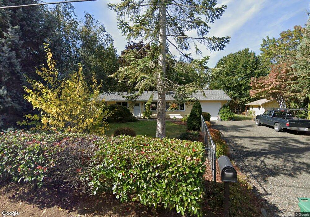
4015 Thorson Rd W Bremerton, WA 98312
Gorst NeighborhoodEstimated Value: $412,000 - $452,000
3
Beds
2
Baths
1,288
Sq Ft
$340/Sq Ft
Est. Value
About This Home
This home is located at 4015 Thorson Rd W, Bremerton, WA 98312 and is currently estimated at $438,181, approximately $340 per square foot. 4015 Thorson Rd W is a home located in Kitsap County with nearby schools including Sunnyslope Elementary School, Cedar Heights Middle School, and South Kitsap High School.
Ownership History
Date
Name
Owned For
Owner Type
Purchase Details
Closed on
May 28, 1996
Sold by
Alessi Robert and Alessi Margaret
Bought by
Wolterman Kevin M and Wolterman Kathleen K
Current Estimated Value
Home Financials for this Owner
Home Financials are based on the most recent Mortgage that was taken out on this home.
Original Mortgage
$93,700
Outstanding Balance
$5,970
Interest Rate
7.97%
Mortgage Type
FHA
Estimated Equity
$432,211
Create a Home Valuation Report for This Property
The Home Valuation Report is an in-depth analysis detailing your home's value as well as a comparison with similar homes in the area
Home Values in the Area
Average Home Value in this Area
Purchase History
| Date | Buyer | Sale Price | Title Company |
|---|---|---|---|
| Wolterman Kevin M | $94,000 | Charter Title Corp |
Source: Public Records
Mortgage History
| Date | Status | Borrower | Loan Amount |
|---|---|---|---|
| Open | Wolterman Kevin M | $93,700 |
Source: Public Records
Tax History Compared to Growth
Tax History
| Year | Tax Paid | Tax Assessment Tax Assessment Total Assessment is a certain percentage of the fair market value that is determined by local assessors to be the total taxable value of land and additions on the property. | Land | Improvement |
|---|---|---|---|---|
| 2026 | $3,243 | $365,910 | $80,180 | $285,730 |
| 2025 | $3,243 | $365,910 | $80,180 | $285,730 |
| 2024 | $3,146 | $365,910 | $80,180 | $285,730 |
| 2023 | $3,124 | $365,910 | $80,180 | $285,730 |
| 2022 | $2,983 | $292,490 | $63,910 | $228,580 |
| 2021 | $2,836 | $263,080 | $58,100 | $204,980 |
| 2020 | $2,745 | $247,280 | $59,990 | $187,290 |
| 2019 | $2,328 | $229,550 | $55,450 | $174,100 |
| 2018 | $2,468 | $186,650 | $47,720 | $138,930 |
| 2017 | $2,086 | $186,650 | $47,720 | $138,930 |
| 2016 | $2,037 | $166,790 | $45,450 | $121,340 |
| 2015 | $1,968 | $163,280 | $45,450 | $117,830 |
| 2014 | -- | $141,810 | $45,800 | $96,010 |
| 2013 | -- | $150,140 | $54,130 | $96,010 |
Source: Public Records
Map
Nearby Homes
- 4415 W Jarstad Dr
- 4576 Hawthorne Ave W
- 3336 Mccary Rd SW
- 44 Acres Mccary Rd SW
- 4833 Lone Bear Ln SW
- 4178 Novak Dr SW
- 4310 Novak Dr SW
- 4160 Dr SW Novak
- 4402 Lone Bear Ln SW
- 3928 McCormick Village Dr Unit 26
- 3900 McCormick Village Dr Unit 19
- 3916 McCormick Village Dr Unit 23
- 3920 McCormick Village Dr Unit 24
- 3904 McCormick Village Dr Unit 20
- Caymen Plan at Sinclair Ridge at McCormick - Sinclair Ridge
- Powell Plan at Sinclair Ridge at McCormick - Sinclair Ridge
- Luna Plan at Sinclair Ridge at McCormick - Sinclair Ridge
- Bridger Plan at Sinclair Ridge at McCormick - Sinclair Ridge
- Hadley Plan at Sinclair Ridge at McCormick - Sinclair Ridge
- Aurora Plan at Sinclair Ridge at McCormick - Sinclair Ridge
- 4045 Thorson Rd W
- 4070 W Frone Dr
- 3988 Thorson Rd W
- 4352 W Jarstad Dr
- 4075 Thorson Rd W
- 0 XX Thorson Rd W
- 3971 Thorson Rd W
- 4082 Thorson Rd W
- 4040 W Frone Dr
- 4384 W Jarstad Dr
- 3900 Thorson Rd W
- 4463 W Jarstad Dr
- 4000 W Frone Dr
- 4085 Thorson Rd W
- 4420 W Jarstad Dr
- 3901 Thorson Rd W
- 3879 Thorson Rd W
- 4503 W Jarstad Dr
- 3857 Thorson Rd W