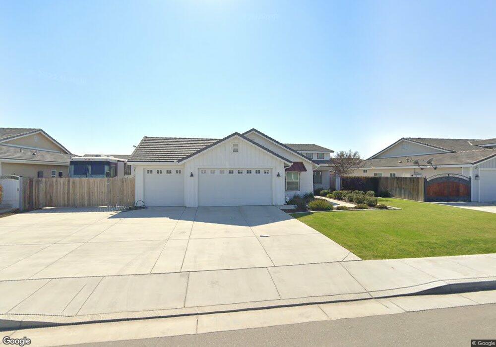
4017 Rolling Rock Ave Bakersfield, CA 93313
Stonegate NeighborhoodEstimated Value: $550,000 - $598,000
4
Beds
2
Baths
2,212
Sq Ft
$259/Sq Ft
Est. Value
About This Home
This home is located at 4017 Rolling Rock Ave, Bakersfield, CA 93313 and is currently estimated at $572,194, approximately $258 per square foot. 4017 Rolling Rock Ave is a home with nearby schools including Panama Elementary School, Stonecreek Junior High School, and Ridgeview High School.
Ownership History
Date
Name
Owned For
Owner Type
Purchase Details
Closed on
Apr 14, 2022
Sold by
Wilkerson Family Trust
Bought by
Valadez Jose and Ramirez Camille
Current Estimated Value
Home Financials for this Owner
Home Financials are based on the most recent Mortgage that was taken out on this home.
Original Mortgage
$489,250
Outstanding Balance
$463,026
Interest Rate
5%
Mortgage Type
New Conventional
Estimated Equity
$109,168
Purchase Details
Closed on
May 5, 2021
Sold by
Wilkerson Sammy W and Wilkerson Janet
Bought by
The Wilkerson Family Trust
Purchase Details
Closed on
May 6, 2016
Sold by
D & A Premier Properties Llc
Bought by
Wilkerson Sammy W
Home Financials for this Owner
Home Financials are based on the most recent Mortgage that was taken out on this home.
Original Mortgage
$248,900
Interest Rate
3.57%
Mortgage Type
New Conventional
Create a Home Valuation Report for This Property
The Home Valuation Report is an in-depth analysis detailing your home's value as well as a comparison with similar homes in the area
Home Values in the Area
Average Home Value in this Area
Purchase History
| Date | Buyer | Sale Price | Title Company |
|---|---|---|---|
| Valadez Jose | $515,000 | Placer Title | |
| The Wilkerson Family Trust | -- | None Available | |
| Wilkerson Sammy W | $349,000 | Chicago Title Company |
Source: Public Records
Mortgage History
| Date | Status | Borrower | Loan Amount |
|---|---|---|---|
| Open | Valadez Jose | $489,250 | |
| Previous Owner | Wilkerson Sammy W | $248,900 |
Source: Public Records
Tax History Compared to Growth
Tax History
| Year | Tax Paid | Tax Assessment Tax Assessment Total Assessment is a certain percentage of the fair market value that is determined by local assessors to be the total taxable value of land and additions on the property. | Land | Improvement |
|---|---|---|---|---|
| 2025 | $7,048 | $546,521 | $106,120 | $440,401 |
| 2024 | $6,941 | $535,806 | $104,040 | $431,766 |
| 2023 | $6,941 | $525,300 | $102,000 | $423,300 |
| 2022 | $6,230 | $484,131 | $66,929 | $417,202 |
| 2021 | $6,091 | $474,639 | $65,617 | $409,022 |
| 2020 | $6,091 | $469,773 | $64,945 | $404,828 |
| 2019 | $5,911 | $469,773 | $64,945 | $404,828 |
| 2018 | $5,849 | $451,533 | $62,424 | $389,109 |
| 2017 | $5,420 | $442,680 | $61,200 | $381,480 |
| 2016 | $421 | $13,135 | $13,135 | $0 |
Source: Public Records
Map
Nearby Homes
- 9202 Mcclintock Rd
- 3527 Big Trail Ave
- 4403 Oceanrock Ave
- 3304 Bridget Ave
- 3044 Emerson Way
- 4620 Taft Hwy
- 3406 Kimmie Rachelle Ct
- 3045 Emerson Way
- 3500 Stonecreek Ave
- 3304 Brisbane Ave Unit B
- 4614 Crosshaven Ave Unit 1
- 5103 Green Clover Ave
- 3006 Giovanetti Ave Unit 2
- 8120 Rockhampton Dr
- 8119 Willoughby Ct
- 2714 Tara Leigh Dr
- 9003 Great Harvest Dr
- 8912 Claudia Ct
- 9623 Kanosh Cobble Dr
- 5437 White Wheat Ave
- 4023 Rolling Rock Ave
- 4011 Rolling Rock Ave
- 4018 Smoky Rock Ct
- 4024 Smoky Rock Ct
- 4012 Smoky Rock Ct
- 4029 Rolling Rock Ave
- 4005 Rolling Rock Ave
- 4030 Smoky Rock Ct
- 4006 Smoky Rock Ct
- 4018 Rolling Rock Ave
- 4024 Rolling Rock Ave
- 4012 Rolling Rock Ave
- 4030 Rolling Rock Ave
- 4006 Rolling Rock Ave
- 4019 Smoky Rock Ct
- 4025 Smoky Rock Ct
- 4013 Smoky Rock Ct
- 4000 Rolling Rock Ave
- 4031 Smoky Rock Ct
- 9608 Moonrock Way