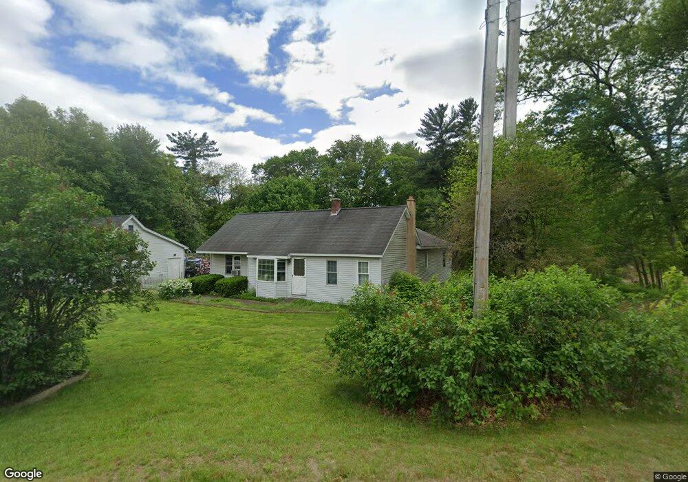
402 Paper Mill Rd Westfield, MA 01085
Estimated Value: $378,000 - $438,000
3
Beds
1
Bath
1,736
Sq Ft
$232/Sq Ft
Est. Value
About This Home
This home is located at 402 Paper Mill Rd, Westfield, MA 01085 and is currently estimated at $402,822, approximately $232 per square foot. 402 Paper Mill Rd is a home located in Hampden County with nearby schools including Westfield High School and Saint Mary High School.
Ownership History
Date
Name
Owned For
Owner Type
Purchase Details
Closed on
Dec 31, 2025
Sold by
Derouin Mark H
Bought by
Clegg Michael T and Derouin Stephanie E
Current Estimated Value
Home Financials for this Owner
Home Financials are based on the most recent Mortgage that was taken out on this home.
Original Mortgage
$140,000
Outstanding Balance
$139,867
Interest Rate
6.26%
Mortgage Type
New Conventional
Estimated Equity
$262,955
Purchase Details
Closed on
Apr 30, 2018
Sold by
Derouin Mark H and Derouin Melissa A
Bought by
Derouin Mark H
Home Financials for this Owner
Home Financials are based on the most recent Mortgage that was taken out on this home.
Original Mortgage
$104,400
Interest Rate
2.99%
Mortgage Type
Adjustable Rate Mortgage/ARM
Create a Home Valuation Report for This Property
The Home Valuation Report is an in-depth analysis detailing your home's value as well as a comparison with similar homes in the area
Home Values in the Area
Average Home Value in this Area
Purchase History
| Date | Buyer | Sale Price | Title Company |
|---|---|---|---|
| Clegg Michael T | $175,000 | -- | |
| Derouin Mark H | -- | -- |
Source: Public Records
Mortgage History
| Date | Status | Borrower | Loan Amount |
|---|---|---|---|
| Open | Clegg Michael T | $140,000 | |
| Previous Owner | Derouin Mark H | $104,400 |
Source: Public Records
Tax History
| Year | Tax Paid | Tax Assessment Tax Assessment Total Assessment is a certain percentage of the fair market value that is determined by local assessors to be the total taxable value of land and additions on the property. | Land | Improvement |
|---|---|---|---|---|
| 2025 | $4,929 | $324,700 | $128,100 | $196,600 |
| 2024 | $5,005 | $313,400 | $116,800 | $196,600 |
| 2023 | $4,645 | $283,700 | $111,000 | $172,700 |
| 2022 | $4,645 | $251,200 | $98,800 | $152,400 |
| 2021 | $4,497 | $238,200 | $93,200 | $145,000 |
| 2020 | $4,372 | $227,100 | $93,200 | $133,900 |
| 2019 | $4,272 | $217,200 | $88,800 | $128,400 |
| 2018 | $4,205 | $217,200 | $88,800 | $128,400 |
| 2017 | $4,136 | $213,000 | $90,100 | $122,900 |
| 2016 | $4,141 | $213,000 | $90,100 | $122,900 |
| 2015 | $3,949 | $213,000 | $90,100 | $122,900 |
| 2014 | $2,953 | $213,000 | $90,100 | $122,900 |
Source: Public Records
Map
Nearby Homes
- 103 Woodcliff Dr
- 120 Woodcliff Dr
- 24 Francis St
- 242 Eastwood Dr
- 315 Holyoke Rd
- 19 Sherwood Ave
- 119 Union St Unit 4
- 24 Sunflower Ln Unit B
- 63 George St
- 19 Arch Rd
- 25 Dubois St
- 33 George St
- 61 Ridgecrest Dr
- 0 E Mountain Rd
- 0 Lockhouse Rd Unit 73473161
- 83 Mechanic St
- 25 White St
- 189 Springfield Rd Unit 23
- Lot 3 Montgomery
- 9 Montgomery St
- 7 Mockingbird Ln
- 17 Mockingbird Ln
- 420 Paper Mill Rd
- 25 Mockingbird Ln
- 8 Mockingbird Ln
- 430 Paper Mill Rd
- 16 Mockingbird Ln
- 31 Mockingbird Ln
- 22 Mockingbird Ln
- 39 Mockingbird Ln
- 28 Mockingbird Ln
- 20 Marla Cir
- 336 Paper Mill Rd
- 24 Marla Cir
- 28 Marla Cir
- 10 Marla Cir
- 45 Mockingbird Ln
- 36 Mockingbird Ln
- 333 Paper Mill Rd
- 34 Marla Cir