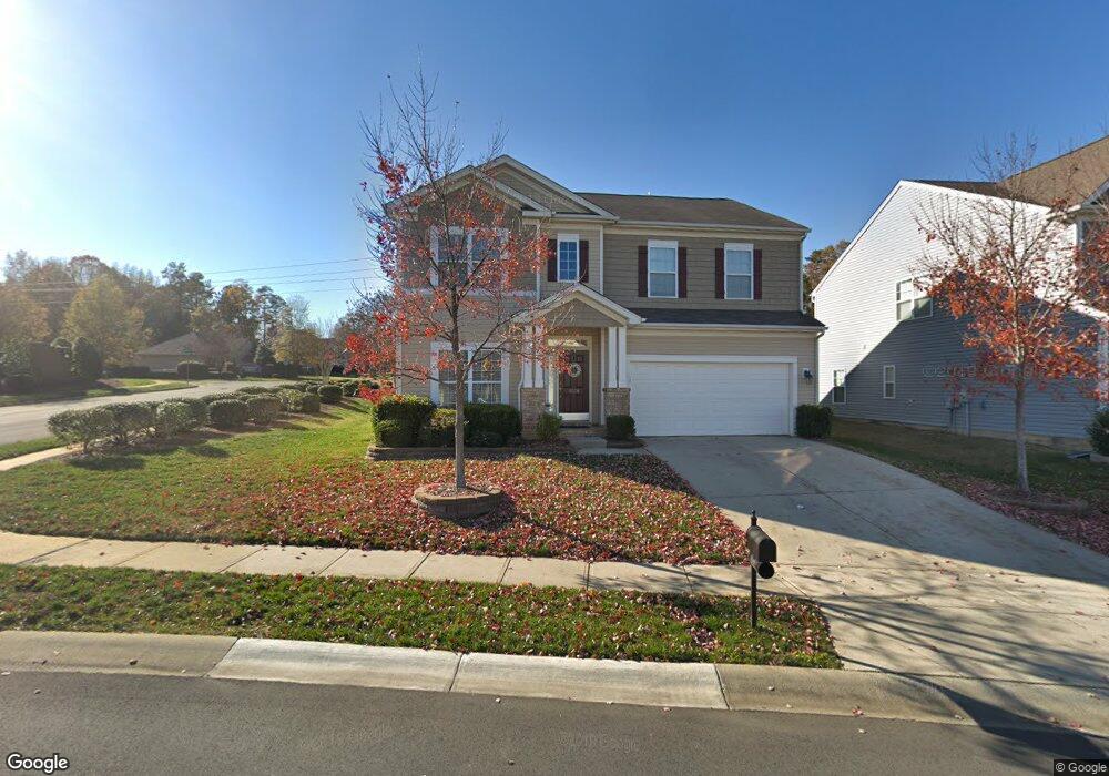
4028 Lawrence Daniel Dr Matthews, NC 28104
Estimated Value: $492,000 - $562,000
4
Beds
2
Baths
2,830
Sq Ft
$181/Sq Ft
Est. Value
About This Home
This home is located at 4028 Lawrence Daniel Dr, Matthews, NC 28104 and is currently estimated at $512,370, approximately $181 per square foot. 4028 Lawrence Daniel Dr is a home located in Union County with nearby schools including Stallings Elementary School, Porter Ridge Middle School, and Porter Ridge High School.
Ownership History
Date
Name
Owned For
Owner Type
Purchase Details
Closed on
Oct 17, 2007
Sold by
The Ryland Group Inc
Bought by
Watts Jerrol Brent and Watts Paula Ann
Current Estimated Value
Home Financials for this Owner
Home Financials are based on the most recent Mortgage that was taken out on this home.
Original Mortgage
$195,177
Outstanding Balance
$122,180
Interest Rate
6.44%
Mortgage Type
Unknown
Estimated Equity
$390,190
Purchase Details
Closed on
Oct 2, 2006
Sold by
Woodbridge At Stallings Lp
Bought by
The Ryland Group Inc
Create a Home Valuation Report for This Property
The Home Valuation Report is an in-depth analysis detailing your home's value as well as a comparison with similar homes in the area
Home Values in the Area
Average Home Value in this Area
Purchase History
| Date | Buyer | Sale Price | Title Company |
|---|---|---|---|
| Watts Jerrol Brent | $229,500 | None Available | |
| The Ryland Group Inc | $227,500 | None Available |
Source: Public Records
Mortgage History
| Date | Status | Borrower | Loan Amount |
|---|---|---|---|
| Open | Watts Jerrol Brent | $195,177 |
Source: Public Records
Tax History Compared to Growth
Tax History
| Year | Tax Paid | Tax Assessment Tax Assessment Total Assessment is a certain percentage of the fair market value that is determined by local assessors to be the total taxable value of land and additions on the property. | Land | Improvement |
|---|---|---|---|---|
| 2025 | $3,336 | $488,400 | $0 | $0 |
| 2024 | $2,784 | $316,800 | $55,000 | $261,800 |
| 2023 | $2,670 | $316,800 | $55,000 | $261,800 |
| 2022 | $2,649 | $316,800 | $55,000 | $261,800 |
| 2021 | $2,648 | $316,800 | $55,000 | $261,800 |
| 2020 | $2,282 | $223,400 | $37,500 | $185,900 |
| 2019 | $2,271 | $223,400 | $37,500 | $185,900 |
| 2018 | $2,271 | $223,400 | $37,500 | $185,900 |
| 2017 | $2,337 | $223,400 | $37,500 | $185,900 |
| 2016 | $2,351 | $223,400 | $37,500 | $185,900 |
| 2015 | $2,375 | $223,400 | $37,500 | $185,900 |
| 2014 | $1,634 | $230,820 | $32,500 | $198,320 |
Source: Public Records
Map
Nearby Homes
- 4023 Lawrence Daniel Dr
- 4006 Scarlet Dr Unit 29
- 4324 Stallingswood Dr
- 3017 Stevens Schultz Ln
- 15108 Castlebridge Ln
- 14601 Phillips Rd
- 1830 Light Brigade Dr Unit v512
- 2126 Blue Iris Dr
- 5401 Stevens Mill Rd
- 5419 Stevens Mill Rd
- 5033 Haven Lodge Rd
- 2544 Mount Harmony Church Rd
- 14027 Hackamore Dr
- 315 Tamarack Dr
- 16020 Clear Creek Farm Rd
- 809 Clonmel Dr
- 14200 Springwater Dr
- 2108 Stallings Rd
- 2526 Clearkirk Ct
- 14818 Hooks Rd
- 0 Lawrence Daniel Dr Unit 816849
- 0000 Lawrence Daniel Dr
- 4026 Lawrence Daniel Dr
- 4024 Lawrence Daniel Dr
- 4100 Lawrence Daniel Dr
- 4027 Lawrence Daniel Dr
- 4022 Lawrence Daniel Dr
- 4101 Lawrence Daniel Dr
- 15041 Middlesborough Dr
- 4106 Lawrence Daniel Dr
- 4017 Lawrence Daniel Dr
- 4020 Lawrence Daniel Dr
- 4105 Lawrence Daniel Dr
- 15040 Middlesborough Dr
- 2800 Creek Ct
- 4018 Lawrence Daniel Dr
- 4015 Lawrence Daniel Dr
- 15033 Middlesborough Dr
- 4016 Lawrence Daniel Dr
- 4205 Lawrence Daniel Dr