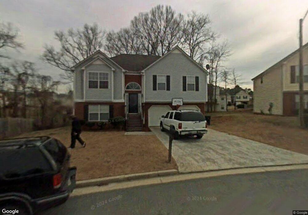
4029 Rhinehart Ct Unit 2 Austell, GA 30106
Estimated Value: $278,000 - $342,000
3
Beds
2
Baths
1,298
Sq Ft
$243/Sq Ft
Est. Value
About This Home
This home is located at 4029 Rhinehart Ct Unit 2, Austell, GA 30106 and is currently estimated at $315,022, approximately $242 per square foot. 4029 Rhinehart Ct Unit 2 is a home located in Cobb County with nearby schools including Deerwood Elementary School, Clarkdale Elementary School, and Garrett Middle School.
Ownership History
Date
Name
Owned For
Owner Type
Purchase Details
Closed on
Mar 24, 2025
Sold by
Scott Teresa D and Johnson Teresa D
Bought by
Johnson Teresa D and Johnson Willie
Current Estimated Value
Home Financials for this Owner
Home Financials are based on the most recent Mortgage that was taken out on this home.
Original Mortgage
$146,000
Outstanding Balance
$142,415
Interest Rate
5.94%
Mortgage Type
New Conventional
Estimated Equity
$172,607
Purchase Details
Closed on
Oct 5, 1999
Sold by
Palladium Homes Inc
Bought by
Scott Teresa D
Home Financials for this Owner
Home Financials are based on the most recent Mortgage that was taken out on this home.
Original Mortgage
$124,300
Interest Rate
7.91%
Mortgage Type
FHA
Create a Home Valuation Report for This Property
The Home Valuation Report is an in-depth analysis detailing your home's value as well as a comparison with similar homes in the area
Home Values in the Area
Average Home Value in this Area
Purchase History
| Date | Buyer | Sale Price | Title Company |
|---|---|---|---|
| Johnson Teresa D | -- | First Source Title | |
| Scott Teresa D | $125,400 | -- | |
| Palladium Homes Inc | $26,500 | -- |
Source: Public Records
Mortgage History
| Date | Status | Borrower | Loan Amount |
|---|---|---|---|
| Open | Johnson Teresa D | $146,000 | |
| Previous Owner | Palladium Homes Inc | $124,300 |
Source: Public Records
Tax History Compared to Growth
Tax History
| Year | Tax Paid | Tax Assessment Tax Assessment Total Assessment is a certain percentage of the fair market value that is determined by local assessors to be the total taxable value of land and additions on the property. | Land | Improvement |
|---|---|---|---|---|
| 2025 | $2,600 | $114,204 | $14,000 | $100,204 |
| 2024 | $2,602 | $114,204 | $14,000 | $100,204 |
| 2023 | $2,060 | $114,204 | $14,000 | $100,204 |
| 2022 | $2,375 | $102,848 | $14,000 | $88,848 |
| 2021 | $1,800 | $76,580 | $14,000 | $62,580 |
| 2020 | $1,653 | $69,884 | $14,000 | $55,884 |
| 2019 | $1,329 | $55,072 | $12,000 | $43,072 |
| 2018 | $1,329 | $55,072 | $12,000 | $43,072 |
| 2017 | $1,061 | $45,836 | $6,000 | $39,836 |
| 2016 | $1,062 | $45,836 | $6,000 | $39,836 |
| 2015 | $543 | $27,260 | $6,000 | $21,260 |
| 2014 | $548 | $27,260 | $0 | $0 |
Source: Public Records
Map
Nearby Homes
- 4025 Rhinehart Ct
- 4033 Rhinehart Ct
- 2026 Rhinehart Rd Unit 2
- 4021 Rhinehart Ct
- 2022 Rhinehart Rd Unit 2
- 4037 Rhinehart Ct
- 4193 Rhinehart Dr
- 2018 Rhinehart Rd
- 2030 Rhinehart Rd
- 4017 Rhinehart Ct
- 4022 Rhinehart Ct
- 2014 Rhinehart Rd
- 0 Rhinehart Dr Unit 7224317
- 0 Rhinehart Dr Unit 8946347
- 0 Rhinehart Dr Unit 7061937
- 0 Rhinehart Dr Unit 7044947
- 0 Rhinehart Dr Unit 3281276
- 0 Rhinehart Dr Unit 3144039
- 0 Rhinehart Dr Unit 8890700
- 0 Rhinehart Dr Unit 8534645