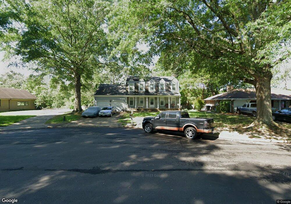
403 Dunham Massive Dr Hampton, VA 23669
Fox Hill NeighborhoodEstimated Value: $446,272 - $478,000
4
Beds
4
Baths
2,557
Sq Ft
$179/Sq Ft
Est. Value
About This Home
This home is located at 403 Dunham Massive Dr, Hampton, VA 23669 and is currently estimated at $456,818, approximately $178 per square foot. 403 Dunham Massive Dr is a home located in Hampton City with nearby schools including Phillips Elementary School, Benjamin Syms Middle School, and Kecoughtan High School.
Ownership History
Date
Name
Owned For
Owner Type
Purchase Details
Closed on
May 29, 2024
Sold by
Silvis Judy A
Bought by
Yost Theodore Richard
Current Estimated Value
Home Financials for this Owner
Home Financials are based on the most recent Mortgage that was taken out on this home.
Original Mortgage
$435,000
Outstanding Balance
$429,533
Interest Rate
7.1%
Mortgage Type
VA
Estimated Equity
$27,285
Purchase Details
Closed on
Sep 13, 2016
Sold by
Silvis Val Joseph and Silvis Judy A
Bought by
Silvis Judy A
Create a Home Valuation Report for This Property
The Home Valuation Report is an in-depth analysis detailing your home's value as well as a comparison with similar homes in the area
Home Values in the Area
Average Home Value in this Area
Purchase History
| Date | Buyer | Sale Price | Title Company |
|---|---|---|---|
| Yost Theodore Richard | $435,000 | Fidelity National Title | |
| Silvis Judy A | -- | None Available |
Source: Public Records
Mortgage History
| Date | Status | Borrower | Loan Amount |
|---|---|---|---|
| Open | Yost Theodore Richard | $435,000 |
Source: Public Records
Tax History
| Year | Tax Paid | Tax Assessment Tax Assessment Total Assessment is a certain percentage of the fair market value that is determined by local assessors to be the total taxable value of land and additions on the property. | Land | Improvement |
|---|---|---|---|---|
| 2025 | $4,880 | $426,900 | $117,000 | $309,900 |
| 2024 | $3,836 | $333,600 | $117,000 | $216,600 |
| 2023 | $4,075 | $322,400 | $117,000 | $205,400 |
| 2022 | $3,692 | $312,900 | $111,000 | $201,900 |
| 2021 | $3,686 | $280,000 | $111,000 | $169,000 |
| 2020 | $3,422 | $276,000 | $103,600 | $172,400 |
| 2019 | $3,368 | $271,600 | $104,900 | $166,700 |
| 2018 | $3,695 | $269,900 | $104,900 | $165,000 |
| 2017 | $3,603 | $0 | $0 | $0 |
| 2016 | $3,603 | $269,900 | $0 | $0 |
| 2015 | $3,787 | $0 | $0 | $0 |
| 2014 | $3,572 | $284,100 | $110,400 | $173,700 |
Source: Public Records
Map
Nearby Homes
- 820 Lemaster Ave
- 425 Sonora Dr
- 919 Laredo Ct
- 426 Stockton St
- 702 New Bern Ave
- 702 Nottingham Dr
- 18 Fort Worth St
- 702 Kings View Ct
- 353 Fox Hill Rd
- 635 Kings View Ct
- 7 Maverick Ct
- 615 Page Dr
- 639 Fairfield Blvd
- 10 Zilber Ct
- 8 Zilber Ct
- 121 Fort Worth St
- 619 Queens View Ct
- 60 Harris Creek Rd
- 107 Fort Worth St
- 116 Pine Creek Dr
- 413 Durham St
- 411 Durham St
- 818 Lemaster Ave
- 825 Lemaster Ave
- 823 Lemaster Ave
- 415 Durham St
- 400 Galveston Ct
- 417 Durham St
- 816 Lemaster Ave
- 402 Galveston Ct
- 821 Lemaster Ave
- 419 Durham St
- 404 Galveston Ct
- 814 Lemaster Ave
- 819 Lemaster Ave
- 401 Galveston Ct
- 812 Lemaster Ave
- 406 Galveston Ct
- 421 Durham St
- 418 Durham St
Your Personal Tour Guide
Ask me questions while you tour the home.