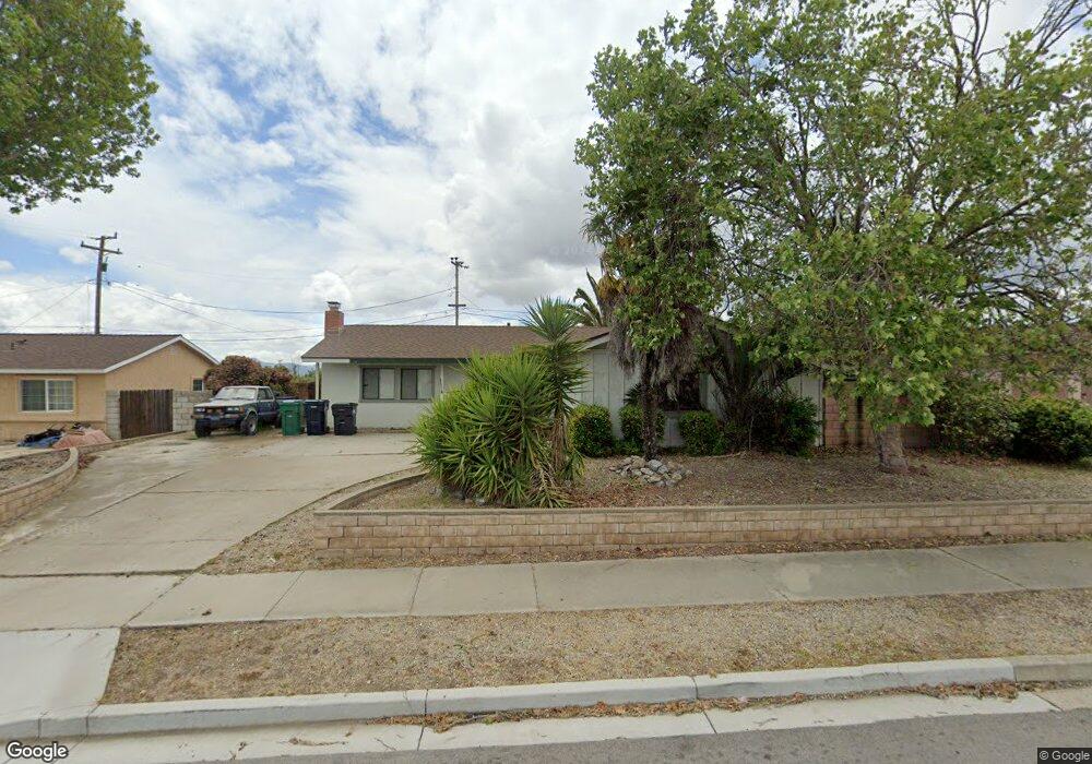
4032 Polaris Ave Unit 1 Lompoc, CA 93436
Estimated Value: $571,000 - $630,000
3
Beds
2
Baths
1,598
Sq Ft
$380/Sq Ft
Est. Value
About This Home
This home is located at 4032 Polaris Ave Unit 1, Lompoc, CA 93436 and is currently estimated at $607,559, approximately $380 per square foot. 4032 Polaris Ave Unit 1 is a home located in Santa Barbara County with nearby schools including Buena Vista Elementary School, Cabrillo High School, and Olive Grove Charter - Lompoc.
Ownership History
Date
Name
Owned For
Owner Type
Purchase Details
Closed on
Feb 18, 2026
Sold by
Kaanoi Gruel
Bought by
Kevin Gruel Trust and Gruel
Current Estimated Value
Purchase Details
Closed on
Jul 15, 2014
Sold by
Gruel Nancy Colleen
Bought by
Gruel Kevin Kaanoi
Home Financials for this Owner
Home Financials are based on the most recent Mortgage that was taken out on this home.
Original Mortgage
$138,800
Interest Rate
3.25%
Mortgage Type
New Conventional
Purchase Details
Closed on
Jun 6, 1995
Sold by
Wise Richard L and Wise Carolyn A
Bought by
Gruel Kevin Kaanoi and Gruel Nancy Colleen
Home Financials for this Owner
Home Financials are based on the most recent Mortgage that was taken out on this home.
Original Mortgage
$121,400
Interest Rate
8.36%
Create a Home Valuation Report for This Property
The Home Valuation Report is an in-depth analysis detailing your home's value as well as a comparison with similar homes in the area
Home Values in the Area
Average Home Value in this Area
Purchase History
| Date | Buyer | Sale Price | Title Company |
|---|---|---|---|
| Kevin Gruel Trust | -- | None Listed On Document | |
| Gruel Kevin Kaanoi | $91,000 | First American Title Company | |
| Gruel Kevin Kaanoi | $136,500 | Chicago Title Company |
Source: Public Records
Mortgage History
| Date | Status | Borrower | Loan Amount |
|---|---|---|---|
| Previous Owner | Gruel Kevin Kaanoi | $138,800 | |
| Previous Owner | Gruel Kevin Kaanoi | $121,400 |
Source: Public Records
Tax History
| Year | Tax Paid | Tax Assessment Tax Assessment Total Assessment is a certain percentage of the fair market value that is determined by local assessors to be the total taxable value of land and additions on the property. | Land | Improvement |
|---|---|---|---|---|
| 2025 | $2,761 | $229,077 | $92,365 | $136,712 |
| 2023 | $2,761 | $220,183 | $88,779 | $131,404 |
| 2022 | $2,718 | $215,867 | $87,039 | $128,828 |
| 2021 | $2,744 | $211,635 | $85,333 | $126,302 |
| 2020 | $2,717 | $209,466 | $84,459 | $125,007 |
| 2019 | $2,678 | $205,359 | $82,803 | $122,556 |
| 2018 | $2,641 | $201,333 | $81,180 | $120,153 |
| 2017 | $2,508 | $197,387 | $79,589 | $117,798 |
| 2016 | $2,195 | $193,518 | $78,029 | $115,489 |
| 2015 | $2,178 | $220,805 | $88,428 | $132,377 |
| 2014 | $2,146 | $186,873 | $75,349 | $111,524 |
Source: Public Records
Map
Nearby Homes
- 232 Vega Ave
- 3939 Mesa Circle Dr
- 3922 Mesa Circle Dr
- 3916 Mesa Circle Dr Unit A
- 113 Gemini Ave
- 4447 Falcon Dr
- 250 Saint Andrews Way
- 6 Stanford Cir
- 18 Galaxy Way
- 4166 Oakwood Ct
- 4173 Oakwood Ct
- 73 Stanford Cir
- 372 Oak Hill Dr
- 384 Falcon Crest Dr
- 649 Burning Tree Way
- 0 Oak Hill Dr Unit 24-783
- 240 Oak Hill Dr
- 372 Falcon Crest Dr
- 3843 Cassini Cir Unit 3
- 4473 Greenbrier Rd
- 4022 Polaris Ave Unit 1
- 4042 Polaris Ave
- 4017 Altair Place
- 4052 Polaris Ave
- 233 Altair Ave
- 4033 Polaris Ave
- 4025 Polaris Ave
- 241 Altair Ave Unit 2
- 4041 Polaris Ave Unit 1
- 245 Altair Ave
- 4017 Polaris Ave
- 4051 Polaris Ave Unit 1
- 4020 Altair Place
- 4062 Polaris Ave Unit 1
- 4009 Polaris Ave
- 4038 Constellation Rd
- 4059 Polaris Ave
Your Personal Tour Guide
Ask me questions while you tour the home.