Estimated Value: $100,787 - $126,000
--
Bed
--
Bath
--
Sq Ft
5,009
Sq Ft Lot
About This Home
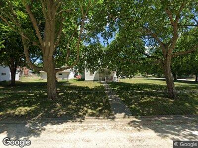
This home is located at 404 N Main St, Fonda, IA 50540 and is currently estimated at $113,394. 404 N Main St is a home located in Pocahontas County with nearby schools including Newell-Fonda Elementary School, Newell-Fonda Middle School, and Newell-Fonda High School.
Ownership History
Date
Name
Owned For
Owner Type
Purchase Details
Closed on
Feb 20, 2021
Sold by
Black Shauna N and Black Nathan D
Bought by
Davis Logan M
Current Estimated Value
Home Financials for this Owner
Home Financials are based on the most recent Mortgage that was taken out on this home.
Original Mortgage
$61,600
Outstanding Balance
$56,866
Interest Rate
3.08%
Mortgage Type
New Conventional
Estimated Equity
$57,058
Purchase Details
Closed on
Jul 5, 2016
Sold by
Fritz Wesley L and Fritz Margie
Bought by
Black Nathan D and Black Shauna N
Home Financials for this Owner
Home Financials are based on the most recent Mortgage that was taken out on this home.
Original Mortgage
$64,990
Interest Rate
3.66%
Mortgage Type
New Conventional
Create a Home Valuation Report for This Property
The Home Valuation Report is an in-depth analysis detailing your home's value as well as a comparison with similar homes in the area
Home Values in the Area
Average Home Value in this Area
Purchase History
| Date | Buyer | Sale Price | Title Company |
|---|---|---|---|
| Davis Logan M | $77,000 | -- | |
| Black Nathan D | $66,250 | -- |
Source: Public Records
Mortgage History
| Date | Status | Borrower | Loan Amount |
|---|---|---|---|
| Open | Davis Logan M | $61,600 | |
| Previous Owner | Black Nathan D | $64,990 |
Source: Public Records
Tax History Compared to Growth
Tax History
| Year | Tax Paid | Tax Assessment Tax Assessment Total Assessment is a certain percentage of the fair market value that is determined by local assessors to be the total taxable value of land and additions on the property. | Land | Improvement |
|---|---|---|---|---|
| 2024 | $40 | $2,200 | $2,200 | $0 |
| 2023 | $52 | $2,200 | $2,200 | $0 |
| 2022 | $48 | $2,200 | $2,200 | $0 |
| 2021 | $48 | $2,200 | $2,200 | $0 |
| 2020 | $55 | $2,200 | $2,200 | $0 |
| 2019 | $40 | $1,540 | $0 | $0 |
| 2018 | $43 | $1,540 | $0 | $0 |
| 2017 | $38 | $1,540 | $0 | $0 |
| 2016 | $38 | $1,540 | $0 | $0 |
| 2015 | $38 | $1,540 | $0 | $0 |
| 2014 | $34 | $1,540 | $0 | $0 |
Source: Public Records
Map
Nearby Homes
- 1035 190th St
- 104 Main St
- 474 E Jensen St
- 136 Cedar St
- 109 S Oswego St
- 410 Sophie Dr
- 609 S Cayuga St
- 13446 530th St
- 3409 240th St
- 3070 230th St
- 19591 520th St
- 810711200007 Rolf Avenue and Highway 20
- 7467 Twin Lakes Rd
- 7080 Twin Lakes Rd
- 606 Park Ave
- 5851 Sandy Point Rd
- 8921 Twin Lakes Rd
- 5151 Lakeside Ln
- 1106 2nd Ave NW
- 204 NW 12th St