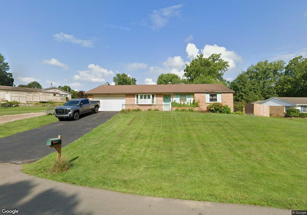
4056 Clarkston Dr Bellbrook, OH 45305
Estimated Value: $334,706 - $377,000
4
Beds
2
Baths
1,800
Sq Ft
$194/Sq Ft
Est. Value
About This Home
This home is located at 4056 Clarkston Dr, Bellbrook, OH 45305 and is currently estimated at $349,177, approximately $193 per square foot. 4056 Clarkston Dr is a home located in Greene County with nearby schools including Stephen Bell Elementary School, Bell Creek Intermediate School, and Bellbrook Middle School.
Ownership History
Date
Name
Owned For
Owner Type
Purchase Details
Closed on
Oct 14, 2020
Sold by
Stacy Robinson Renee M and Robinson Frank Kendall
Bought by
Stacy Robinson Renee
Current Estimated Value
Home Financials for this Owner
Home Financials are based on the most recent Mortgage that was taken out on this home.
Original Mortgage
$188,600
Outstanding Balance
$167,444
Interest Rate
2.8%
Mortgage Type
New Conventional
Estimated Equity
$181,733
Purchase Details
Closed on
Jun 21, 2019
Sold by
Huffman Allan L and Huffman Kathy C
Bought by
Stacy Renee M and Robinson Frank Kendall
Home Financials for this Owner
Home Financials are based on the most recent Mortgage that was taken out on this home.
Original Mortgage
$188,000
Interest Rate
4%
Mortgage Type
New Conventional
Create a Home Valuation Report for This Property
The Home Valuation Report is an in-depth analysis detailing your home's value as well as a comparison with similar homes in the area
Home Values in the Area
Average Home Value in this Area
Purchase History
| Date | Buyer | Sale Price | Title Company |
|---|---|---|---|
| Stacy Robinson Renee | -- | None Available | |
| Stacy Renee M | $235,000 | Vantage Land Title |
Source: Public Records
Mortgage History
| Date | Status | Borrower | Loan Amount |
|---|---|---|---|
| Open | Stacy Robinson Renee | $188,600 | |
| Closed | Stacy Renee M | $188,000 |
Source: Public Records
Tax History Compared to Growth
Tax History
| Year | Tax Paid | Tax Assessment Tax Assessment Total Assessment is a certain percentage of the fair market value that is determined by local assessors to be the total taxable value of land and additions on the property. | Land | Improvement |
|---|---|---|---|---|
| 2024 | $5,282 | $91,930 | $17,740 | $74,190 |
| 2023 | $5,282 | $91,930 | $17,740 | $74,190 |
| 2022 | $4,952 | $70,310 | $15,430 | $54,880 |
| 2021 | $5,003 | $70,310 | $15,430 | $54,880 |
| 2020 | $4,571 | $70,310 | $15,430 | $54,880 |
| 2019 | $3,770 | $52,690 | $9,390 | $43,300 |
| 2018 | $3,774 | $52,690 | $9,390 | $43,300 |
| 2017 | $3,483 | $52,690 | $9,390 | $43,300 |
| 2016 | $3,483 | $48,210 | $9,390 | $38,820 |
| 2015 | $3,493 | $48,210 | $9,390 | $38,820 |
| 2014 | $3,236 | $48,210 | $9,390 | $38,820 |
Source: Public Records
Map
Nearby Homes
- 1692 Glenwood Way
- 4184 Wood Acre Dr
- 4204 N Golden Clove Bend Unit 56-305
- 4206 N Golden Clove Bend Unit 56-303
- 4208 N Golden Clove Bend Unit 56-103
- 4214 N Golden Clove Bend Unit 56-102
- 4216 N Golden Clove Bend Unit 56-302
- 4218 N Golden Clove Bend Unit 56-300
- 4222 N Golden Clove Bend Unit 56-201
- 4220 N Golden Clove Bend Unit 56-301
- 4232 Apple Branch Dr Unit 55-305
- 4234 Apple Branch Dr Unit 55-303
- 4236 Apple Branch Dr Unit 55-103
- 4242 Apple Branch Dr Unit 55-102
- 4244 Apple Branch Dr Unit 55-302
- 4246 Apple Branch Dr Unit 55-300
- 4267 Sugar Point Way
- 4258 Apple Branch Dr Unit 54-204
- 4262 Apple Branch Dr
- 4264 Apple Branch Dr
- 4054 Clarkston Dr
- 4062 Clarkston Dr
- 4049 Clarkston Dr
- 4052 Clarkston Dr
- 4076 Clarkston Dr
- 4051 Clarkston Dr
- 1546 Gunther Dr
- 4055 Clarkston Dr
- 1538 Gunther Dr
- 4047 Clarkston Dr
- 4088 Clarkston Dr
- 4050 Clarkston Dr
- 4063 Clarkston Dr
- 1530 Gunther Dr
- 4073 Clarkston Dr
- 4100 Clarkston Dr
- 1545 Gunther Dr
- 4065 Caudell Dr
- 4083 Clarkston Dr
- 4083 Caudell Dr