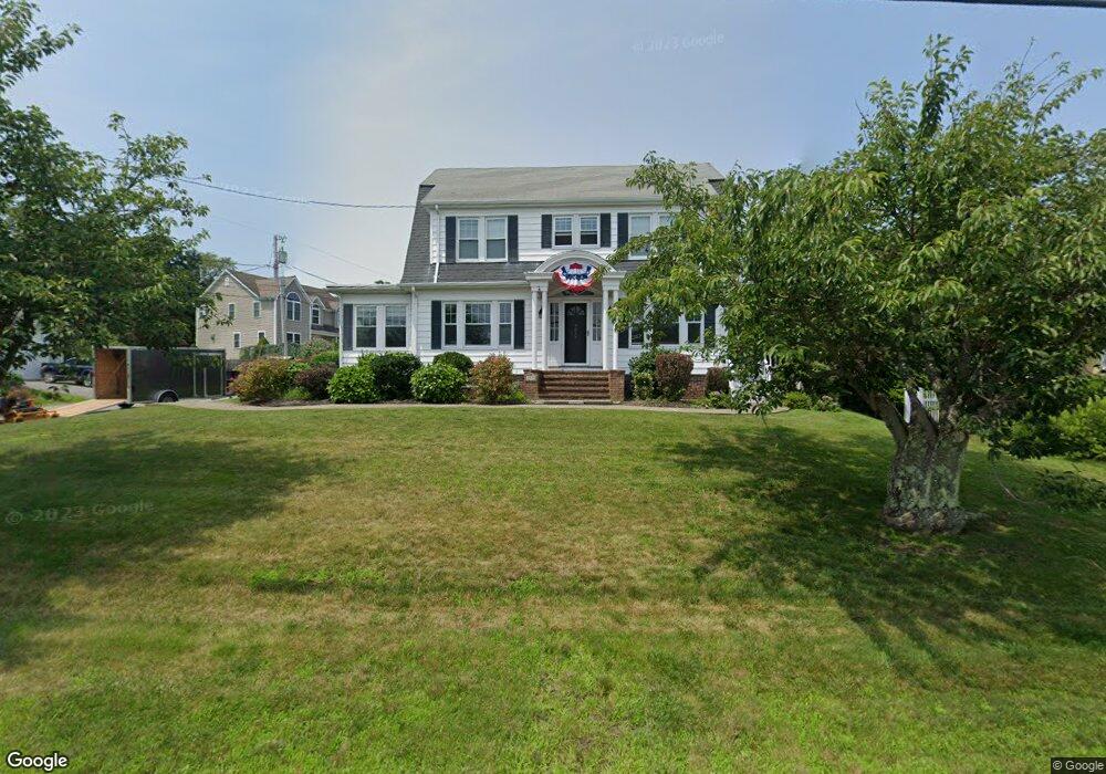
4059 Riverside Ave Somerset, MA 02726
Pottersville NeighborhoodEstimated Value: $576,729 - $688,000
4
Beds
2
Baths
2,280
Sq Ft
$276/Sq Ft
Est. Value
About This Home
This home is located at 4059 Riverside Ave, Somerset, MA 02726 and is currently estimated at $629,432, approximately $276 per square foot. 4059 Riverside Ave is a home located in Bristol County with nearby schools including North Elementary School, Somerset Middle School, and St. Michael's School.
Ownership History
Date
Name
Owned For
Owner Type
Purchase Details
Closed on
Feb 18, 2025
Sold by
Coombes Christopher A and Coombes Karen
Bought by
Coombes Ft and Coombes
Current Estimated Value
Purchase Details
Closed on
Apr 4, 2013
Sold by
Coombes Christopher A
Bought by
Coombes Christopher A and Coombes Karen
Home Financials for this Owner
Home Financials are based on the most recent Mortgage that was taken out on this home.
Original Mortgage
$252,000
Interest Rate
3.58%
Mortgage Type
New Conventional
Purchase Details
Closed on
Nov 27, 2002
Sold by
Menard Charles R and Menard Joan M
Bought by
Coombes Christopher A
Home Financials for this Owner
Home Financials are based on the most recent Mortgage that was taken out on this home.
Original Mortgage
$256,500
Interest Rate
6.16%
Mortgage Type
Purchase Money Mortgage
Create a Home Valuation Report for This Property
The Home Valuation Report is an in-depth analysis detailing your home's value as well as a comparison with similar homes in the area
Home Values in the Area
Average Home Value in this Area
Purchase History
| Date | Buyer | Sale Price | Title Company |
|---|---|---|---|
| Coombes Ft | -- | None Available | |
| Coombes Ft | -- | None Available | |
| Coombes Christopher A | -- | -- | |
| Coombes Christopher A | -- | -- | |
| Coombes Christopher A | $285,000 | -- | |
| Coombes Christopher A | $285,000 | -- |
Source: Public Records
Mortgage History
| Date | Status | Borrower | Loan Amount |
|---|---|---|---|
| Previous Owner | Coombes Christopher A | $252,000 | |
| Previous Owner | Coombes Christopher A | $256,500 |
Source: Public Records
Tax History Compared to Growth
Tax History
| Year | Tax Paid | Tax Assessment Tax Assessment Total Assessment is a certain percentage of the fair market value that is determined by local assessors to be the total taxable value of land and additions on the property. | Land | Improvement |
|---|---|---|---|---|
| 2025 | $6,850 | $515,000 | $182,900 | $332,100 |
| 2024 | $6,362 | $497,400 | $182,900 | $314,500 |
| 2023 | $5,716 | $450,800 | $166,000 | $284,800 |
| 2022 | $5,285 | $397,700 | $143,200 | $254,500 |
| 2021 | $5,335 | $363,400 | $129,400 | $234,000 |
| 2020 | $5,029 | $330,400 | $129,500 | $200,900 |
| 2019 | $5,993 | $328,400 | $150,900 | $177,500 |
| 2018 | $5,217 | $307,600 | $145,300 | $162,300 |
| 2017 | $5,211 | $299,500 | $145,300 | $154,200 |
| 2016 | $5,244 | $299,500 | $145,300 | $154,200 |
| 2015 | $5,101 | $294,000 | $147,700 | $146,300 |
| 2014 | $6,902 | $285,800 | $147,700 | $138,100 |
Source: Public Records
Map
Nearby Homes
- 4079 Riverside Ave
- 11 Captains Way
- 50 Captains Way
- 35 Captains Way
- 4019 Riverside Ave
- 55 Captains Way
- 4105 Riverside Ave
- 70 Captains Way
- 4005 Riverside Ave
- 75 Captains Way
- 24 Carrie Hood Ln
- 3985 Riverside Ave
- 90 Captains Way
- 95 Captains Way
- 4143 Riverside Ave
- 30 Keegan Ct
- 33 Carrie Hood Ln
- 45 Carrie Hood Ln
- 97 Keegan Ct
- 4163 Riverside Ave