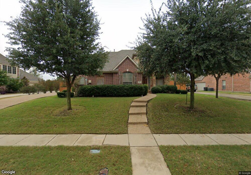
406 High Point Dr Murphy, TX 75094
Estimated Value: $687,544 - $756,000
About This Home
This home is located at 406 High Point Dr, Murphy, TX 75094 and is currently estimated at $728,136, approximately $194 per square foot. 406 High Point Dr is a home located in Collin County with nearby schools including Martha Hunt Elementary School, Murphy Middle School, and C A Mcmillen High School.
Ownership History
We collect this data history from publicly available records. To have your information removed, we recommend requesting removal directly through your county’s website.
Purchase Details
Home Financials for this Owner
Home Financials are based on the most recent Mortgage that was taken out on this home.Home Values in the Area
Average Home Value in this Area
Purchase History
We collect this data history from publicly available records. To have your information removed, we recommend requesting removal directly through your county’s website.
| Date | Buyer | Sale Price | Title Company |
|---|---|---|---|
| -- | None Available |
Mortgage History
We collect this data history from publicly available records. To have your information removed, we recommend requesting removal directly through your county’s website.
| Date | Status | Borrower | Loan Amount |
|---|---|---|---|
| Closed | $160,000 |
Tax History
We collect this data history from publicly available records. To have your information removed, we recommend requesting removal directly through your county’s website.
| Year | Tax Paid | Tax Assessment Tax Assessment Total Assessment is a certain percentage of the fair market value that is determined by local assessors to be the total taxable value of land and additions on the property. | Land | Improvement |
|---|---|---|---|---|
| 2025 | $8,538 | $624,384 | $185,250 | $534,420 |
| 2024 | $8,082 | $567,622 | $185,250 | $487,061 |
| 2023 | $8,082 | $516,020 | $185,250 | $413,750 |
| 2022 | $9,187 | $469,109 | $142,500 | $399,197 |
| 2021 | $8,807 | $426,463 | $114,000 | $312,463 |
| 2020 | $9,294 | $445,000 | $114,000 | $331,000 |
| 2019 | $9,487 | $433,000 | $114,000 | $319,000 |
| 2018 | $8,900 | $402,505 | $114,000 | $312,329 |
| 2017 | $8,091 | $365,914 | $108,000 | $257,914 |
| 2016 | $8,280 | $378,463 | $108,000 | $270,463 |
| 2015 | $7,177 | $336,259 | $85,500 | $250,759 |
Map
- 1029 Brentwood Dr
- 211 High Point Dr
- 929 Brentwood Dr
- 1307 Featherwood Dr
- 1020 Oriole Dr
- 822 Shadybrook Dr
- 503 Raven Dr
- 605 Royal Glen Dr
- 1311 Overland Dr
- 436 Dakota Dr
- 618 Forest Hill Dr
- 802 Shadybrook Dr
- 103 Westminister Ave
- 828 Mallard Trail
- 437 Quail Creek Dr
- 902 Nighthawk Dr
- 2611 Dublin Park Dr
- 523 Buffalo Bend Ct
- 108 Windsor Dr
- 524 Buffalo Bend Ct
- 1108 Midpark Ln
- 1112 Midpark Ln
- 1107 Westminister Ave
- 1107 Westminster Ave
- 1111 Westminister Ave
- 407 High Point Dr
- 410 High Point Dr
- 402 High Point Dr
- 1116 Midpark Ln
- 408 Silver Springs Ln
- 1115 Westminster Ave
- 1115 Westminister Ave
- 414 High Point Dr
- 411 High Point Dr
- 1108 Westminster Ave
- 412 Silver Springs Ln
- 1108 Westminister Ave
- 418 High Point Dr
- 1112 Westminister Ave
- 1119 Westminister Ave
Ask me questions while you tour the home.