Estimated Value: $143,538 - $180,000
4
Beds
2
Baths
1,795
Sq Ft
$94/Sq Ft
Est. Value
About This Home
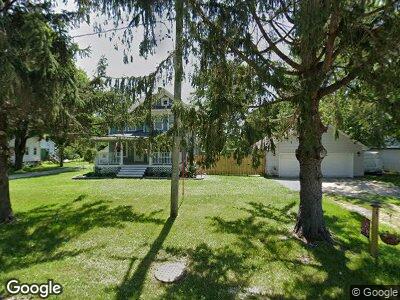
This home is located at 406 Main St, Stout, IA 50673 and is currently estimated at $168,885, approximately $94 per square foot. 406 Main St is a home with nearby schools including New Hartford Elementary School, Dike Elementary School, and Dike-New Hartford Junior High School.
Ownership History
Date
Name
Owned For
Owner Type
Purchase Details
Closed on
Dec 8, 2021
Sold by
Earlee Llc
Bought by
Mehrhoff Brice W and Mehrhoff Affton K
Current Estimated Value
Home Financials for this Owner
Home Financials are based on the most recent Mortgage that was taken out on this home.
Original Mortgage
$125,100
Outstanding Balance
$119,684
Interest Rate
4.88%
Mortgage Type
New Conventional
Estimated Equity
$49,994
Purchase Details
Closed on
Dec 16, 2020
Sold by
Hayes Bros Llc
Bought by
Earlee Llc
Home Financials for this Owner
Home Financials are based on the most recent Mortgage that was taken out on this home.
Original Mortgage
$67,769
Interest Rate
2.6%
Mortgage Type
New Conventional
Create a Home Valuation Report for This Property
The Home Valuation Report is an in-depth analysis detailing your home's value as well as a comparison with similar homes in the area
Home Values in the Area
Average Home Value in this Area
Purchase History
| Date | Buyer | Sale Price | Title Company |
|---|---|---|---|
| Mehrhoff Brice W | $139,000 | None Listed On Document | |
| Earlee Llc | -- | None Listed On Document |
Source: Public Records
Mortgage History
| Date | Status | Borrower | Loan Amount |
|---|---|---|---|
| Open | Mehrhoff Brice W | $125,100 | |
| Closed | Mehrhoff Brice W | $6,950 | |
| Closed | Mehrhoff Brice W | $125,100 | |
| Previous Owner | Earlee Llc | $67,769 | |
| Previous Owner | Hayes Dustin E | $70,500 | |
| Previous Owner | Junkins Robert K | $90,000 | |
| Closed | Mehrhoff Brice W | $6,950 |
Source: Public Records
Tax History Compared to Growth
Tax History
| Year | Tax Paid | Tax Assessment Tax Assessment Total Assessment is a certain percentage of the fair market value that is determined by local assessors to be the total taxable value of land and additions on the property. | Land | Improvement |
|---|---|---|---|---|
| 2024 | $1,808 | $123,570 | $14,270 | $109,300 |
| 2023 | $1,808 | $124,020 | $14,270 | $109,750 |
| 2022 | $1,572 | $94,230 | $11,410 | $82,820 |
| 2021 | $1,572 | $94,230 | $11,410 | $82,820 |
| 2020 | $1,156 | $78,800 | $11,410 | $67,390 |
| 2019 | $1,386 | $77,220 | $0 | $0 |
| 2018 | $1,222 | $77,220 | $0 | $0 |
| 2017 | $1,222 | $77,220 | $11,410 | $65,810 |
| 2016 | $1,218 | $77,670 | $0 | $0 |
| 2015 | $1,218 | $82,070 | $0 | $0 |
| 2014 | $1,302 | $82,070 | $0 | $0 |
Source: Public Records
Map
Nearby Homes
- 0000 S Ave
- 1603 Hogan Alley
- Building site Tanner Rd
- 411 Nicklaus Dr
- 15037 N Ave
- 1103 Commerce Ave
- 1415 Watson Way
- 1501 Watson Way
- 806 Florence St
- 804 Florence St
- 32561 Newell Ave
- Conn Street Unit Parcel 1531202017
- 1205 Wemple St
- 802 Hwy 57
- 1212 Grant St
- 1208 Grant St
- 1206 Grant St
- 801 3rd Ave
- 509 Lincoln St
- 209 Brookside Dr