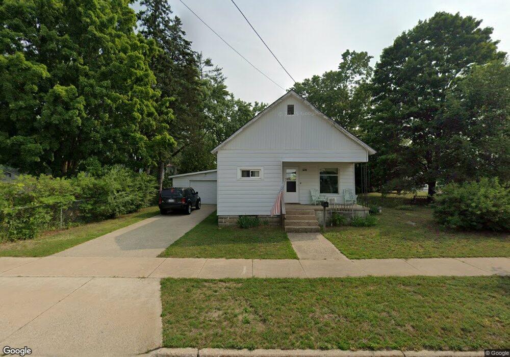
406 Maple St Grayling, MI 49738
Estimated Value: $113,164 - $149,000
Studio
--
Bath
1,124
Sq Ft
$117/Sq Ft
Est. Value
About This Home
This home is located at 406 Maple St, Grayling, MI 49738 and is currently estimated at $131,791, approximately $117 per square foot. 406 Maple St is a home located in Crawford County with nearby schools including Grayling Elementary School, Grayling Middle School, and Grayling High School.
Ownership History
Date
Name
Owned For
Owner Type
Purchase Details
Closed on
Aug 21, 2025
Sold by
Ashton David J
Bought by
Ashton David J
Current Estimated Value
Purchase Details
Closed on
Jul 17, 2024
Sold by
Ashton David J
Bought by
Warner Stephanie and Russell Cheryl
Purchase Details
Closed on
Jan 1, 2008
Sold by
Wheeler Glenna G and Ashton David J
Purchase Details
Closed on
Oct 2, 2006
Sold by
Wheeler Glenna G
Bought by
Wheeler Glenna G and Ashton David J
Purchase Details
Closed on
Dec 15, 1989
Sold by
Wheeler Glenna G
Bought by
Wheeler Glenna G and Wheeler Herbert W
Create a Home Valuation Report for This Property
The Home Valuation Report is an in-depth analysis detailing your home's value as well as a comparison with similar homes in the area
Home Values in the Area
Average Home Value in this Area
Purchase History
| Date | Buyer | Sale Price | Title Company |
|---|---|---|---|
| Ashton David J | -- | -- | |
| Warner Stephanie | -- | -- | |
| -- | -- | -- | |
| Wheeler Glenna G | -- | -- | |
| Wheeler Glenna G | -- | -- |
Source: Public Records
Tax History
| Year | Tax Paid | Tax Assessment Tax Assessment Total Assessment is a certain percentage of the fair market value that is determined by local assessors to be the total taxable value of land and additions on the property. | Land | Improvement |
|---|---|---|---|---|
| 2025 | $1,440 | $41,400 | $2,100 | $39,300 |
| 2024 | $930 | $38,700 | $2,100 | $36,600 |
| 2023 | $887 | $33,900 | $2,100 | $31,800 |
| 2022 | $845 | $29,300 | $2,100 | $27,200 |
| 2021 | $1,031 | $27,600 | $2,100 | $25,500 |
| 2020 | $1,017 | $26,700 | $2,100 | $24,600 |
| 2019 | $995 | $26,200 | $2,100 | $24,100 |
| 2018 | $977 | $23,300 | $2,100 | $21,200 |
| 2017 | $807 | $23,500 | $2,100 | $21,400 |
| 2016 | $800 | $21,400 | $2,100 | $19,300 |
| 2015 | -- | $21,400 | $0 | $0 |
| 2014 | -- | $22,500 | $0 | $0 |
| 2013 | -- | $26,500 | $0 | $0 |
Source: Public Records
Map
Nearby Homes
- 205 Park St
- Lot 4 Erie St
- 601 Peninsular Ave
- 704 Elm St
- 809 Maple St
- 110 State St
- 1205 E Michigan Ave
- 109 Madsen St
- 1024 S I-75 Business Loop
- 000 W M-72 Hwy
- 4593 Orbit Dr
- 300 Rolla St
- V/L L71-75 Evergreen Dr
- 5973 W M-72 Hwy
- 4900 Helen Dr
- V/L Lot 9 Norseman Dr
- V/L Lot 2 Norseman Dr
- V/L Lot 10 Norseman Dr
- V/L Lot 1 Norseman Dr
- 6960 Trem Pal Rd
- 410 Maple St
- 603 E Michigan Ave
- 405 Park St
- 604 Ottawa St
- 403 Park St
- 607 E Michigan Ave
- 608 Ottawa St
- 611 E Michigan Ave
- 405 Maple St
- 407 Maple St
- 403 Maple St
- 506 Ottawa St
- 615 E Michigan Ave
- 511 E Michigan Ave
- 504 Ottawa St
- 507 E Michigan Ave
- 601 Ottawa St
- 0 Michigan Ave
- 605 Ottawa St
- 404 Chestnut St
Your Personal Tour Guide
Ask me questions while you tour the home.